| The Lustik Travel Home Page |
June 17 - 30, 2002
Monday, June 17, 2002 Big Bend National Park, TX
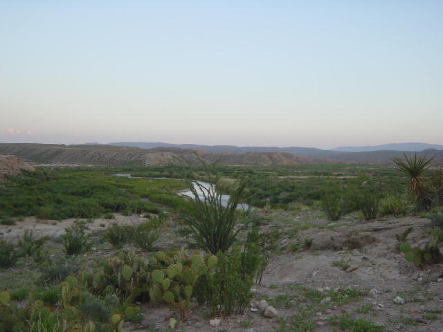
We went for a good walk this morning before packing up and heading southwest to Big Bend National Park. It got warmer and warmer as the day went on. We arrived at the park late in the afternoon and enjoyed a leisurely drive down to Rio Grande Village in the southeast corner of the park. I have never been to this park, and I was amazed at what I saw. The monochromatic first impression quickly gives way to a subtle beauty in texture, scale and balance.
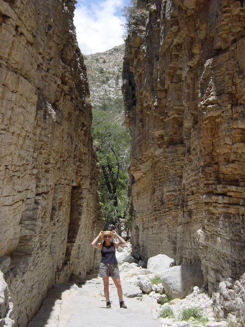
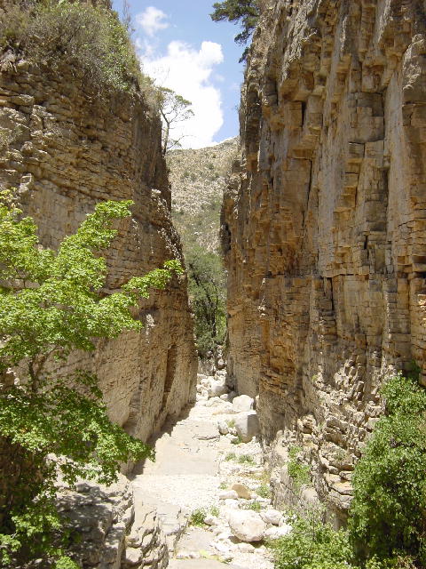
We hooked up the RV in the village campground and hid inside with the A/C until later in the evening. Today’s temperatures were up to 107 degrees. We enjoyed a comfortable dinner of venison burgers and rested before venturing back out to enjoy the park at sunset. We drove over to Boquillas Canyon to take a short hike into the slot canyon. The evening colors were splendid with the backdrop of the Rio Grande. We were a stone’s throw from Mexico across this narrow section of the river. The sun had dropped us into the shade, but the heat was still oppressive. We returned to the RV and noted that the temperature was still 100 degrees at 10:00PM. We enjoyed a spectacular electric storm over the mountains to the east, but it never reached our campground.
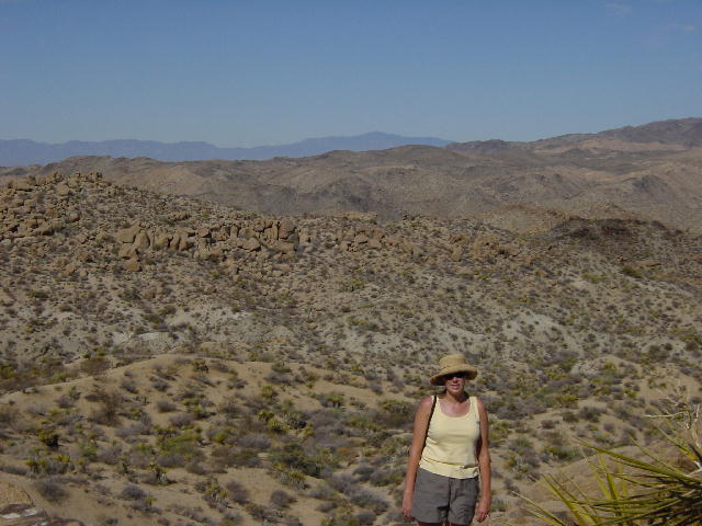
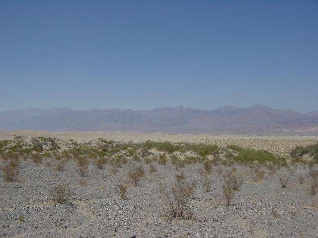
The new spotlight picture page is focused on Big Bend National Park. Click here to enjoy those pictures.
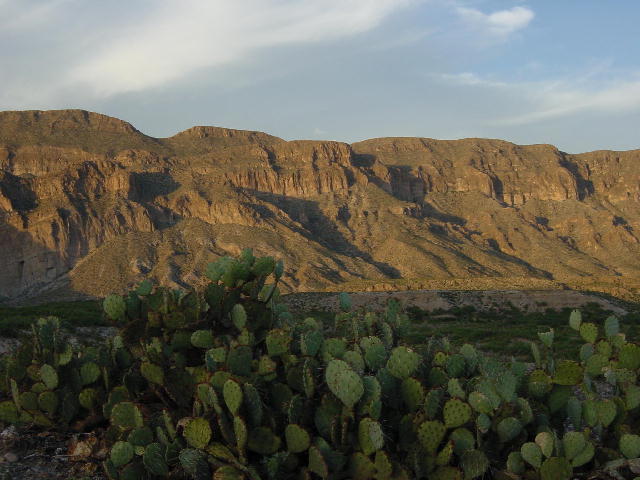
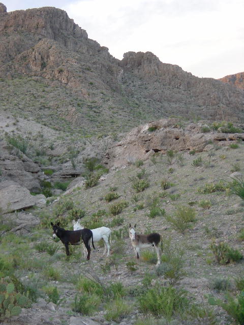
1) Big Bend National Park. 2) The Rio Grande river. 3) When we went for our walk this evening there were many wild Burros watching us near the canyon.
Tuesday, June 18, 2002 Presidio, TX
We decided to get a fairly early start to enjoy the outdoors before the heat of the day invaded. It was 80 degrees at 8:00 AM. We drove up to the main Visitor Center gaining nearly 2000 feet in elevation. The higher elevation helped keep it a little cooler. We selected a 5-mile hike up in the Chisos Mountains (wholly contained within the Park), but our RV wasn’t permitted on the road to reach the trailhead. We took Christine’s bike off the RV and left the RV at the Visitor Center. We doubled up on the bike and rode to the trailhead.
The Lost Mine Trail climbs over 1000 feet in 2.5 miles, then returns down the same path. This was a fantastic hike with 32 excellent interpretive stops along the trail. We learned to recognize three different types of juniper trees, the pinyon pine and some desert oaks. The park’s cactus is also quite varied. Christine and I enjoyed identifying the ocotillo, prickly pear, lechuguilla and agave. The last two from that list only flower once in their lifetime, and then die. Even though we missed the spring blossoms, there are several flowering cactuses that were still in bloom.
We returned from our hike as the heat of the day was settling in. We ate lunch and took a relaxing drive down to Santa Elena Canyon in the southwest corner of the park. We gave up all our elevation as we returned to the Rio Grande and found ourselves suffocating in temperatures holding between 110-112 degrees—amazing! I rock-hopped across Terlingua Creek to get a closer look at the Rio Grande squeezing through the 1500-foot walls of Santa Elena Canyon. It is amazing to take in the scale of this sight. I was able to gain reference by watching some canoes float down the river through the canyon.
I took every opportunity today to ask park personnel about the condition of the Old Maverick Road, a gravel route running north from Santa Elena Canyon. Every single inquiry resulted in negative discouraging words about the condition of the road. So what did I do? I disregarded all the advice and took the gravel road anyway. People that don’t know me might wonder why I even bothered to ask about the road’s condition if I had no intention of heeding the advice. I guess I get a greater sense of adventure by knowing what I’m up against. I considered myself informed and had devised a plan if I got into trouble.
The 13-mile road wasn’t any worse than some of the poor sections of the Denali Highway in Alaska, and we spent 120 miles on that gravel route. The washboard effect was my concern, and we did run into it, but just took it slowly. It took us an hour to cover the length, but we never had any regrets with our choice.
We left the park and continued our westerly heading toward Presidio through Big Bend Ranch State Park. The highway runs along the north bank of the Rio Grande for 50 miles through some extraordinary scenery. We were both so impressed with the views we took in today. We continued driving until 7:00 PM since there was nothing better to do in this heat. The RV’s dash A/C was working very hard just to keep the cab at 90 degrees, but we were both quite comfortable. People say it has something to do with how dry the heat is out here, but don’t try to convince my wife of that. To her, hot is hot, regardless of the humidity. We found a campground just before reaching Presidio and Christine cooked up some tasty venison tacos as we hid inside the cooling RV.

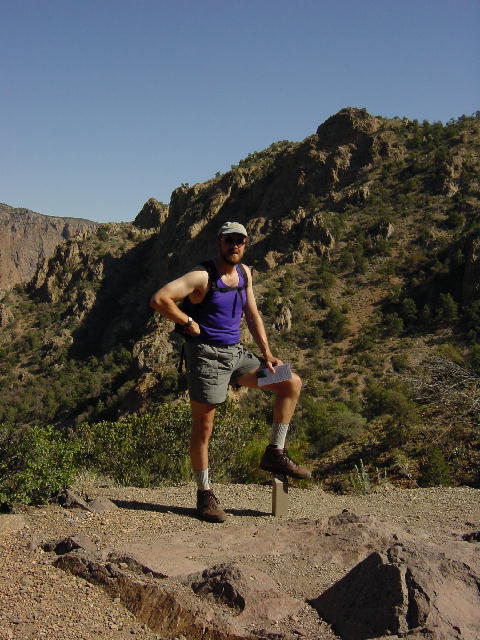
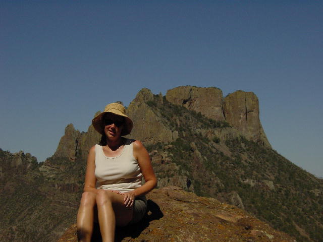
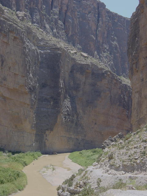
1) This is one of Christine's favorite plants, the Agave. Who can tell me why this is a wonderful plant? Hint - Where does Tequila come from? 2) Joe on the Lost Mine Trail. 3) Behind Christine you'll find the peak named Casa Grande. 4) The Santa Elena Canyon, if you look carefully you'll see what looks like a dot on the left side of the river. This is a canoe just to give perspective.
Wednesday, June 19, 2002 Van Horn, TX
We enjoyed a very scenic drive north from Presidio. We stopped in Van Horn, Texas early in the afternoon. We stopped here for the night so Christine could focus on her two end-of-term class projects that are due on Friday. We found a campground with a phone hookup at the site, making it very convenient for Christine.
Thursday, June 20, 2002 Carlsbad, NM
I was able to schedule an oil change for the RV this morning, and got a new fuel filter installed without delay. All in hopes of improving our faltering fuel economy. We continued north to the Guadalupe Mountains National Park. This park is significant as one of the finest examples of an ancient marine fossil reef. We followed through with plans to go for a hike, even though it was midday by the time we got started. We chose the Devil’s Hall Trail back into Pine Spring Canyon. It was a 4-mile round trip that took us about 2.5 hours. Much of the hike was up a dry creek bed into the canyon. It ended at the Devil’s Hall formation, a narrow 15-foot slot through the canyon with sheer rock walls on each side.
Christine and I enjoyed identifying many of the tress that we had learned at Big Bend. The rock formations were also very impressive, with much evidence of its coral history 250 million years ago. We were pretty exhausted from the heat by the end of our hike. We continued on into New Mexico, saying goodbye to Texas after two full weeks of exploration. Believe it or not, that still leaves a lot of Texas unexplored for us. It is one BIG state.
We checked into another hi-tech campground just north of Carlsbad to give Christine one last night of internet connection at the campsite. Her papers/projects would have been finished and posted tonight had it not been for one very violent thunderstorm. It lasted for a couple hours at dusk and knocked out our phone line for the night, leaving Christine cut off until tomorrow morning. This storm had us both very nervous, though I tried not to show it. The campground here is in a wide-open space and the lightning was striking directly overhead, with amazing intensity and frequency. The winds were hitting us with their full force, and blowing the rain past our window seals. It was very uncomfortable for over an hour. The one advantage to our location was the fact that the campground sits right next to a large pecan grove. Apparently hail is a pecan grower’s nemesis. The solution is a $40,000 propane canon that blasts a loud percussive report into the darkening clouds with the intention of breaking up the formation of any hailstones. The campground warned us about the possibility of this noise. It felt like we were parked next to an artillery range. The booming lasted for nearly three hours, and it must have worked—there was no hail.
By Christine: One neat thing about our walk today was 2 deer. They started when we passed by them but they didn't move far and then they just stood and watched us. They seemed to be saying, "Please, keep moving so we don't have to leave our shady spot." On our return they were still in the area watching us as we watched them.
Tonight was very frustrating. Having two papers due tomorrow was stressful and I really like to get them in ahead of time just in case one of my instructors is looking for anything more. As I was stressed about the phone's going out, I knew I should just be happy I was trying to accomplish this a day ahead of time. It gives me a buffer of time.
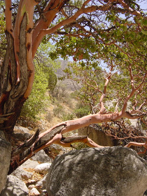
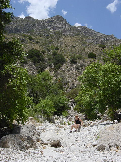
1) I think this is the rare Texas Madrone. The bark is a beautiful smooth reddish color. The tree flowers in the spring and gets red berries in the fall. 2) The trail we chose followed a wash and was very rocky, but the views were pretty. 3 and 4) The trail in Guadalupe ended at a place called the Devils Hall. I am in one picture just to give perspective to the width and height of this slot canyon.
Friday, June 21, 2002 Carlsbad, NM
We woke to silence and Christine immediately set about posting her final projects. Relief would not come until she received confirmation that they had been received without error. That e-mail came a little while later this morning, and then I got my wife back. The immediate relief of having this all behind her was enough to make her day.
We celebrated our first official day of summer with a cool walk down into the caves at Carlsbad Caverns. This begs the question: was that really spring that we’ve been experiencing for the past month? The caverns maintain a constant temperature of 56 degrees and 90% humidity. We started our hike through the natural entrance of the cave that descends 750 feet over a mile of paved trail. It is a steep decline that drives home the reality of how far under ground this all goes.
Once we finished our descent we spent an hour exploring the Big Room, a 14-acre single cave chamber, the largest in the world. There are many fabulous formations to admire, though 95% of them have stopped growing. The walk around the Big Room is well over a mile, then we returned to the surface via an elevator.
We left the park and ate an early dinner before going back to the park to catch the evening bat flight. Like the Congress Avenue Bridge bats in Austin, TX, the Carlsbad Mexican Freetail bats return each year from Mexico to give birth. Over a half million make their home in an unvisited corner of the cave and then fly out at dusk to feed on flying insects of the night: mosquitoes and moths. The evening was perfect for the bat flight. They began to spiral out of the cave opening at 7:45 and sustained a constant dense vortex for the next 15 minutes solid. It was quite impressive. I was unable to take more than a couple pictures because too many people were using their flash bulbs. The park ranger banned all cameras after one last flash occurred. On the other hand, it was kind of nice to just sit back and enjoy the spectacle without being distracted by trying to figure out the best way to photograph it.
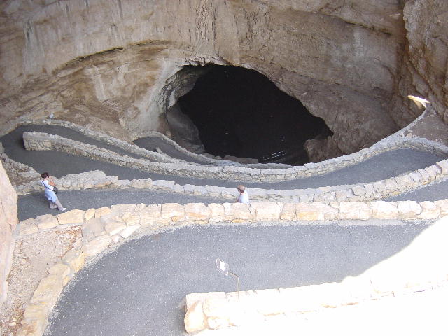
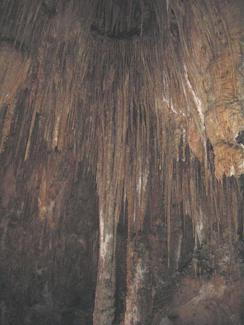
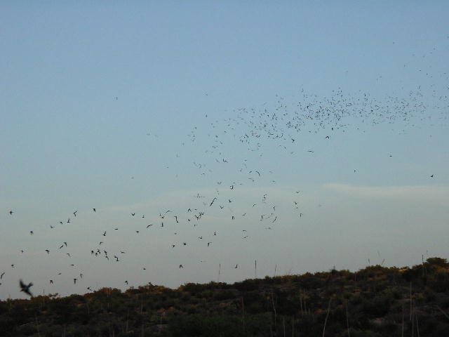
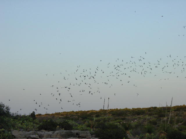
1) This is the entrance to the Natural Cave. You are seeing the path as it uses switchbacks to descend into the cave. 2) We didn't get any really good pictures because it was too dark in the cave, but this shows one of the many formations. 3 and 4) The bat flight. You may see a bird in the first picture, yes that is a bird not a bat. There were many cave Swallows flying around waiting to settle back into their nests just inside the cave.
Saturday, June 22, 2002
Lordsburg, NM
We left Carlsbad and headed west over the Sacramento Mountains and into the Tularosa Basin, the location of White Sands National Monument. White Sands is the largest collection of gypsum sand dunes in the world at 275 square miles. The gypsum is washed out of the surrounding mountains and drains into Lake Lucero. The lake is usually dry, leaving behind the gypsum that is carried by the winds to form the nearby dunes. The brightness of this white sand is unsettling, even with dark sunglasses. We played in the sand a bit and took some pictures, but we were soon overcome by the combination of high temperatures and reflected sunlight.
We drove further west through Las Cruces and stopped for the night just shy of the Arizona border. I grilled out the ostrich fillets that Christine bought in Austin and we washed the tasty meal done with a bottle of wine. I have been so impressed with my recent experiences with ostrich.
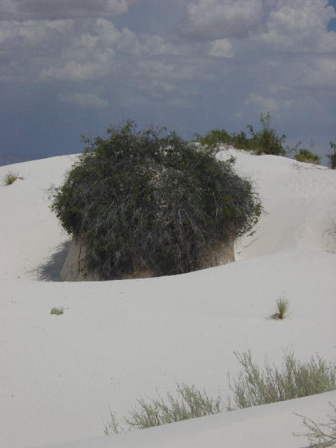
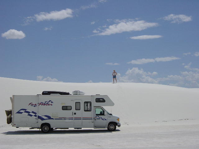
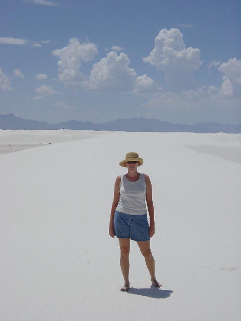
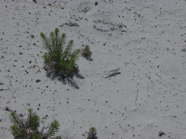
These were all taken in White Sands National Monument. In the third picture you can see the mountains far in the distance. 4) Can you find the lizard? Many of the animals have definitely adapted to their surroundings.
Sunday, June 23, 2002 Tucson, AZ
We enjoyed a scenic drive down through Douglas, Arizona and up into legendary Tombstone, scene of “The Shootout at the OK Corral.” The town has preserved several blocks to honor the time that marked this town’s role in American History. A group of volunteer men and women calling themselves the Tombstone Vigilantes have been recreating period events for over 50 years. It is fun to see them walking around in 1880’s dress and shooting off blank rounds from shotguns and six-shooters.
A quick review of the historic events follows. On October 26, 1881 Marshal Virgil Earp along with brothers Wyatt and Gordon, and Doc Holliday faced of against Ike and Billy Clanton, and Frank and Tom McLowry. The Clantons and McLowrys were known outlaws, but running free. Several events had occurred over the previous couple months between the parties involved, escalating tensions and threats. In the showdown the Earps and Holliday shot and killed Billy Clanton and the McLowrys. Morgan Earp was shot through the shoulders and back, and survived. Doc Holliday took a bullet in the hip and Virgil Earp was hit in the leg.
The town sheriff arrested the Earps and Holliday for murder, and a month long trial followed before they were all acquitted. This marked the decline of the Wild West. Due to the mining in the area, Tombstone was the most populated city between San Francisco and St. Louis at that time.
We continued into Tucson and met up with Christine’s friends, the Shaws. We visited with Don and Lynette, and their two girls, Maggie and Mary Ann when we were in this area last March. Christine’s arm was in a cast at that time and we were touring through Arizona and New Mexico in between doctor appointments. We all went out for pizza tonight and order a 24” pie of pizza. Yes, that is one very large pizza. We had plenty of leftovers to take with us.
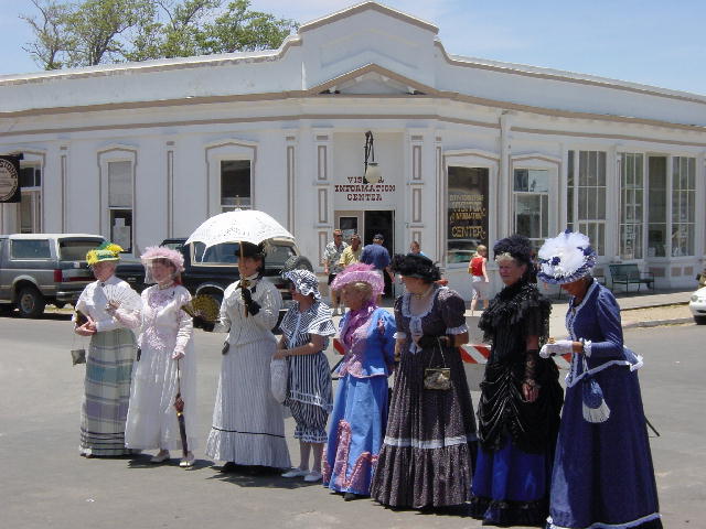
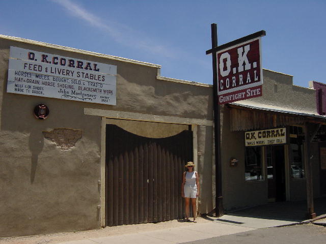
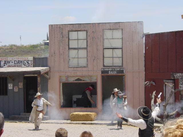
1) A 1800's fashion show was being held in the streets. 2) The famous OK Corral. 3) One of the shootouts we were witness to, as Joe commented at one point Tombstone is just an excuse for grown-ups to dress up as cowboys and play.
Monday, June 24, 2002
Tempe, AZ
We continued west into the Phoenix area to visit the state capital. We got into Tempe early enough to make some phone calls. I have been concerned about some audible knocking in the RV’s engine. I finally found a mechanic that could tell me what it was, without having to bring it in for an expensive diagnosis. Apparently the intense heat down here is causing some pre-detonation in the intake manifold. I’ll have to switch to higher-octane fuel until we can get to the cooler temperatures of the high Sierras later this week.
I also called an oral surgeon to have a blocked saliva duct looked at. They were able to squeeze me in this afternoon, so I dropped Christine off at a mall and went to my appointment. I was told by the doctor to wait out my condition, which is fine by me. I met Christine at the mall and we had a light dinner and then a good beer at the Alcatraz brewery before heading back into the 110-degree heat. Goodnight, we took advantage of a campsite phone hookup to update our website.
Tuesday, June 25, 2002 Desert City, CA
After making a few phone calls this morning we drove up to Scottsdale to tour Taliesin West, Frank Lloyd Wright’s winter architectural studio and apprentice workshop. The tour was quite fascinating. Christine and I had visited the house he built at Falling Water in Ohiopyle, PA five years ago. We learned today that Falling Water was a critical success for Wright during uncertain times. He only had two pieces of work commissioned during the Depression era 1930’s; and Falling Water in 1936 put him back on the radar screen. He used the $8000 from the Falling Water commission to purchase 640 acres in Arizona—Taliesin West in 1937.
Taliesin in Spring Green, Wisconsin had already been well established as Wright’s studio and apprentice training classroom. Taliesin West became an extension to this, and offered seasonal changes for Wright and his apprentices.
I was amazed at how photogenic Taliesin West was for me today. I seemed to see something interesting to photograph each time I turned around. Our tour guide was very knowledgeable, making it all very worthwhile. I’ve come to respect Wright for his many interesting and innovative ideas, even though quite a few of them are very impractical.
We took advantage of our trip through Phoenix to pay a visit to the Arizona State Capitol Building. It is actually more proper to refer to it as the State Capitol Complex, consisting of 48 buildings. The old Capitol Building was completed in 1901 and served the Arizona Territory until Arizona was admitted as the 48th state in 1912. The old building now serves as the Capitol Museum, having lost its official functions over a 20-year period from the 1950’s into the 1970’s. The newer buildings are much less interesting, though likely more functional. The Museum had a special exhibit honoring the Navajo code-talkers that were depicted in the current film: “Windtalkers.”
We used what was left of the hot day (112 degrees, but only 6% relative humidity) to drive west into California. We found a campground just east of Joshua Tree National Park, which we intend to explore tomorrow. Christine and I are both tiring of the extreme heat, though we’ve held up well. Perhaps it is the knowledge that we’ll be in the high Sierras in a few short days that has us eager to put the heat behind us.
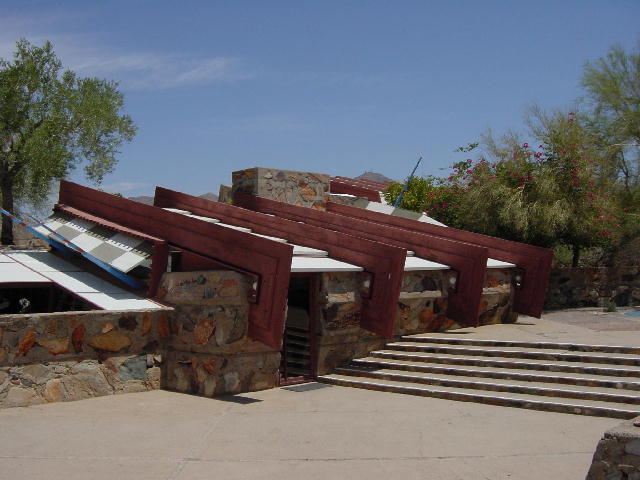
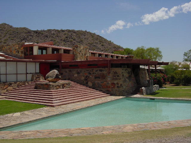
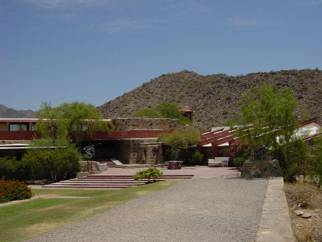
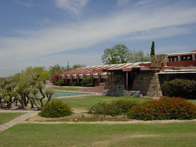
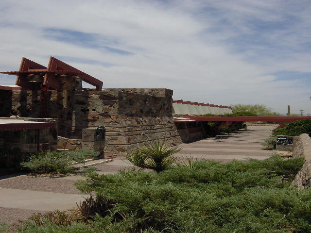
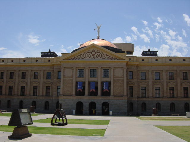
Pictures 1-5 are of Frank Lloyd Wright's Taliesin West. The last picture is the Arizona State Capital or technically the Capital Museum. I found the Arizona State Capital complex one of the most unimpressive Capital's we've seen so far - but that could have been the heat.
Wednesday, June 26, 2002 Barstow, CA
We did our best to get an early start so that we could get a hike in before the heat kicked in. We entered Joshua Tree National Park from the south and stopped for a three-mile hike through the Cottonwood Spring area. We did the Mastodon Peak loop trail. The temperature was already 100 degrees by 9:00, so we couldn’t push ourselves very hard. We learned that 6:00 AM is a proper starting time for a hike this time of year.
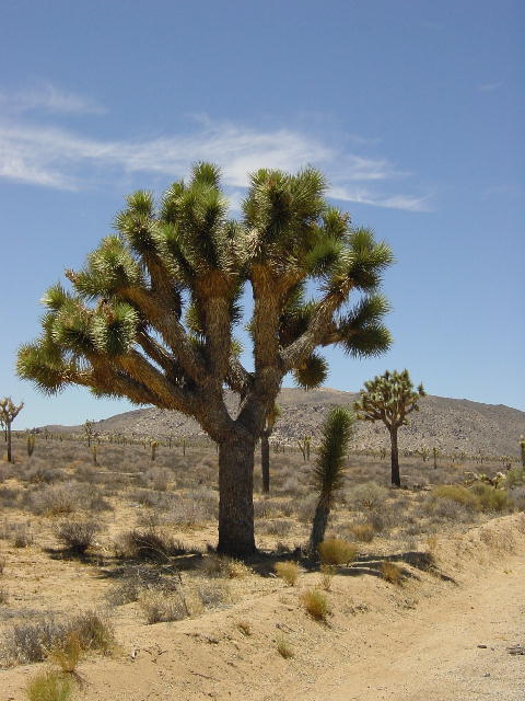
Joshua Tree National Park is the meeting place of two different deserts, separated primarily by elevation. The lower Colorado Desert (below 3000 feet) is drier and supports less vegetation (creosote bush, ocotillo, and cholla cactus), except for the occasional spring-fed oasis and the towering fan palms squeezed into their drainage areas. The higher Mojave Desert supports more diverse vegetation; of particular interest here is the Joshua Tree, actually a member of the yucca (lily) family.
The changes in scenery as the elevation varies are often accompanied by interesting rock formations. We followed up our morning hike with a couple more interesting hikes. One was through a cholla garden, an unusual cactus that can cause a lot of pain if touched. And later we walked through a section of big rocks around a dry lake. The heat finally caught up with us, but we had gotten to see a lot of this park.
We drove on up to Barstow and took in an afternoon movie (Windtalkers) to get out of the heat. Dinner was some spicy venison burritos.
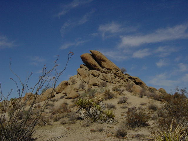

All of these pictures were taken in Joshua Tree National Park, as you can see it is somewhat of a varied landscape. 1) Cottonwood springs; 2) A view from the top of Ma
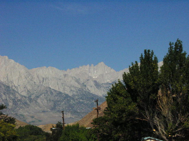
Thursday, June 27, 2002 Lone Pine, CA
Today was a very interesting day. We drove through Death Valley National Park on our way north to the coolness of the mountains. The whole Death Valley journey was so unusual. We entered the valley from the south over 3288-foot Salisberry Pass, then we steadily descended all the way to Badwater Basin at 280 feet below sea level. The entire area is so harsh and unwelcoming to life of any kind. We stopped for lunch at Badwater and took some photos. Most of the scenery today was not easily captured by a camera. The entire day was about extremes. The Park Visitor Center posted today’s high at 119 degrees. Needless to say, there weren’t a lot of visitors in the park.
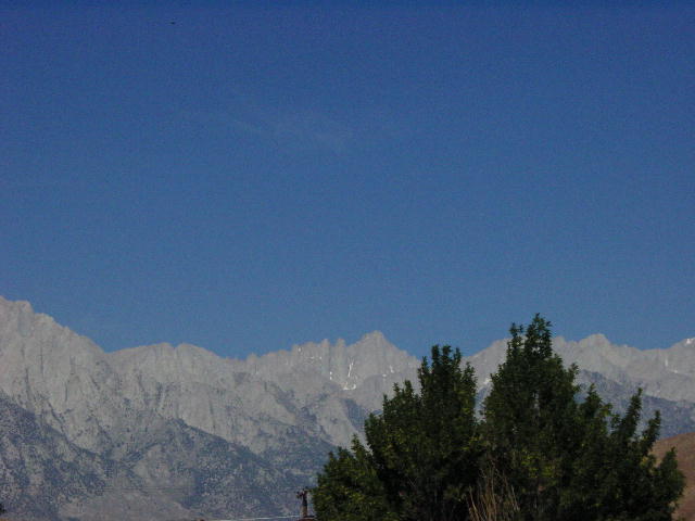
There were two steep 5000-foot passes on the way out of the park. Our poor RV really struggled getting up these climbs in the extreme heat. We pulled over and let the RV rest for a while and eventually cruised into Lone Pine. At 3000 feet, we were finally out of the low desert heat. Lone Pine sits just west of Mt Whitney (14,497’), the highest point in the contiguous 48 states. It is one of the best places to view the mountain from a paved road.
By Christine: Hallelujah! I am so happy to be out of the heat. It was too much for me. Those were some beautiful places, and bless the people who live there, but I couldn't do it.
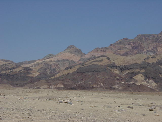
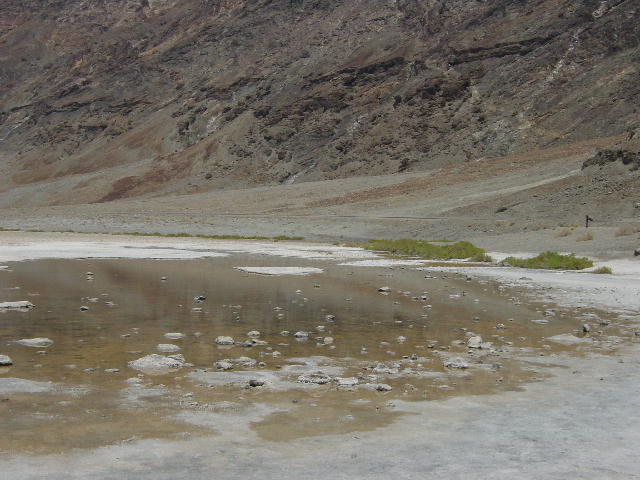
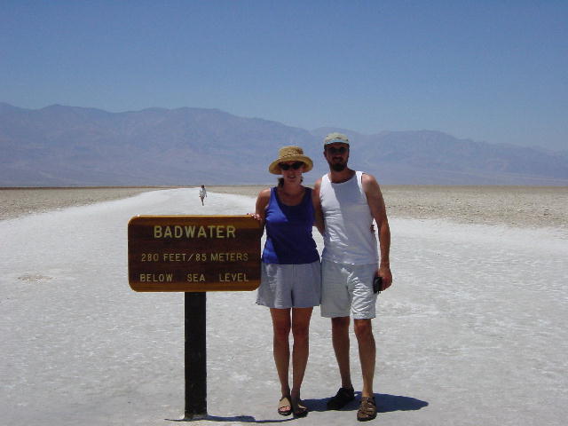
1 and 2) The first two pictures are landscapes of Death Valley. 3) This is a picture of Badwater, there is an actual pool of water here, but it is very stagnant, warm, and smelly. 4) The lowest point in the United States, and yes a picture with both Joe and Christine! Now that doesn't happen very often.
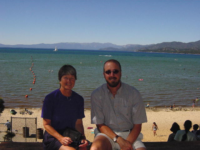
Friday, June 28, 2002 S. Lake Tahoe, CA
We really enjoyed sleeping without the A/C last night. We had a beautiful drive north along route 395. The view of the Sierra Nevada range to the west had us stimulated all day. The views of the snow-capped peaks were outstanding. We crossed over several 7000 and 8000-foot passes on our way up to Lake Tahoe.
We took a side trip to the Blue Lakes area in hopes of finding Capetown Jenny on the PCT (Pacific Crest Trail). I met Jenny when we were both thru-hiking the Appalachian Trail in 1997. She started her thru-hike of the PCT in April and we’ve been planning to hook up with her when we got out here. The most current information we had on her location put her in a 150-mile stretch between Yosemite Park and Lake Tahoe. We took a shot at finding her in the Blue Lakes area. It was a long shot, but it gave us an excuse to take a nice hike along the PCT.
We got about two miles south on the trail when we met up with two thru-hikers, Doc and Llama, and their dog, Coy. These two had eaten lunch with Jenny on the trail yesterday, and were moving at a faster pace after having one of their food bags taken by a bear. After some brief conversation, Doc recognized Christine and me as being the ones that fed him breakfast on Easter Sunday, 1998 when he was thru-hiking the AT. What are the odds of that? We gave Doc and Llama some cold drinks and apples, and invited them back to the RV to enjoy some more snacks before continuing their hike.
Christine and I were very pleased to learn of Jenny’s whereabouts and to know that we’ll probably meet up with her Sunday evening. We drove on into South Lake Tahoe and got a campsite just before dark. A tasty antipasto salad and some venison burgers on the grill served as our dinner. It had been a great day.
Mt. Whitney
Saturday, June 29, 2002 S. Lake Tahoe, CA
We got an early start to go for a 200-mile motorcycle ride. The weather was clear and comfortable for a day of riding. We rode west on US 50 down to Placerville (near Sacramento) and dropped south along route 49 through Sutter Creek (origin of the 1849 California gold rush) to catch route 88 back up into the mountains. The canyon roads were in great shape with predictable curves and mild grades, but a bit heavy with weekend traffic fleeing the heat of the Sacramento Valley.
Christine is riding well, but it takes a lot out of her to ride unfamiliar mountain roads with a lot of traffic. I was proud of the way she handled the foreign terrain. We returned to our campsite mid-afternoon and rested until dinner; grilled chicken breast salad.
Sunday, June 30, 2002 S. Lake Tahoe, CA
I was out of bed at 7:00 AM to go for another motorcycle ride this morning. Christine had opted to pass on this much longer and more challenging 300-mile route. I grabbed a donut and some coffee when I filled up my gas tank, and added some layers to offset the morning chill (42 degrees). I dropped south nearly to Yosemite National Park before picking up route 108 over Sonora Pass (9628’) west into the valley. This was a very twisty pass with a lot of elevation change, a very exciting riding. I descended to Sonora and picked up route 4 back up into the mountains over Ebbets Pass (8731’). There was a 30-mile section over Ebbets Pass that narrowed to a single winding lane. There was no center line, and cars had to stop and yield to each other in order to pass. This is the narrowest paved section of highway that I have ever seen. The route was dangerous because there was no signage indicating hairpin turns, and no guardrails. I had a few “Oh Shit!” moments as I grabbed a handful of brake, but it just made the ride very stimulating.
I was back at the campsite at 1:00, hungry and spent, but very elated. Christine had successfully exchanged e-mails with Capetown Jenny, and we arranged to meet her at her motel in town at 4:00. We drove over to look at Lake Tahoe and then had a great meal of Thai food. We spent the evening asking Jenny questions about her PCT hike. We dug out our trail guidebooks and chose a road crossing to do some trail magic for Jenny and her friends next Sunday. We arranged to have Jenny over for lunch tomorrow before taking her back up to the trail.
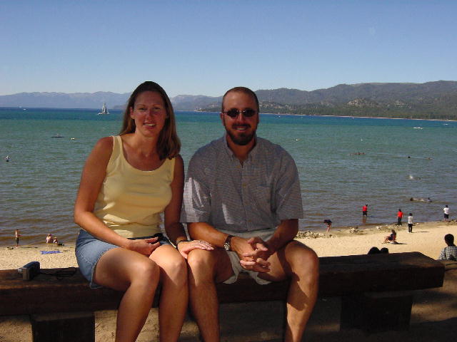
1) Jenny and Joe in front of Lake Tahoe.