| The Lustik Travel Home Page |
July 1 - 10, 2002
Monday, July 1, 2002 S. Lake Tahoe, CA
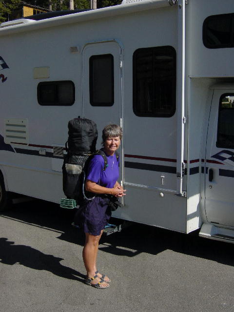
Christine and I made use of the campground tennis court this morning before it got too hot. I then did some sewing alterations on my motorcycle jacket and washed my motorcycle. It all made for a relaxing morning. I picked up Jenny and brought her back to out campsite for a fresh lunch that Christine prepared. We just sat around and visited with her until it was time for her to get back on the trail. We drove her back up to Echo Lake and watched her go through her mail drop as she readied herself for another section of her hike. We are so proud of her, and did our best to encourage her.
Christine and I returned to the campground for our last night (4 nights in one place is quite unusual for us) and grilled up some more chicken breasts for dinner. We have enjoyed the cool dry climate of the upper elevations these past few days, but it’s time to move on.
 Capetown Jenny
Tuesday, July 2, 2002 Reno, NV
We got up early and suffered another session on the tennis court before packing up and moving on. We stopped in Markleeville to pick up a mail drop before heading into Nevada to visit the state capitol building in Carson City.
Nevada sits on land that was purchased from Mexico in 1948, and was part of the Utah territory until 1861. Nevada Territory was awarded statehood (36th) three years later in 1864. The Capitol Building was constructed in 1870-1871 and went through several modifications before being completely restored in 1977. It now serves as a museum and continues to house the governor’s office. New Statehouse and Supreme Court buildings were built in the 1960’s, but complement the original Capitol Building.
We continued north to Reno for the night and ran a bunch of errands in the area. We camped in an RV park across from the Peppermill Casino. We even ventured inside to consider the casino buffet for dinner, but we opted for the Irish pub next to the RV park. We were attracted by the Alaskan Amber beer sign in the window. Dinner was very tasty. Christine had some fish (salmon) and chips, and I had a mahi-mahi stir fry, all washed down with Alaskan Amber on tap—oh yeah!
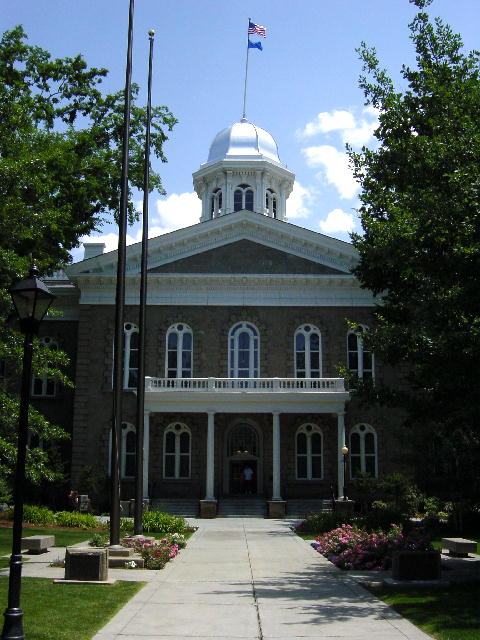 The Nevada State Capitol building. Nevada had a very pretty
capital complex.
The Nevada State Capitol building. Nevada had a very pretty
capital complex.
Wednesday, July 3, 2002 Dunnigan, CA
We spent the whole morning in Reno running errands associated with our plans to attend the Burning Man Festival two hours north of here in late August. We arranged for the rental of a self-storage space to hold our motorcycles while we are at the festival. We also did some scrounging around at surplus stores to get ideas about how to make our experience unique, creative, and comfortable.
We finally left Reno and headed west on I-80 to Sacramento. We visited the California State Capitol Building there and were very impressed. California became the 31st state in 1850, shortly after the discovery of gold. Sacramento was the fourth and final city to serve as the state capital beginning in 1854. The capitol building was constructed between 1860 and 1874, and it showcases the great wealth of this state. The Capitol Building sits in a 40-acre park that is tastefully landscaped with over 450 varieties of trees and flowering shrubs. This is one of the finest capitol buildings that we have seen, and we’ve already visited 21 of them.
We struggled to get out of Sacramento on this holiday eve. The frenetic pace of pre-holiday traffic was enough to hurry us out of town. We found a quiet campground north of the city and called it a day.
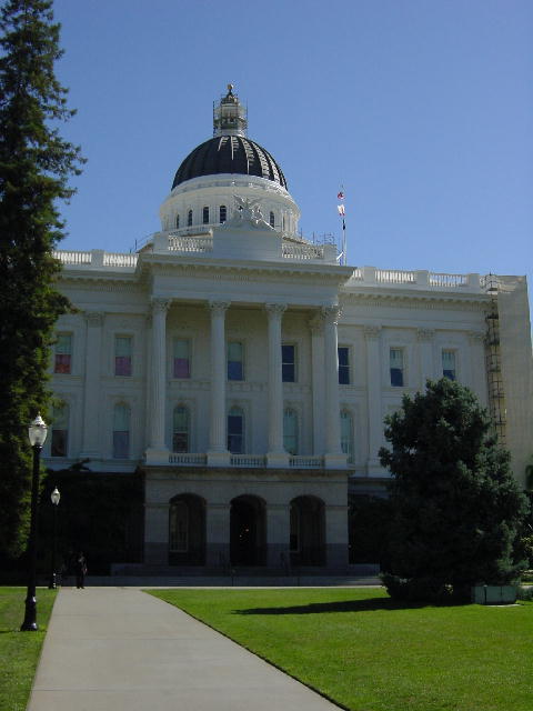 The California State Capitol building.
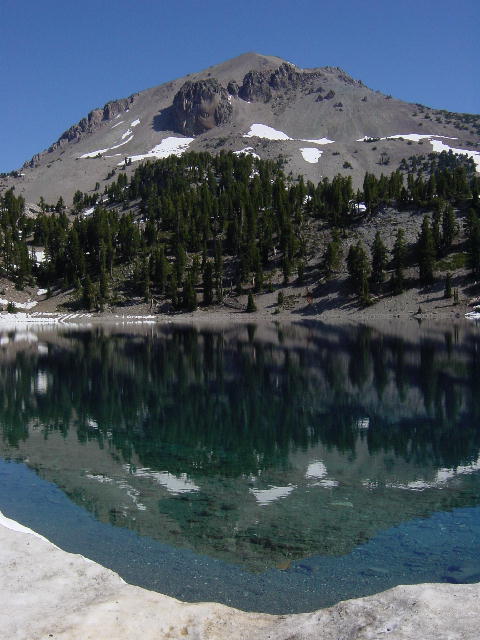
Thursday, July 4, 2002 Mineral, CA
We got a slow start on this holiday. We went for a good 3-mile walk before finally driving out of the valley back up into the mountains. We lucked into a campsite just outside of Lassen Volcanic National Park. I had made several calls this morning trying to secure a campsite for these next two nights, but everything had long been reserved for the holiday. We decided to take a chance and just head on up here. We were so pleased to find such a quiet peaceful spot.
We didn’t feel too ambitious, so we played a game of Scrabble and then had a great dinner of grilled salmon. It was so nice to just sit here in the cool mountain evening. Christine even whipped up a desert that she made out of frozen ripe banana slices. She whipped them with a splash of milk, powdered chocolate and brandy in her mini food processor, and voila—instant banana ice cream, without the sugar or fat.
Friday, July 5, 2002 Mineral, CA
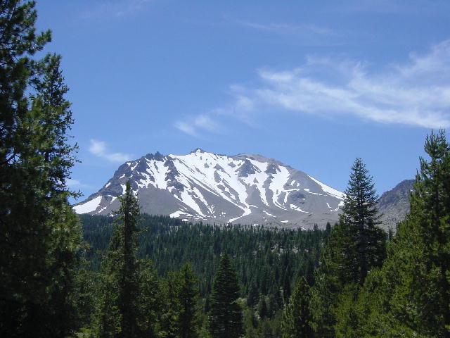
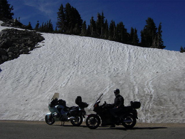
I rolled the motorcycles off the RV and we packed for a day of exploring the park. We rode in the south entrance and decided to climb to the summit of Lassen Peak (10,457’) … on foot. We had brought our hiking shorts and water bottles. We changed into our shorts at the trailhead and began a 2000’ ascent over 2.5 miles to the top. It was a fantastic day and a strenuous climb. The 5-mile round trip took a little over 3 hours. We had great views from the summit, especially of Mt Shasta (14,162) 70 miles to the northwest.
Afterward, we were well past our lunch hour, and very hungry. We rode out the north entrance of the park to Old Station and devoured two of the tastiest cheeseburgers you can imagine. Christine returned to our campsite through the park while I continued a 150-mile loop around the east side of the park.
Lassen Volcanic National Park is not a well-known park, though it is fabulously beautiful. Lassen is the southernmost peak of the Cascade Range that extends all the way to Canada. Lassen Peak erupted in 1914 and continued its activity for the next seven years. Prior to Mt. Saint Helens eruption in 1980, Lassen had been the most recent volcanic activity in the contiguous 48 states. Today scientists predict that Lassen or Shasta are the most likely peaks to become active again. There is evidence of geothermal activity throughout the park, including steam vents and mudpots. This is a park of amazing beauty.
Back at the campsite we were able to beg for an e-mail connection to confirm some PCT trail magic that we have planned for Sunday. We kicked back in the RV and watch a couple video rentals and ate leftover venison chili. It had been a really good day.
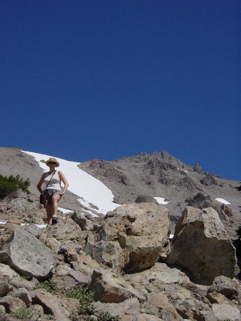
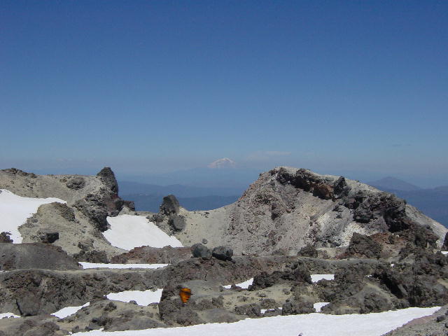
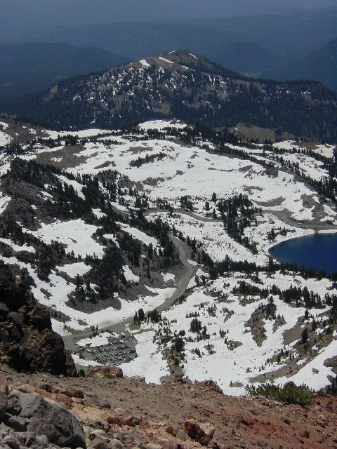
These pictures were all taken in Lassen Volcanic National Park. 1) This was the trail to the peak behind me. 2) This is the top of the mountain, you can see the volcanic area and in the background look closely for the white top of Mt. Shasta. 3) We started in that parking lot. It sure looks far away in this picture. 4) A view of Lassen Peak from further down the road. 5) We passes lots of snow and walked some on our hike. 6) Lake Helen.
Saturday, July 6, 2002 Sierra City, CA
We checked out of our campground and drove back into Lassen Park for another hike. We walked the 3-mile roundtrip to Mill Creek Falls, a much easier trail than yesterday’s summit of Lassen Peak. It was another perfect day for taking a walk through the woods. There are surprisingly few bugs up here and the temperature couldn’t be better. We left the park and made our way south to Sierra City on Hwy 49.
Sierra City is 1.5 miles west of where the PCT crosses the highway. We had arranged with Capetown Jenny to do some trail magic here tomorrow. We checked into the campground in town and began making plans for tomorrow. We took a couple thru-hikers up to the trail and learned of a shortcut from the PCT into town. Christine got busy preparing dishes and cookies for tomorrow, and I did my best to stay out of her way.
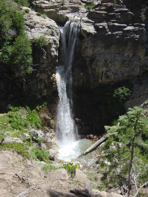
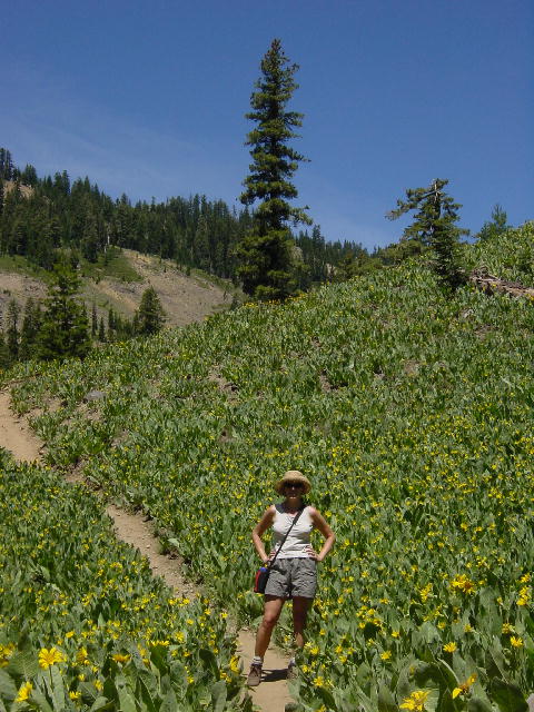
1) Mill Creek Falls in Lassen Park. 2) We passed many meadows of beautiful flowers today. The flowers behind me have large leaves and are called Mule Ears.
Sunday, July 7, 2002 Sierra City, CA
I took my motorcycle off and prepared to go for a ride. I had to hang up some signs on the trail by the shortcut into town. I got the two-mile hike out of the way and then went for a sweet 100-mile motorcycle ride along a loop of twisty roads.
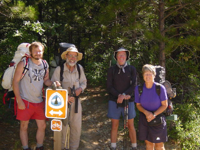
Back at the campground Christine was ready to feed hungry hikers. We cleaned up and drove up to the trailhead to pick up hikers as they hit the road. Jenny came in at 2:30 and told us that everyone else had taken the shortcut into town. We returned to the campground and got set up for dinner. We ended up feeding 7 thru-hikers (Jenny, Bedbug, Grunge, “T”, Caveman, Strawberry Girl, and Black hawk), a section hiker (Mountain Mike), and another trail angel (Bruce).
Christine had outdone herself. She had fresh veggies, a bowl of cherries, watermelon, chips and dip for starters. Burgers and beer brats on the grill with all the fixin’s (sautéed onions and mushrooms, bacon, cheese, lettuce, tomato, saurkraut, etc). She made a great antipasto salad and a potato salad, and doctored up some baked beans. It was quite a meal and everyone clearly had their fill. We continued to sit around for several hours and finally pulled out a couple half gallons of ice cream to go with the cookies Christine made. We drank the bottle of merlot that Mike brought, and most of the beer and soft drinks were consumed. It had really been a good evening.
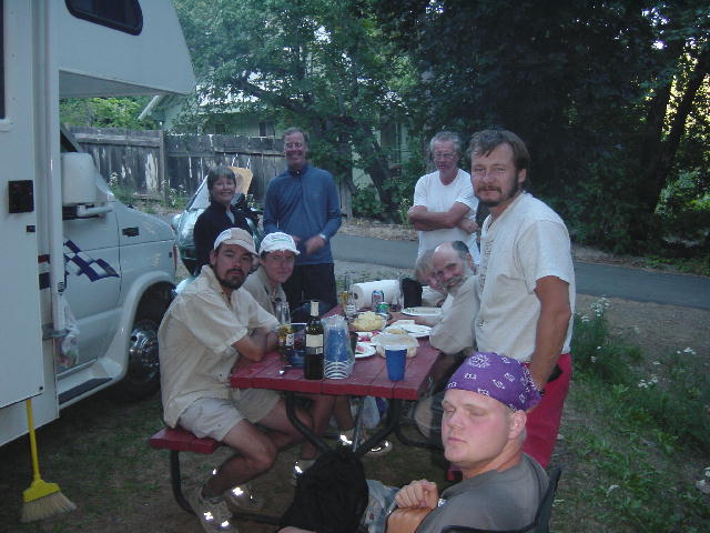
Unfortunately this is the best picture we have, from the left, we have Black hawk, Strawberry Girl, Jenny, T, Bruce, Caveman, Grunge, Mike, and Bug.
Monday, July 8, 2002 Nice, CA
We stuck around this morning and shuttled hikers up to the trailhead as they got ready to continue their hike. We finally left town and came out of the mountains back into the Sacramento Valley. We stopped in Yuba City at a library to get some internet time before heading west up into the Coastal Mountain Range. We stopped at a campground in Nice on Clear Lake. Christine wanted to know if Nice was a nice place. We learned that Nice is pronounced (neese), but it is indeed a nice place. We camped right on the lake and began eating some of the leftovers from last night’s smorgasbord.
This was our first group dropped off at the
trail today, Mike, Grunge, T, and Jenny. They were all wonderful people to
spend a night with and we wish them well on their journey.
Tuesday, July 9,
2002 Fortuna,
CA
We got a pretty early start and drove the twisty road down to the Pacific Coast Highway. We drove down to Mendocino and ate lunch in Mendocino Head State Park. It was only 57 degrees along the coast. We enjoyed walking around the quaint town of Mendocino for an hour and then headed north on Highway 1. We drove up into Humboldt County and found a great campground just south of Eureka. We decided to stay here a few days so that we could explore the area on motorcycles.
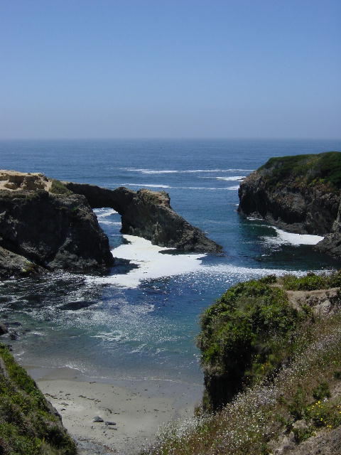
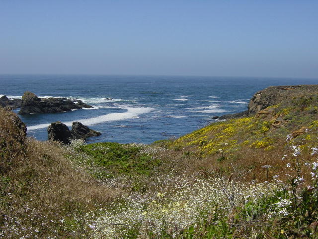
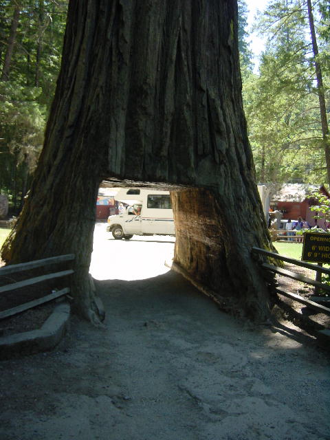
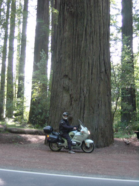
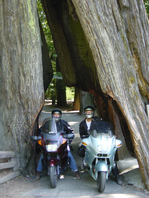
1 and 2) The Mendocino Coast; 3) Well we
didn't fit, but it was billed as a drive through tree.
Wednesday, July 10,
2002 Fortuna,
CA
I
got up pretty early and went for a twisty 250-mile motorcycle ride that took me
toward Redding, CA and then back out to the coast.
It was a cold, damp and foggy 58 degrees when I started, but it hit 100
degrees inland very quickly. As I
descended into Eureka it dropped back down to 70 degrees. It’s amazing how much the temperature can fluctuate due to
the combined effects of the Pacific Ocean and the Coastal Mountain Range.
I
got back to the campground in time for lunch and prepared to go for another
ride, this time with Christine. She
had stayed behind to do laundry and do some school work. She just began her
final class. We hit the road back
south and completed nearly another 100 miles of riding, 32 of which were along
the Avenue of the Giants. This is a
fantastic scenic route that parallels Hwy 101 between Pepperwood and
Phillipsville. The entire route is
bordered by old growth coastal redwood trees.
The
coastal redwood tree is the tallest natural growth in the world. It can reach heights in excess of 350 feet (35 story
building) and live for up to 2000 years. The
Sequoia tree of the Sierra Nevada Mountains is actually larger in mass, but
doesn’t exceed 300 feet in height. Nearly
all the old growth redwoods are now on land that protects them from being
harvested. It is so spectacular to
be in the presence of such massive trees. Their
root system permits them to grow close together in dense groves that seem to
amplify the effect of their size. It
was perfect to get to ride through these trees on motorcycles, having no roof
overhead to limit our skyward gaze.
We
returned to the campground and cleaned up for dinner out.
There is a brewpub within walking distant of our campground.
That’s something that the two of us consider to be a blessing.
We enjoyed a couple robust beers and some fine pub meals at the Eel River
Brewing Company.
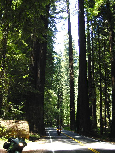
These pictures were taken along the Avenue of the Giants. It was a beautiful ride.
Thursday, July 11,
2002 Brookings,
OR
I
wanted to get one more motorcycle ride in before continuing north. Christine chose to stay behind and exercise.
I took what I thought was going to be a fun 50-mile ride on the Lost
Shore Road loop, but it ended up being a very demanding 100-mile trial that took
me well over two hours. I rode
through a section of Humboldt Redwoods State Park before winding over to the
coast for a very scenic section where I battled the wind.
It was a great ride, but I’m glad that Christine had chosen to stay
behind—it was quite challenging.
We
packed up and stopped at the Loleta Cheese Factory looking for cheese curds.
They had some, but they were from Monday, which just isn’t fresh
enough. We then continued north
through Eureka and on up to Redwoods National Park.
We stopped for a three-mile walk through the woods.
Until you’ve experienced a walk amidst the coastal redwoods, you
can’t really know the sensation of childlike awe and wonder that these trees
elicit. It almost feels like a
playground and fuels your imagination to conjure fairy tale visions.
I truly enjoy these towering trees.
We
crossed into Oregon and celebrated the fact that Hawaii is now the only state
neither of us has been to. It’s
been a long great journey so far. We
pulled into Brookings for the next two nights and were surprised by the warm
clear climate of this coastal town. This
area is referred to as Oregon’s Banana Belt and somehow manages to get more
warmth and sunshine than the neighboring coastal areas.
We camped in a busy campground right on the harbor. We took in a walk along the beach and harbor after dinner and
called it a day.
Friday, July 12,
2002
Brookings, OR
I
took my motorcycle off for an exploratory ride, leaving Christine to nail down
the topic and scope of her final project for her final class.
I rode on up the coast to Gold Beach on the first leg of a planned loop
that I ended up not completing. I
found out that a serious rockslide along my route had made the trip unwelcoming.
Instead I spent the day tooling around Gold Beach exploring fishing spots
on the Rogue River.
The
Rogue River is a famous landmark for both fishing and jet-boating. Over fifty years ago the boats that delivered mail upriver to
the settlements began taking on paying passengers to see the sites up river.
Later, the innovation of jet-boats made the trip faster and more
exciting. Now there are multiple
trips from two different outfits that will take a boatload of tourists jetting
up the river 50 miles over whitewater only 6 inches deep.
It is quite a lucrative business.
I opted to focus on the fishing interests on the Rogue River. With some repeated advice from a local fishing outfitter I was able to explore a few good fishing spots and consider some choices for tomorrow. I rode back to Brookings with a plan for fishing the Rogue tomorrow. Christine had been productive today and was ready to spend her birthday tomorrow without touching her computer. Today had been a cool and foggy day along the coast.
By
Christine: It was a very pleasant day to be by myself today. That doesn't
happen often. Not only did I do homework, but I got a great exercise
session and walk in, and I visited one of the local seafood shops in the
harbor. I was like a kid in a candy store picking out fresh seafood for
dinner tonight. I bought a very small chunk of good smoked salmon and a
very small amount of fresh crab meat and a tuna tenderloin. I surprised
Joe with an appetizer of the smoked salmon and a warm crab dip I put together
before slicing the tuna into medallions and lightly cooking them for
dinner. Yum!
Saturday, July 13,
2002 Gold
Beach, OR
We got an early start and drove up to Gold Beach. The friendly outfitter from yesterday sold us some one-day fishing licenses and I had some 12-pound test wound onto our spare spools. I bought some lures and a package of frozen herring for bait. We drove 10 miles up the Rogue River to a bridge crossing at Lobster Creek. There is a cool spring-fed backwater pool just above the bridge that attracts the fish out of the warm water of the Rogue River. I had spotted some 50-pound (4-feet long) Chinook (King) Salmon swimming around in this pool yesterday.
Christine and I scrambled out to a gravel spit that separates the spring-fed pool from the river. We spent the next several hours wading thigh deep in the refreshing water trying to hook some fish. We used the herring with a bobber and an anchor weight to try to hook a big king. That mostly involved casting the line and waiting. We never got any bites that way, so we switched to some spinner lures to cast for trout.
There are two trout common to the Rogue River: the cutthroat and the steelhead. The cutthroat is protected in these waters, which means that they must be released if caught. The steelhead is a sea-run rainbow trout. It resembles salmon in many ways. The steelhead are raised in hatcheries and released in the rivers to maintain stock levels. Only the hatchery-raised steelheads can be harvested. They are recognizable from the native steelheads by their absent adipole fin that gets clipped off in the hatchery.
It was nearly lunchtime when I hooked a steelhead on the light-action rod that we have. It put up a considerable fight and threatened to run out the 60 yards of line that was squeezed on my small spool. I played her hard and fast and dragged the beautiful 2-foot trout onto the gravel beach. I was pleased to see that her fin had been clipped, making her a keeper. Not long after landing the steelhead I hooked a small cutthroat that wouldn’t have been a keeper even if it were legal to harvest cutthroats.
Christine went back up to the RV and prepared some lunch for us while I continued fishing. We sat on the gravel bar and soaked in the wonderful surroundings while eating lunch. We continued fishing for another hour without a bite, and then decided to move on. I filleted and skinned the steelhead coming out with enough fish for six generous portions. It was very pink and resembled salmon meat.
Christine and I drove a few miles down river and checked into a campground. Christine took a birthday nap while I set out at this new location to spend another hour fishing without a bite. The surroundings were just so pleasing that I was eager to be out in them.
We cleaned up and put on some of our dressy clothes (RV dressy that is) while enjoying cocktails before going into town for a fine birthday dinner. We had made reservations at Spinners, Gold Beach’s finest dining establishment and were very pleased with our choice. Christine had a great piece of Oregon halibut with pungent wild mushrooms. I had a king salmon filet grilled and served on a cedar plank. It was interesting to see my fish served to me on a charred plank of cedar, resembling a piece of cedar shake siding. It was a fine meal and a good cap to the celebration of Christine’s birthday.
By Christine: It was a very nice place to spend my birthday. It's hard to believe the day could be even more relaxing than any other day in our lives. I had a little birthday moment today. This morning when we were making our way out to the gravel bar there were two deer drinking out of where we spent the day fishing. They looked at us for a moment and moved on. When we were done fishing, I was climbing back up the hill (it was pretty hard to get to the gravel bar), and as I reached the edge of the woods I heard a sound knowing it was a large animal. I carefully moved forward up the path and as I came out at the top there was one of the deer (a smaller buck) standing looking at me. He was only about 15 feet away and he didn't move off. So we watched each other for awhile until I heard a sound on the path. I thought it was Joe and I moved back a little hoping the deer would stay put but up the path came the other deer, (a little Doe). She also watched me a bit then turned wagged her white tail at me and they went into the woods, just as Joe was coming up the path. One doesn't get those moments that often.
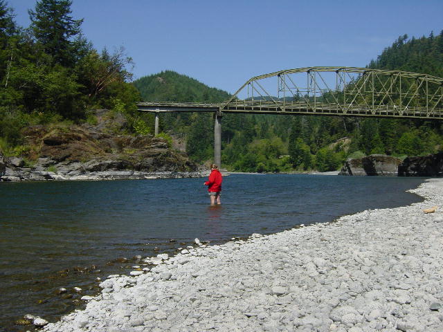

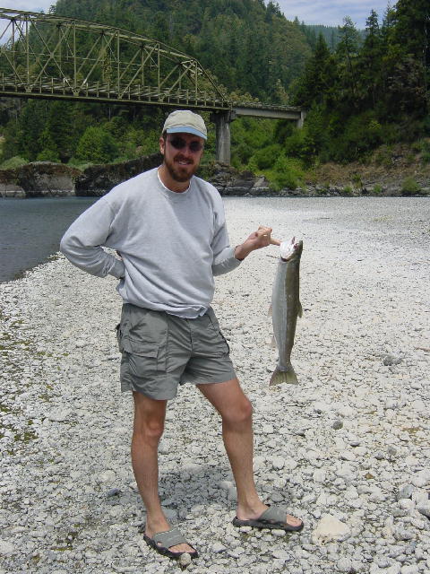
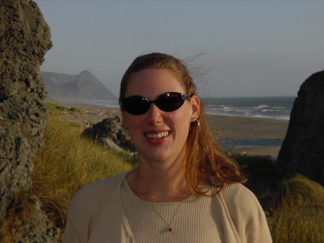
1) Christine fishing (not catching); 2) Joe fishing; 3) Joe and his Steelhead trout; 4) Christine's birthday picture.
Sunday, July 14, 2002 Lakeside, OR
We took our time getting started and stopped frequently to take in the coastal views and snap some photos. We stopped at Cape Blanco to visit the oldest, longest-running, and highest lighthouse on the Oregon Coast. It was also the first Oregon lighthouse to have a woman keeper, in 1903. We climbed the lighthouse and learned more about Fresnel lenses and the network of lighthouses in Coastal Oregon. We fought very strong coastal winds as we explored the cape.
We continued north and stopped for lunch in Bandon where we found another cheese factory that to our joy had fresh cheese curds today. They were really quite good cheese curds, and made a perfect lunchtime snack. We followed lunch with a fun walk amongst the giant boulders along Bandon’s Beach Loop Road and past the Coquille River Lighthouse. We continued north through Coos Bay and stopped for the night in Lakeside, in the middle of the Oregon Dunes National Recreation Area. We stayed in an RV park that actually had a great little pub right in the campground. We enjoyed shooting a few games of pool over some cold pints of Labatts before calling it a night.
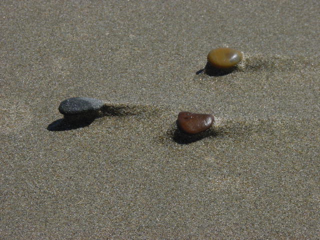
1) Coquille River lighthouse; 2 and 3) The beaches around Brandon; 4) The Oregon coast: 5) It was super windy for our walk on the beach you can see by these sand formations how windy it was. All the rocks were like this, it was like a big screen saver.
Monday, July 15, 2002 Dexter, OR
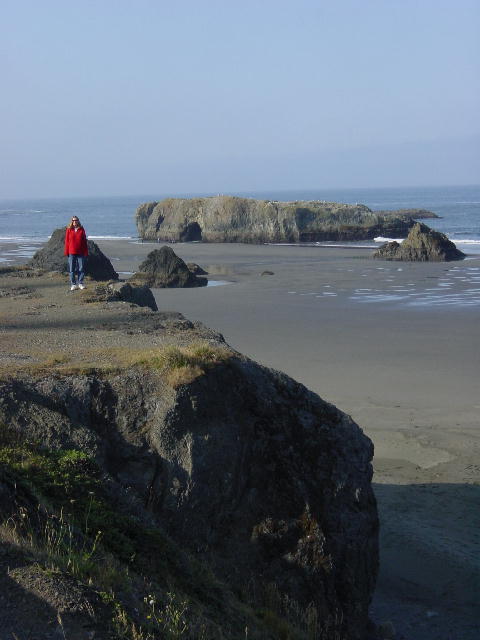
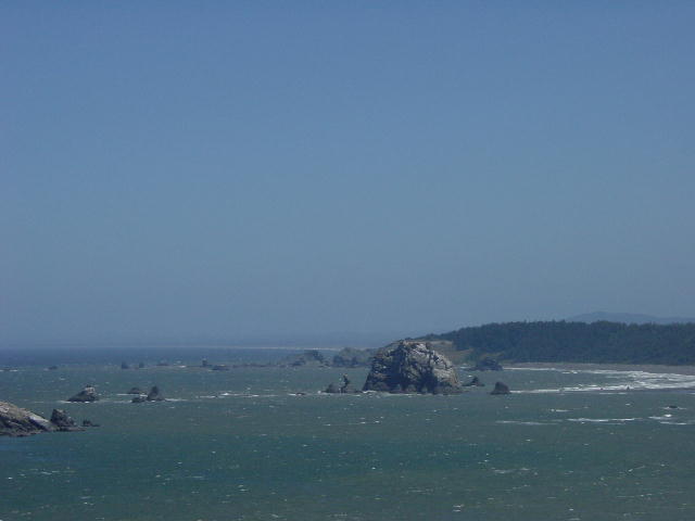
We started today by exploring the Oregon Dunes around Winchester Bay. We considered renting some ATV’s, but opted instead for the exercise of climbing the dunes on foot. The day was beautiful with great views. The wind occasionally spewed sand in our faces, but the walk was otherwise just plain fun.
We visited the Umpqua Lighthouse before continuing up the coast to Florence and turning inland toward Eugene. We stopped for some shopping in Eugene and camped for the day just east of the city.
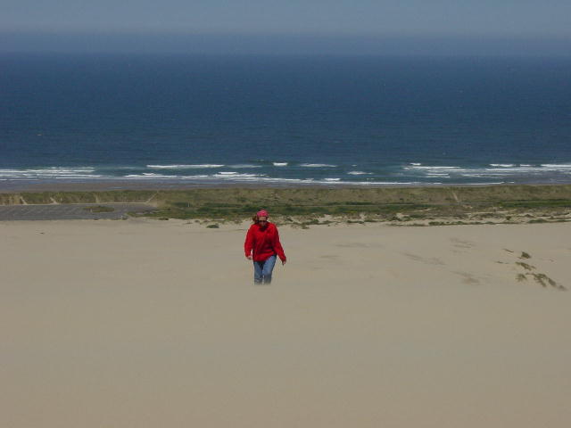
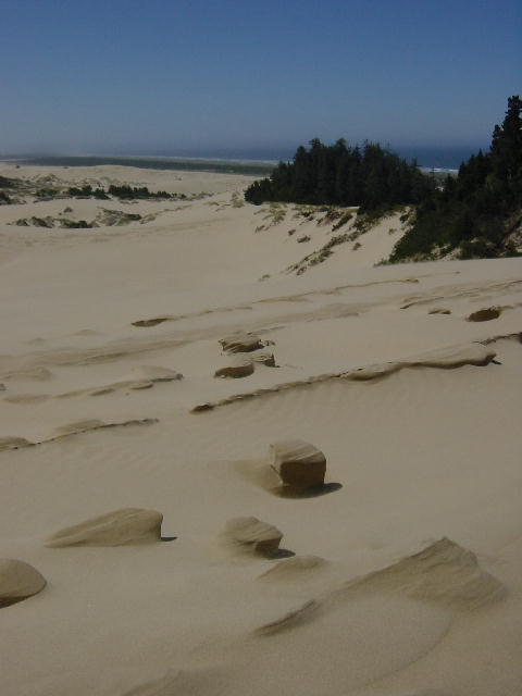
By the two above pictures you can again see how windy this climb was and how the wind affects the sand.
To view more pictures of the Oregon coast and Sand Dune visit the new Spotlight Pictures page.
Continue with July 16, 2002...