| The Lustik Travel Home Page |
July 16 - 31 2002
Tuesday, July 16, 2002
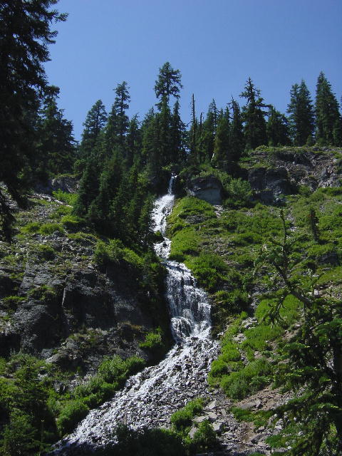
Crater Lake National Park, OR
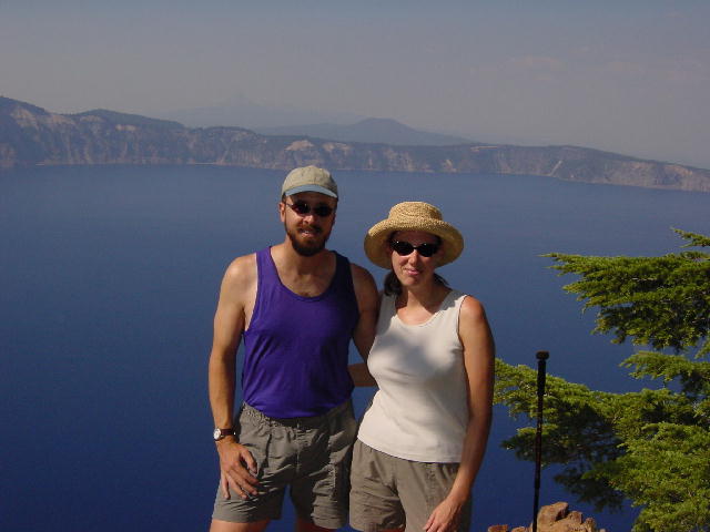
We got under way and made it to Crater Lake National Park in time to have a late lunch with a view of the lake from the rim of the crater. We were both disappointed to see a heavy smoky haze filling the crater basin and obstructing the views. There had been an electrical storm this past Friday and Saturday that had ignited ten small fires in the park, but most of the haze was caused by much larger fires outside the park in surrounding Oregon and northern California. We did our best to curb our disappointment and hope that the conditions would improve sometime during our brief stay here.
We decided to drive back off the rim and check into the park campground for a couple nights before coming back up for a late afternoon hike. We put on our hiking clothes and drove back up to the rim. We were so pleased to see that the conditions had improved considerably in just the two hours that we had left the rim.
Crater Lake is what remains of Mt. Mazama (est. 12,000’), a volcano that erupted nearly 8000 years ago. The volcanic cone of Mt. Mazama stayed in tact during the eruption until it was so weakened that it collapsed into itself leaving a massive caldera rimmed by the base of the mountain. The crater filled with rainwater and melted snow and is now 1,943 feet deep at its deepest point. This makes Crater Lake the deepest in the U.S. and one of the deepest in the world. This depth along with the record-breaking clarity of the water (visibility measured to a depth of 163 feet) give the lake its intensely blue color. The lake has reached a balance between its sources (rain and snowmelt) and the forces of evaporation and seepage; the water level of the lake now varies less than three feet annually.
Gold prospectors discovered the lake in 1853. Crater Lake became the country’s 5th national park in 1902. That should do it for facts and figures. We went for a 3-mile hike up to Garfield Peak (8054’), about 3000 feet above the lake. The views of the lake were very good. We met two other couples that were hard-core travelers. One couple had full-timed for a year, and the other couple had been at it for 6 years. Both the other couple had done their full-timing on sailboats. They had actually met while they were both full-timing in the Bahamas. It was fun to chat with our contemporaries. We went back to the campground and enjoyed some grilled burgers for dinner, and a bowl of fresh berries (blue, black, and raspberries) for dessert.
Yes, we are still traveling together!
Wednesday, July 17, 2002 Crater Lake National Park, OR
We set out for another day of exploring the park. We began by starting to drive around the 33-mile Rim Drive. We stopped halfway around to hike to the summit of Mount Scott (8929’), the highest point in the park. Christine packed us some lunch and we had no trouble with the 2.5-mile climb up 1300 feet to the top. We enjoyed our lunch with the great views before us. The area surrounding the park is thickly masked in haze. We were barely able to pick out Mt. Shasta through the smoke 100 miles to the south. We descended and continued our Rim Drive loop stopping frequently to take pictures. Another mile or so of short hikes rounded out our day. We returned to the campground and cleaned up before grilling out some of our trout for dinner. Christine kicked my but in a game of cards. Other than that, it had been a really good day.
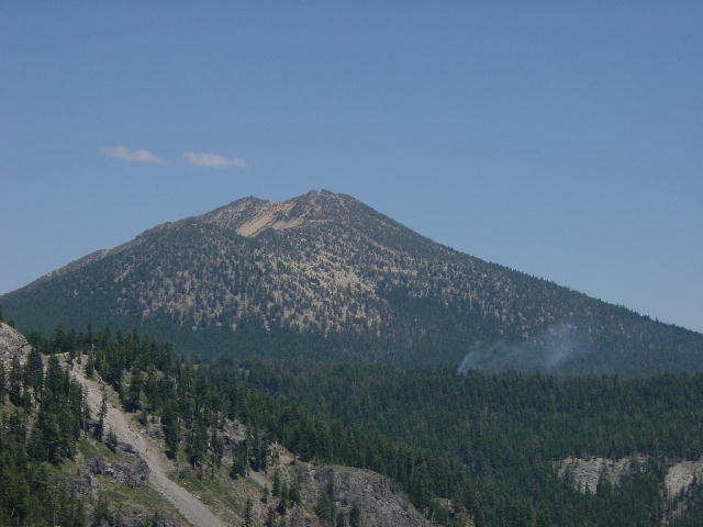
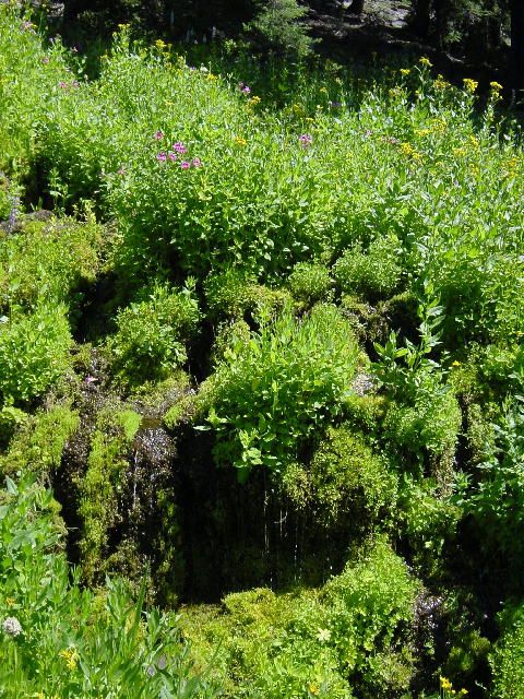
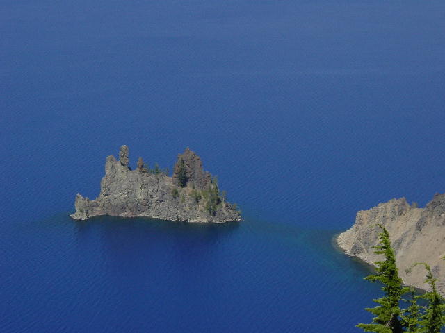
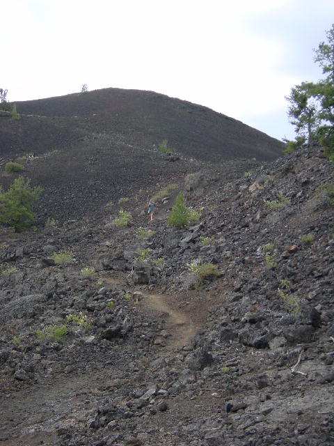
1) This is Mt. Scott, we climbed all the way to the top. In front of it you can see a plume of smoke from one of the small fires burning in the park. 2) Crater Lake is mostly pine forest but this picture is to show you there are lush areas of water and flowers. 3) This is the Phantom ship, I find it fascinating that this little formation was inside of the volcano the whole time and only after the volcano fell into itself did this formation become visible and is the only island other than Wizard island in this lake. Also, if you look closely you can see how clear the lake is on the edges. 3) This is called Vidae falls.
To see many more beautiful Crater Lake pictures visit the new spotlight pictures page.
Thursday, July 18, 2002 Bend, OR
We made time for one more hike before leaving the park today. We descended from the rim down to the lake to better appreciate the clarity of the water. I was able to stand on the dock for the tour-boats and clearly see the lake bottom 25-feet beneath me. It is amazing.
We left the park and continued north toward Bend. We stopped on the way to visit the Newberry Volcanic National Monument. We are really getting a complete picture of the volcanic history of the Cascade Range. The monument has flows as recent as 1300 years old compared to the 8000 year old history of Crater Lake.
We continued into Bend and found a campground for the night. Bend is a cool city of about 60,000, but it feels much smaller. We were able to do some shopping here and then went out to eat at the Deschutes Brewery and Restaurant. I was so pleased to find that they had two of their beers on cask conditioning. One of them was a medium bodied organic bitter, and the other was a red ale. I was thrilled with both of them, as well as our fine meals. Christine had a baked vegetable spring roll, and I had a Portobello mushroom sandwich covered in blue cheese and caramelized walnuts. We were both very pleased with the meal.
Friday, July 19, 2002 Mt. Vernon, OR
We were so pleased with the Bend area that we spent a little more time exploring. We had an especially nice day since the weather had pushed the smoke east. We had a great view of the mountains, from the Three Sisters up to Mount Jefferson. We drove on up to the town of Sisters and learned that the real estate here is over our budget.
We drove east through the Ochoco National Forest and stopped at the John Day Fossil Beds National Monument. The lower mountains of eastern Oregon are very scenic. We found a great State Park to stop in for the night.
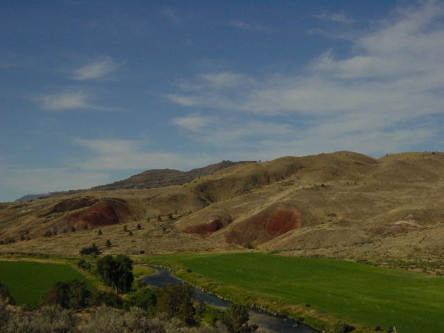
I think this picture really shows some of the great color variations in the hills of John Day Fossil Beds National Monument.
Saturday, July 20, 2002 La Grande, OR
We continued east through the mountains and found some of the area to be very attractive. We drove through Baker City and up to La Grande and investigated some of the available real estate. It has a lot of promise and we’ll give it ongoing consideration as we compare it to land in Idaho and western Montana.
Sunday, July 21, 2002 Meridian, ID
We left Oregon today into Idaho. We took a side trip to visit a couple fine wineries west of Boise. Ste. Chapelle Winery was having a great sale on some of their older vintages. We also caught them during one of their Summer Sunday Jazz Concerts. The place was really jumpin’. We also visited the Koenig Distillery & Winery. In addition to their fine wines, they make a wide selection of brandies from their fruit orchards. Unfortunately due to state liquor laws we couldn't taste the brandies and we couldn't even buy the brandy on Sunday.
We checked into a congested campground for a couple nights and prepared to have some work done on the RV.
Monday, July 22, 2003 Meridian, ID
We got an early start on our errands today. I dropped Christine off at the Starbucks near the downtown library since she’d have to wait an hour for the library to open. I took the RV to the Ford dealer and got my brakes fixed. The ABS sensor had failed on one of the wheels, which caused my Brake and ABS warning lights to stay illuminated on my dash. I had learned to disregard these lights over the past two weeks, but that caused me trouble when I forgot to disengage my parking brake on two occasions. I got everything taken care of at the dealer and was gladly out before noon without spending a lot of money.
I hooked up with Christine after lunch and we went to visit the Idaho State Capitol Building. Idaho didn’t become the 43rd state until 1890. It’s capitol building was constructed from 1905-1920 in the neoclassic design of so many other state capitols. The capitol uses a lot of shiny bright marble in the interior, but the impressive clomuns in the rotunda are actually a faux marble called scagliola—a mixture of gypsum, glue, marble dust and granite that is dyed to look like marble. The final outcome is very impressive. Another interesting note is that Idaho’s capitol building is the only one in the U.S. heated by geothermal water. A natural source of hot water lying 3000 feet beneath the capitol building has been tapped, and heats the entire Capitol Mall.
We found a large retail area in the suburbs
and did some shopping before catching an early showing of “The Road to
Perdition.” We returned to
the downtown area and had dinner at the Bittercreek Ale House, a beer
drinker’s haven. They have 30
fine microbrews on tap as well as a cask-conditioned ale.
We both enjoyed our meals and several pints of beer.
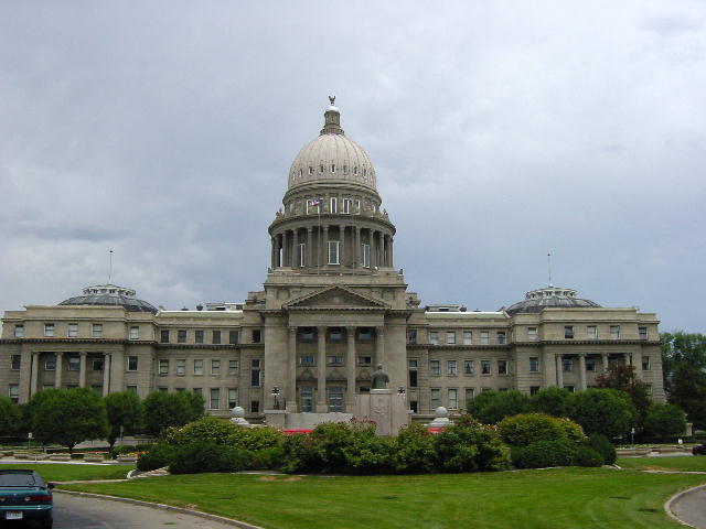
Idaho State Capital
Tuesday, July 23, 2002 Ketchum, ID
We
did a repeat of yesterday morning. I
dropped Christine off at the library and then took the RV to get the leveling
system serviced. I got the
hydraulic leak repaired and then Christine and I headed out of town. We drove up to Ketchum-Sun Valley, the country’s first
destination ski resort. Sun Valley
installed the world’s first chairlift for skiing. The area is still well known for its skiing, but it is also a
fine community of about 4000.
Christine and I found a campground a couple miles south of town and then took our bicycles for a seven-mile tour of the area before coming back for a late dinner. It is a very pretty area.
By
Christine: This was a very nice area but as we looked around we found out we
aren't the only ones that think it is nice. The saying around here is
"the billionaires are chasing out the millionaires".
Wednesday, July 24,
2002 Arco,
ID
We
took in a great five-mile hike in the Sawtooth National Forest before coming
back into town to meet with a real estate agent.
We wanted more info on a property that caught our eye in one of the land
publications. We picked up a plat
of the parcel and set out to see it on our own.
The land has great views of Borah Peak (12,662’), Idaho’s tallest,
but the area was too dry with very few trees.
Our search continues.
We
drove north out of Ketchum over Galena Pass (8701’) to the headwaters of the
Salmon River. This route brought us
into the Sawtooth National Recreation Area.
The Sawtooth Mountains are spectacular pointy peaks that line up like
teeth on a sawblade. I found this
land completely enchanting. At
Stanley we left the Sawtooth Scenic Byway and picked up the Salmon Scenic Byway
to Challis. From there we turned
south on Highway 93 along the Big Lost River valley with the magnificent Lost
River Range on our left. We stopped
for the night in Arco.
Thursday, July 25, 2002 Victor, ID
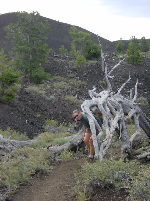
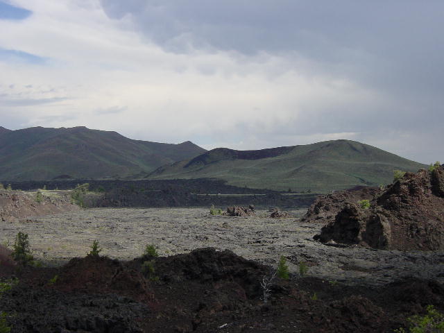
We took a brief detour this morning to visit Craters of the Moon National Monument. This is yet another park relating to volcanic activity. There is not a typical cone shaped volcano here. Beginning 15,000 years ago lava just spewed out of openings in the level surface, until about 2000 years ago. Several small cones and craters were formed by the flows. We enjoyed a three-mile hike through the park before getting out ahead of a major storm front approaching from the west.
Continuing east toward Idaho Falls we stopped at INEEL (Idaho National Engineering and Environmental Laboratory) to visit EBR-I (Experimental Breeder Reactor-I). INEEL is one of the country’s five national laboratories. EBR-I was the world’s first nuclear power plant. In December 1951 the reactor went on line and produced enough electricity to power the plant.
The idea of a ‘breeder’ reactor came out of the believed scarcity of uranium at the time. Since then, large uranium deposits have been discovered. The breeder reactor was able to produce a plutonium atom out of each uranium atom during fission. The offspring plutonium atom could also then perform as fuel in the chain reaction of fission within the reactor. This method proved to be very efficient.
We continued through Idaho Springs and along the Snake River to the Teton River valley. We played tag with the storm as we admired the incredible scenery here in eastern Idaho. We met with a real estate agent in Victor and lined up some properties to look at tomorrow. The storm had dropped the temperature here into the fifties. Christine and I enjoyed the last of our trout for dinner and spent the evening on our computers.
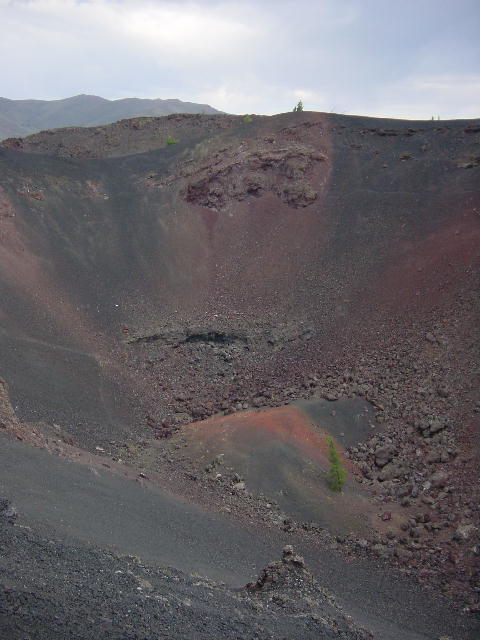
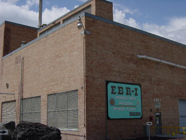
In the first four pictures you can see why this park is called the Craters of the Moon. The third picture is the volcanic crater. 5) EBR -1, the worlds first Nuclear Power Plant.
Friday, July 26, 2002 Ennis, MT
We woke to a heavy rain. We spent the morning chasing down some properties, and learned that we were again shopping in an area out of our price range. We headed north toward Montana and stopped for lunch at the Upper and Lower Mesa Falls. These falls are very impressive. They are fed by Henrys Fork of the Snake River, which originates as a massive spring.
We continued into Montana over Raynolds Pass and descended along the Missouri River to the town of Ennis. We met with a real estate agent there and visited a very attractive piece of property that barely fell in our price range.
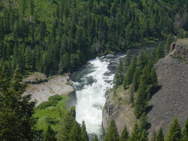
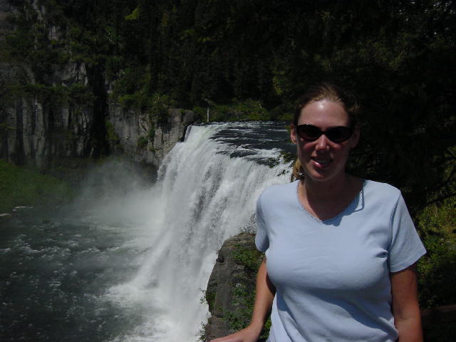
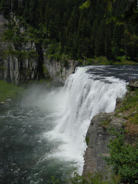
1) Lower Mesa Falls; 2-3) Upper Mesa Falls
Saturday, July 27, 2002 Butte, MT
We meandered around southwest Montana through Virginia City, Sheridan, Dillon, Wisdom and finally made our way up to Butte. We loved the scenery today and look forward to looking for land here. We visited a very promising parcel outside of Butte that really has us thinking. Butte just isn’t a very exciting town.
After dinner we drove up into town and had a couple beers and a few games of pool to check out the town on a Saturday night. Most places were very quiet. Butte’s heyday was nearly a century ago when its location was considered the richest hill on earth. From the 1850’s to the 1930’s mines in the area produced significant fortunes in gold, silver, quartz and other precious metals.
Sunday, July 28, 2002 Missoula, MT
Christine and I started the day with a brisk four-mile walk before leaving Butte and making our way to Missoula. We stopped in Phillipsburg for lunch. This historic mining town was having an old car show today, so we scored some brats with kraut. In Missoula we got busy preparing for the arrival of our guests tomorrow. We gave the RV its first good bath since May and ran several errands.
Monday, July 29, 2002 Salmon, ID
We spent the morning punching out the last few preparations before picking up our friends Teresa and Doug from the airport. They flew in from Madison, Wisconsin to spend a week vacationing with us. We attended their wedding in 2000, and have been guests of their generous hospitality several times during stops through Madison.
We picked them up right on time and headed south through the Bitterroot Valley back into Idaho. We stopped in the scenic area of Salmon and spent our first night of camping together. I got Doug and Teresa acquainted with our tent that they’ll be using for the week and we grilled out a massive fillet of salmon for dinner. It seemed appropriate to eat salmon in Salmon.
Tuesday, July 30, 2002 Jackson, WY
We all enjoyed a smooth drive south through the Lemhi River Valley and the birthplace of Sacajawea, the valuable Shoshone Indian scout that escorted Lewis & Clark through much of their 1805-6 discovery of the American west.
We stopped east of Idaho Falls to look at some land that I was interested in, and then continued up the Snake River into Wyoming and on into Jackson for the evening. We took in some shopping and stopped at the Jackson Hole Buffalo Meat Company to replenish our freezer with exotic meats. We bought some elk tenderloins, buffalo patties, buffalo Italian sausage, and a smoke buffalo roast. We cleaned up and walked into town for dinner out. We stopped for a cocktail at the famous Million Dollar Cowboy Bar, but eventually ended up at the Snake River Brewing Company for some fine beers and a satisfying meal. The town of Jackson was much busier than it had been during our past visits through here.
Wednesday, July 31, 2002 Yellowstone National Park, WY
We made reservations last night for a rafting trip down through the Snake River Canyon. This meant that we had to be at the outfitter rendezvous point before 7:00 AM. We were all up and going by 6:00 AM and made our way to the meeting point. The bus dropped us in the river south of Jackson and we spent the first hour quietly floating down a calmer section of the river watching for wildlife. We saw many bald eagles and osprey perched in the trees along the river, otherwise we mostly shivered in the chill of the early morn.
The raft trip included a hot pancake and sausage breakfast set up at a primitive camp along the river. We all filled up on the hot food and found openings of sunshine to warm our bodies. After breakfast we continued our calm 8-mile float down the river until we met up with other rafts joining us for another 8-mile section of whitewater rafting. By now we were all warmed up and stripped down to minimal layers of clothing. We were in a 14-person raft led by one very good guide, Tom. He was instrumental in maximizing our river experience. Teresa & Doug were both having their first whitewater experience. By this time of year the river is past its heavy flow period of snowmelt, but it was still a lot of fun. Tom made us all very active in steering the boat into the most violent waves. He also went through great lengths to make sure that we all got thoroughly soaked.
We got off the river around noon, completing 16 fun miles of the Snake River Canyon. We were bused back into town and picked up some groceries before heading up into Grand Teton National Park. We parked at Jenny Lake and changed into our hiking clothes for a 6-mile hike around the lake and up to Hidden Falls and Inspiration Point. This led us back into Cascade Canyon. It was a pretty tiring hike, but we enjoyed the views.
It was getting pretty late by the time we all returned to the RV. We continued north into Yellowstone National Park where we had a campsite reserved for the night. We had a very late dinner when I finished grilling a big pork tenderloin.

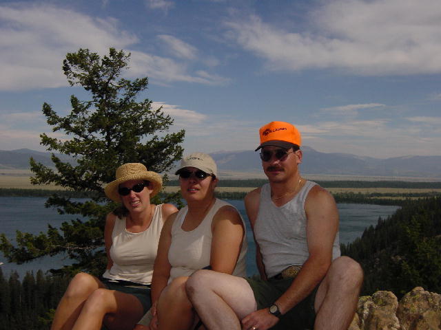
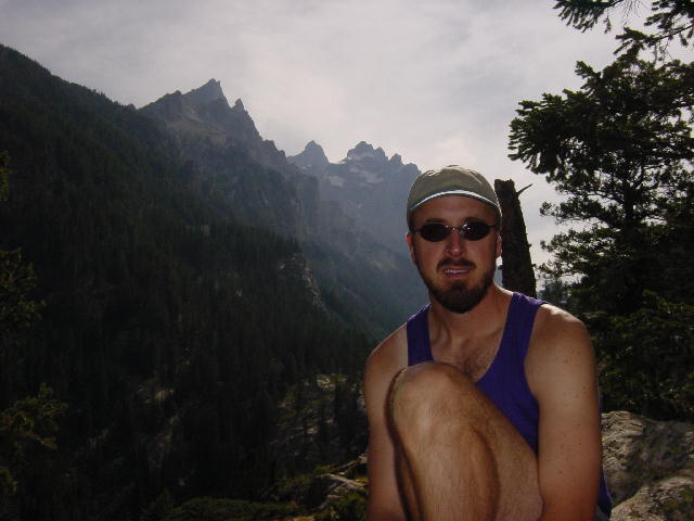
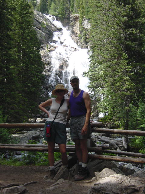
1) An early morning picture on the Snake River. 2) Christine, Teresa, and Doug resting for a bit at Inspiration Point. 3) Joe with the sun and Tetons behind him. 4) Hidden Falls.
Continue on to August 1, 2002...