| The Lustik Travel Home Page |
August 1 - 15, 2002
Thursday, August 1, 2002
Gardiner, MT
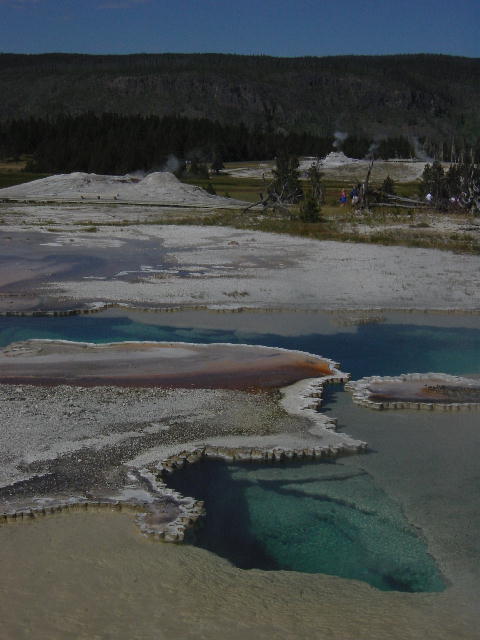
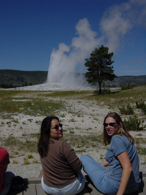
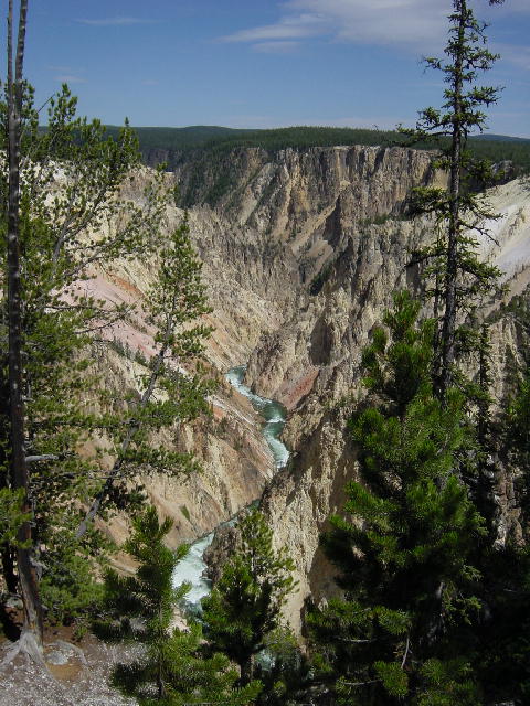
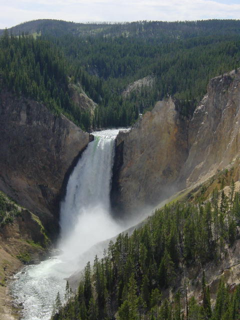
We spent today exploring Yellowstone National Park. It was cool out as we got started. Our first stop was the upper geyser basin of Old Faithful. We were lucky to catch the Beehive Geyser erupting, which only occurs twice a day. We also stuck around for Old Faithful. It had become a beautiful day. We visited several thermal events (springs, mudpots, geysers, vents, etc.) as we continued through the park around to the Grand Canyon of Yellowstone. We hiked along the canyon rim and took in a view of the Lower Falls of the Yellowstone River.
We ended our visit to Yellowstone by looping back around to the Mammoth Hot Springs in the northwest corner of the park. We had seen buffalo, elk, coyote, and antelope, but nothing like the numbers that Christine and I enjoyed when we visited the park last fall. We camped just outside the park and grilled up some chicken and vegetable kabobs.
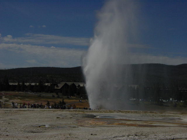
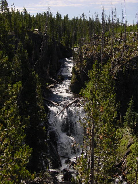
1) The Beehive Geyser; 2) Doublet Pools; 3) Old Faithful; 4) The Grand Canyon of Yellowstone and the Yellowstone River; 5) Lewis Falls.
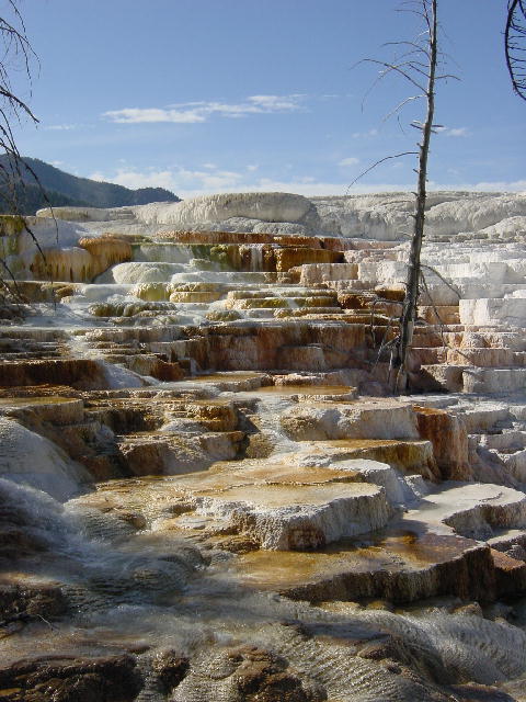
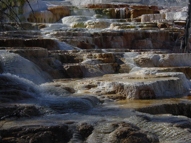
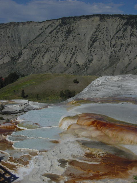
1) Tower Falls in Yellowstone; 2-4) These are all pictures of Mammoth Hot Springs.
Friday, August 2, 2002 Hungry Horse, MT
Today was a marathon day. We drove over 400 miles on our way up to Glacier National Park. We went up through Livingston and crossed the Little Belt Mountains coming into Great Falls. We stopped in East Glacier Park to visit the historic lodge there before continuing to our campground on the west side of the park.
The idea of Glacier National Park was originally conceived by a railroad company. There was already an active railroad line skirting what became the southern boundary of the park. The railroads saw the opportunity to add significant passenger volume to their existing business of moving cargo. Several of the great lodges in the national parks of the west were constructed by the railroad companies to draw wealthy easterners out here for a long vacation. The lodge at East Glacier Park is a fabulous example of the commitment that the railroads put into this endeavor.
We pulled into our campground as weary travelers and set up camp for a stay of two nights. I grilled up some turkey breasts that Christine had stuffed with feta and spinach, and then we lit our first campfire to enjoy some requisite roasted marshmallows.
We relaxed over a few games of euchre as the night wound down.
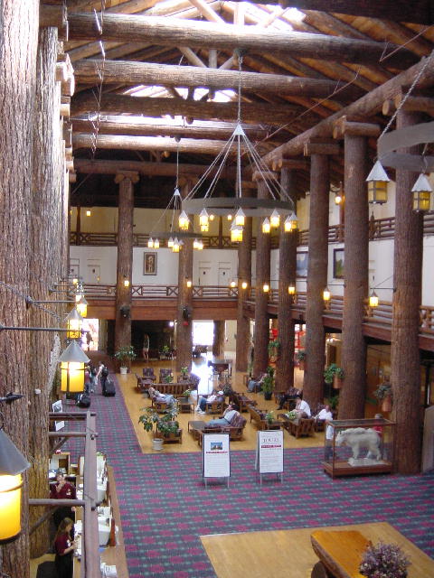 Glacier Park Lodge
Saturday, August 3, 2002 Hungry Horse, MT
I got the motorcycles off the RV and prepared them for a ride through the park. Our RV is too long for the drive over Logan Pass on the Going To The Sun Parkway. We packed our hiking shorts in the saddlebags with plans to get in a hike up at the pass. The drive through the park started out at a cool 60 degrees in the shade, and then got colder as we ascended. By the time we reached the pass, we were surrounded by trees covered in rime ice and we were in the middle of a cloud. We descended the east side of the pass for a ways hoping to return to some sunshine, but we quickly realized that the only chance at warmth was to return down the west side of the pass.
We reached a pullout with views of some mountain goats, and stopped there for lunch. We had packed some sandwiches so we shivered next to some snow banks and ate our meal. We finally tired of the cold and descended to a trailhead that promised to be warmer. We went for a 3-mile warming hike and then descended further for another hike through an impressive stand of cedars.
We got back to our campsite early enough to relax for the remainder of the afternoon. Later we grilled up some buffalo burgers for dinner. They were great coupled with a homemade Southwestern Potato Salad and Slaw. A couple more games of euchre capped off the evening.
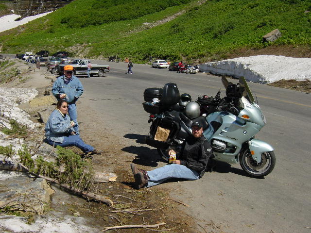

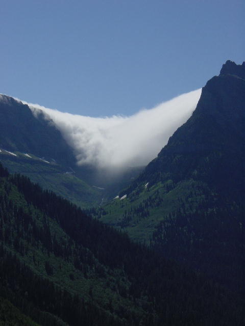
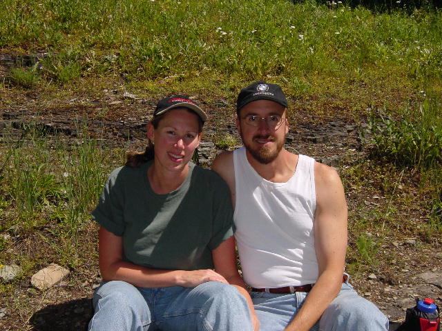
1) A cold lunch break as we try to stop shaking; 2) The historic red buses are back in service after being sent to Ford last year for new engines and parts. 3) Lake McDonald; 4) Logan Pass frosted with clouds; and 5) Christine and Joe enjoying a hiking break.
Sunday, August 4, 2002 Missoula, MT
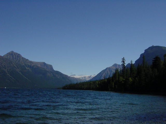
We woke to a mild drizzle of rain, but went ahead with plans to go horseback riding. We drove the RV into the park and took in a 2-hour trail ride along Lake MacDonald and MacDonald Creek. It was a beautiful ride even though we had all gotten pretty wet from the rain at the start. We were glad to get back to the RV and put on dry clothes after the ride. The smell of wet horses remained with us the rest of the day.
We spent the afternoon driving back to Missoula through Kalispell and along Flathead Lake. It turned into a pretty drive as we left the rain behind us. In Missoula we all cleaned up for our last evening together. We drove into town and had some great pizzas and beers at the MacKenzie River Pizza Company. We spent our last night with a few more games of cards. It had really been a good week with all four of us traveling and living in the RV.
By Christine: It is really amazing how easily Teresa and Doug fit into our limited space this past week. They were great about keeping their clothes organized and in setting up and tearing down and storing their tents. It was really a wonderful week with them.
Monday, August 5, 2002 Spokane, WA
We dropped Teresa and Doug at the Missoula Airport and then spent a few hours running errands in town. We were happy to be on our own again. We pointed the RV west and headed for Washington. We looked at some land in St. Regis and later reached Spokane for the night.
Tuesday, August 6, 2002 Newhalem, WA
We took the northern route across Washington crossing the Columbia River at the Grand Coulee Dam. The Grand Coulee Dam is the largest hydro power plant in the U.S. and the third largest in the world. With almost 12 million cubic yards of concrete, it is considered one of the largest concrete structures in the world. The dimensions of the dam are deceiving at first look. At a mile wide, it is four times wider than Hoover Dam and three times larger, though Hoover Dam is 30% taller. It is impossible for us to take a good picture of the dam with our camera, because of its size. The dam’s purpose was to create electricity to pump water up to the high fields of the Grand Coulee for irrigation.
We continued northwest into the North Cascades National Park. We stopped late in the afternoon for a 3-mile hike along the northernmost section of the PCT (Pacific Crest Trail). We were just 60 trail miles from the Canada-U.S. border. Our friend, Jenny will be finishing her 2600-mile PCT thru-hike up here in another six weeks.
We found a quiet campsite in the National Park along Newhalem Creek. I stood out in the rain and grilled up some excellent Salmon fillets as Christine worked up the side dishes indoors.
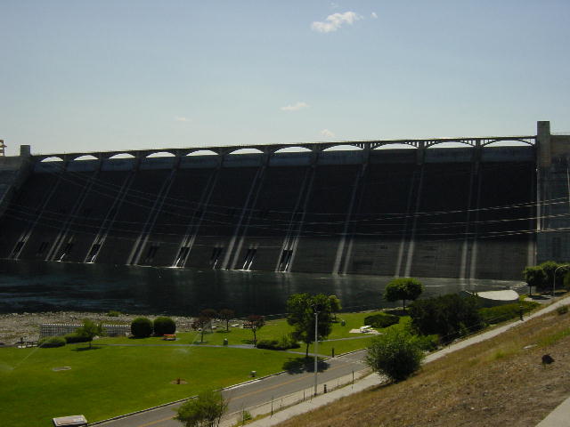
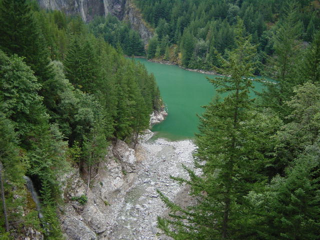
1) This is less than 1/3 of the Grand Coulee Dam. 2) The North Cascades National Park was beautiful, this was just one of the pretty scenes. Most of the lakes we passed were this green color.
Wednesday, August 7, 2002 Kent, WA
We enjoyed another hike of a couple miles before leaving the North Cascades and descending into the Seattle area. We began preparing to run a few errands before meeting Christine’s parents and brother here for a week of vacation together.
Thursday, August 8, 2002 Kent, WA
Our final preparations today consisted of shopping and giving the RV another bath. My in-laws, John & Carol arrived in the late evening, leaving us time to join them for a nightcap. They had picked up a rental SUV at the airport to make our day trips more manageable.
By Christine: I'm surprised Joe didn't mention the highlight of our errands today. We finally met with the photographer that was in the right place when Joe had his bear encounter in Hyder, AK last fall. We spent a couple hours talking to the photographer and looking at the photos. He was so great and printed out all of the photos plus saved some to CD for Joe. It was really a pleasure talking to him.
Friday, August 9, 2002 Kent, WA
We got an early start and drove the SUV into Seattle to play tourists for the day. We spent the morning exploring the Public Market at Pike Place. This is a famous market with several vendors of fresh fish and flowers. The splendid row of aromatic flowers was effective at masking the smells of all the seafood. We bought some produce and snacks before driving up to the Space Needle.
We hadn’t originally planned to pay the high price of admission for this Seattle landmark, but it was such a beautifully clear day that we couldn’t resist. The views were fantastic of the city and Mt. Rainier from the 520’ observation deck. The Space Needle was originally constructed as the centerpiece for the 1962 Seattle Expo, and remains in great condition. It now anchors an entertainment complex.
We stopped at the REI store for a list of backpacking items that we need for our planned hike of the John Muir Trail coming up in September. We then drove north to the Queen Anne area. Kerry Park overlooks downtown Seattle with Mt. Rainier looming far behind it. We were able to take some good pictures from here.
We stayed north of town to have dinner at Hale’s Brewery. We really enjoyed some great food and beer, including their cask-conditioned ale. I’m getting spoiled by the variety of beers on cask out here in the northwest.
We drove back to John and Carol’s motel room for a cocktail before heading back to the airport to pick up Christine’s brother, Craig, arriving on a late flight from Anchorage. He arrived on time and we set our morning rendezvous time for tomorrow’s drive down to Mt. Rainier National Park.
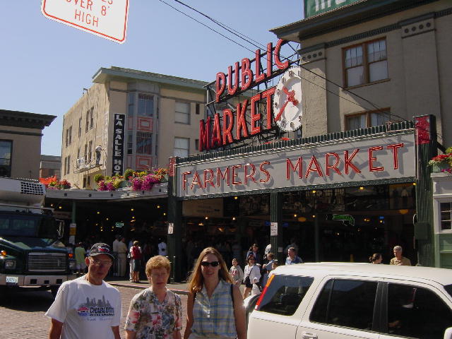

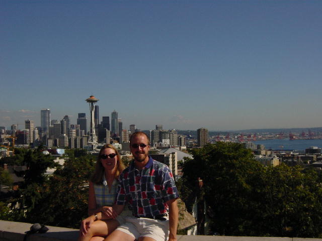
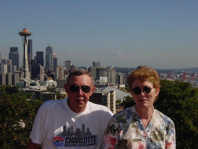
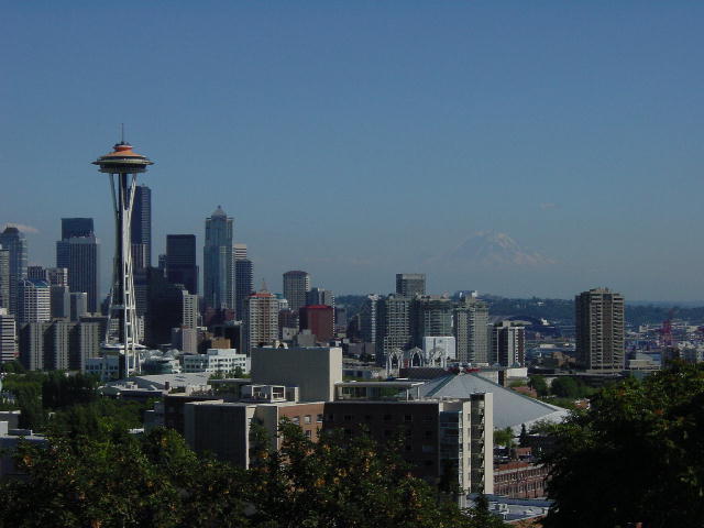
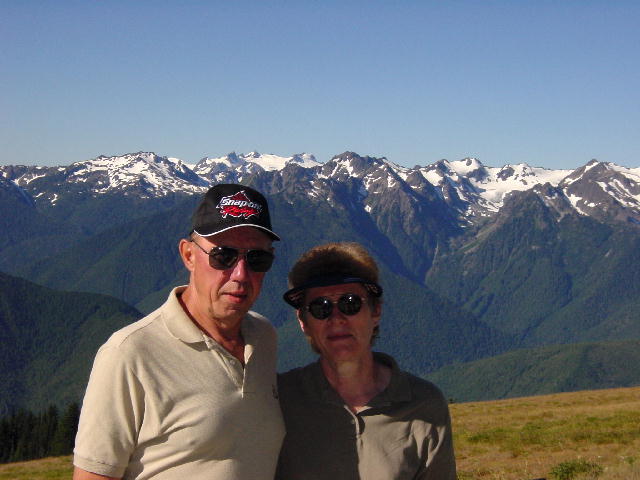
1) Dad, Mom, and Christine in front of Pike's Market. 2) Dad, Mom, and Christine at the top of the space needle. 3) Christine and Joe in Kerry Park with Seattle behind us. 4) A great picture of Dad and Mom with Seattle behind them. 5) This was the view of Seattle from Kerry Park. If you look closely on the right you can see Mt. Rainier. We could see it everywhere we went today.
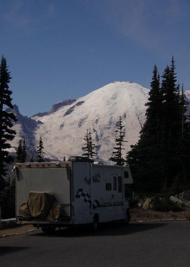
Saturday, August 10, 2002 Mt. Rainier National Park, WA
We were disappointed to wake to low clouds and light rain, but the forecast promised sunshine for today. John, Carol and Craig rode in the SUV while Christine and I followed in the RV. It was an easy drive into the park from the north except where frequent frost heaves buckled the road. We first stopped at the Sunrise Visitor Center and ate lunch there with outstanding clear views of the mountain. We enjoyed a short hike through the mountain meadows, but mostly just stared at the mountain. Looking at the glacier-covered north side of the mountain, it’s easy to believe the statistic that there is over a cubic mile of permanent ice and snow on Mt. Rainier (14,410’).
Mt. Rainier and all the other towering summits of the North Cascades (Mt. Baker, Mt. St. Helens, Mt. Adams and Mt. Hood) were named by the first westerner to note their geographic locations, British Naval Explorer George Vancouver. He surveyed the northwest coastline in the 1792 and named these peaks for unknown British cronies of his.
We left the Sunrise area and continued to the Paradise Inn at the south end of the park. John, Carol and Craig are sharing a room in the inn for two nights while Christine and I stay at a campground ten miles down the road. Paradise Inn is a beautiful old cedar structure that is only open in the summer. In the winter it gets buried by an average of 50 feet of snow.
We all spent the evening at our campsite grilling out venison steaks that my in-laws brought with them. It was cool enough to enjoy the warmth of a campfire and the companionship in general.
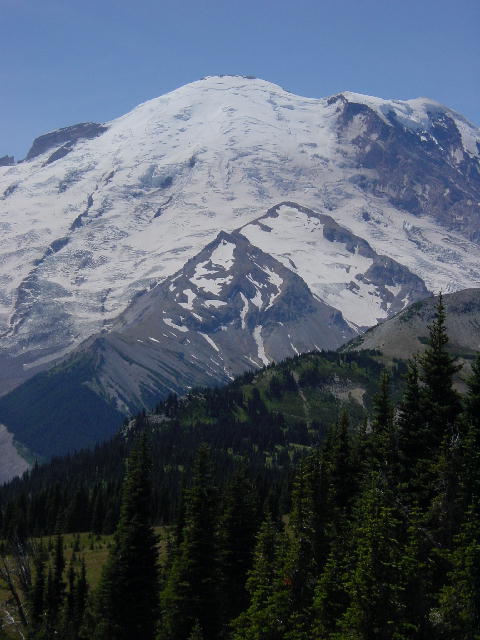
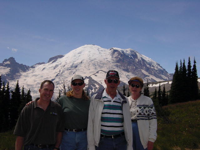
All of these pictures are of Mt. Rainier. In the last picture you find Craig, Christine, Dad, and Mom.
Sunday, August 11, 2002 Mt. Rainier National Park, WA
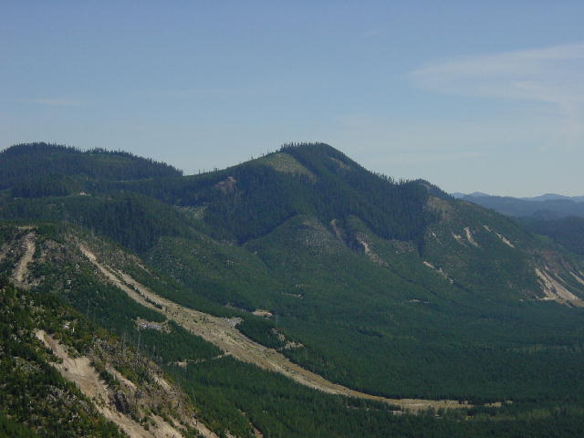
We woke to another beautifully clear day and headed directly to Mt. St. Helens National Volcanic Monument. We came into the park from the east to the Windy Ridge observation area. This brought us to within four miles of the crater. Mt. St. Helens erupted on the morning of May 18, 1980 with much warning. Scientists had been monitoring the increased seismic activity of the mountain for several months before it finally blew. The preparations included a strictly enforced no-entry area around the mountain. Fifty-seven people died that morning due to the unexpected nature of the eruption. Triggered by an earthquake, the recently formed hump on the north side of the mountain gave way in a massive landslide and allowed the volcanic pressure to be released with a horizontal blast, rather than the vertical eruption expected by volcanologists. This sideways blast well exceeded the no-entry area killing campers and photographers with superheated toxic air and ash. The blast sped northward across the area at over 350 mph carrying air superheated to 1400° F. The force of the blast leveled every tree within almost a 10-mile radius arcing out from the volcano. Trees were singed up to another mile beyond the blast zone.
Spirit Lake sits at the foot of the mountain and was dramatically changed by the eruption. A log mat of thousands of trees still floats on the lake today. Most of the blast zone is still stark and barren layers of pumice and ash, but new growth is rapidly taking hold. Mt. St. Helens is now only 8,365 feet high, but was nearly 1500 feet taller before the blast. The old summit now sits as hummock along the shore of Spirit Lake. It simply slid down the mountain in tact on top of a pyroclastic flow. The overall experience of visiting Mt. St. Helens is humbling, and we all got a lot out of it.
We returned to Mt. Rainier National Park and took in the vast exhibits at the Paradise Visitor Center. We then had some cocktails at the Paradise Inn Lounge before enjoying a fine meal in the restaurant there. We had made it a full day.
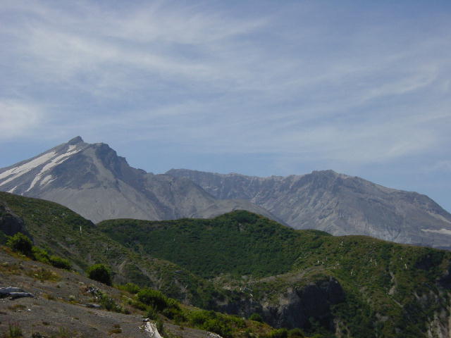
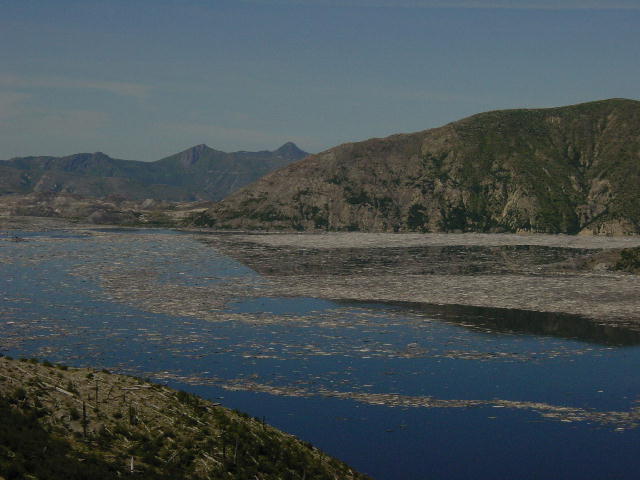
It is hard to take pictures of this mountain and how humbling it is. In the first picture you see the crater at the top of the mountain and the new cone that is reforming and growing. In the second picture you see the valley's but you also see the burn line if you look closely. This is the burn line from the eruption. And in the third picture you can see Spirit Lake and the large log mat that covers much of the lake.
Monday, August 12, 2002 Port Angeles, WA
Christine and I set aside some time for a good 5-mile hike this morning along the Wonderland Trail before rejoining the others. We all regrouped one last time to exit the park and head back to Tacoma to drop Craig at the airport for his return to Anchorage. Hunting for Dall Sheep opens this week, and nothing can keep Craig from taking part. We said goodbye after lunch and continued up to the Olympic Peninsula with John and Carol.
We were having another outstanding day of clear comfortable weather as we pulled into our campground in Port Angeles on the Strait of Juan de Fuca. We set up camp while John and Carol checked into their camping cabin. We grilled up some Italian buffalo sausage for dinner and played some Sheepshead (Wisconsin card game with a bizarre arrangement of trump) for a couple hours.
I dragged Christine out of bed to watch the meteor shower, but it was too intermittent to hold our attention for long.
By Christine: On a future note, Craig got his first Dall sheep later this week. Congratulations to him!
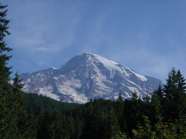
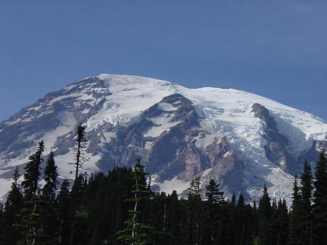
Mount Rainier, a view from the South West.
Tuesday, August 13, 2002 Port Angeles, WA
We spent today exploring the Olympic Peninsula and Olympic National Park. We drove around the west side of the park into the Hoh Rainforest. The park has had much less than its normal amount of precipitation over the past three years, though it’s recorded nearly 200 inches in one year. The moss that covers many of the trees was losing its bright green colors with the drier conditions. It was hard to imagine this as a rainforest under the clear and hot conditions that accompanied our visit.
We drove along the Hoh River all the way to the mouth where it meets the Pacific Ocean. John and I grabbed our fishing gear and sought to hook some steelhead trout on the incoming tide. Instead we quickly found ourselves stranded on an island of gravel as the tide washed out our path back to the bank. We simply got our feet wet, but didn’t catch any fish.
We worked our way up to the Strait of Juan de Fuca and meandered along the waterfront back to San Angeles. Dinner was late, but satisfying. I grilled out a massive pork tenderloin and we retired after eating.
By Christine: Today was a bizarre day of driving. We had to sit for quite awhile in a stopped line of traffic waiting for a fatal car accident to be cleared and then after that we really seemed to encounter some crazy drivers. Sometimes it amazes me that we don't have more encounters with other drivers, for as much as we drive and as crazy as the drivers can be everywhere.
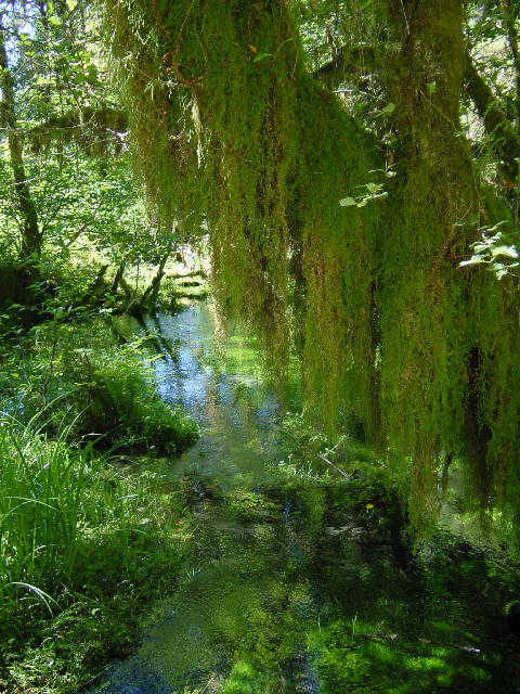
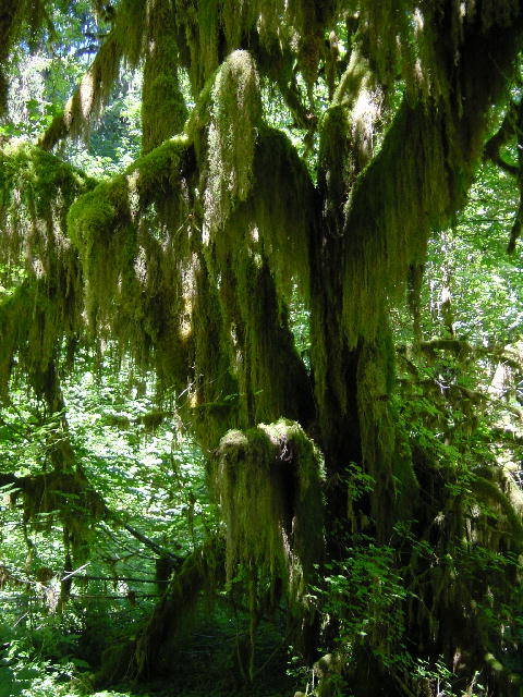
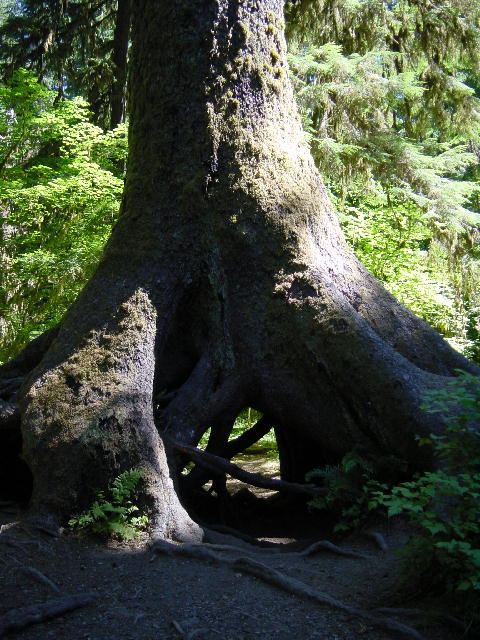
1 and 2) Views of moss covered trees in the
Hoh Rainforest. 3) This tree was originally growing on what they
call a nursing log. We saw many fallen deteriorated logs that had full
grown trees growing out of the top of the log. This is an example of what
happens after the fallen log fully deteriorates. There is a big open space
under this tree where that nursing log used to be.
Wednesday, August 14, 2002 Anacortes, WA
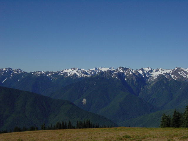
We got an early start and drove up to Hurricane Ridge in Olympic National Park. We were some of the first visitors this morning to this high lookout over the Olympic Range. We had a great view of the mountain range capped by Mount Olympus (7965’). We passed fields of lavender and gardens of dahlias as we left the peninsula by way of the Whidbey Island Ferry from Port Townsend.
We fixed ourselves some lunch while visiting Greenbank Farm, a historic loganberry farm and winery. The loganberry is a domestic hybrid of blackberry and raspberry. John picked out a freshly baked loganberry pie to follow our lunch. It was an excellent pie.
We continued exploring Whidbey Island by visiting the Whidbey Island Winery. This winery has a varied selection of wines that included some less common wines like seigerebbe and lemberger. The tastings were enjoyed by all of us, and together we picked up four bottles to go.
We crossed Deception Pass onto Fidalgo Island and checked into our campground for the next three nights. We had reserved a coach house at the campground for John and Carol, and were very pleased with the accommodations. We drove on into Anacortes for dinner and ate at the Rockfish Grill & Anacortes Brewery. The beer and food were great, all improved by the acoustic sounds of an excellent bluegrass band.
We enjoyed a quiet walk through town before driving up to Cap Sante Park to take in the sunset. It was a gorgeous evening and we had 360-degree views of Puget Sound, Mt. Baker and the San Juan Islands. It was a perfect place to quietly take in the surrounding beauty.
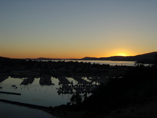
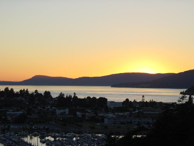
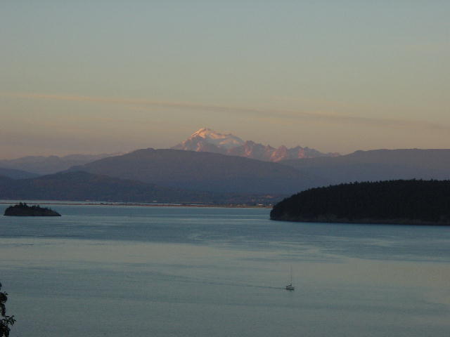
1) The Olympic Mountain Range; 2) The Olympic Mountain Range with Dad and Mom; 3 and 4) The sunset over Anacortes; 5) A sunset with Mount Baker.
Thursday, August 15, 2002 Anacortes, WA
We spent the day exploring Fidalgo Island in its entirety. We drove up to the summit of Mt. Erie for some bird’s-eye views of the area, and then drove through Washington Park before lunching outside at Flounder Bay. We explored the west coastline of the island and then found ourselves back at Deception Pass. We ended our day of driving by looking for some fresh seafood to cook for dinner. It was disappointing that so little seafood was available. We resigned ourselves to shopping at the seafood counter at the supermarket. Christine picked up some jumbo shrimp and scallops that she marinated with orange marmalade and skewered for the grill. Served up with some seasoned couscous made for a great meal.
We spent the rest of the evening playing Sheepshead until Christine and I had lost ALL of our money to her parents. They really took us to the cleaners. By Christine: I had a quarter left!
By Christine: We spent hours today sitting and watching fishermen. It was in the plans to do some deep water fishing with Mom and Dad but we've realized that we can't fish for Halibut and mostly we would only be catching Salmon. Dad can catch Salmon on Lake Michigan so it didn't seem worth the charter money. Much to our selfish relief we didn't see any "catching" only "fishing".
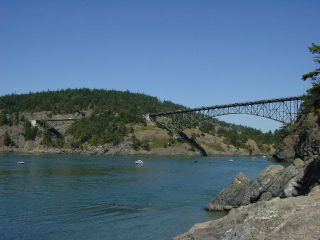 Deception Pass
Continue onto August 16, 2002...