| The Lustik Travel Home Page |
August 1 - 15, 2001
Wednesday, August 1, 2001 Medora, ND
Christine and I really struggled to get out of bed this morning. It’s great knowing that we don’t actually have to get up. Anyway, we jumped back on I-94 west and continued the straight shot across North Dakota. North Dakota is one of only two states that I have yet to explore, Hawaii being the other. I was pleased today to see a state somewhat different than South Dakota. There seems to be more lakes and ponds breaking up the agricultural views. We passed many fields of sunflowers facing us as we approached with the morning sun.
We stopped for lunch in Bismarck, the state capital. We visited the capital complex just to check it out. I’ve been curious about the seats of government in different states, and make a point of visiting the capitals if they aren’t too far out of the way. In Bismarck, the capital is the tallest building in town, and appears more like your average office building than as the seat of government.
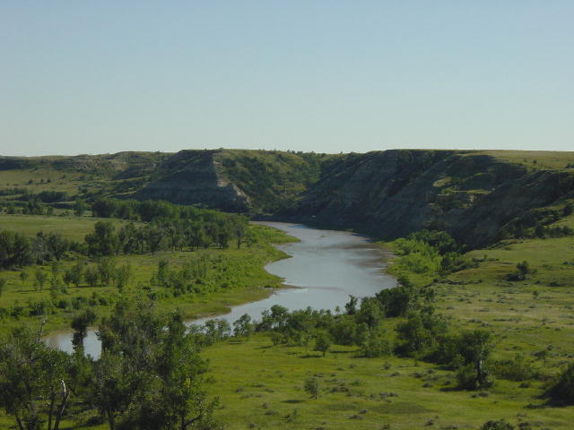
We crossed the Missouri River and later reached our destination for the day in Medora, just outside the Theodore Roosevelt National Park. I hadn’t even been aware of this park until I saw it on the road atlas. Theodore Roosevelt has been quoted saying “I never would have been president if it had not been for my experiences in North Dakota.” Roosevelt established two cattle ranches in this area in the late 1800’s. The area is known as North Dakota’s badlands. They are geographically similar to the badlands of South Dakota, but they are greener with more grasses and vegetation.
We checked into our campground on this beautiful day. The humidity had broken, and we enjoyed a calm comfortable day of driving in the 70’s. I took my motorcycle off the back and we rode it into the park around the 36-mile loop road. It took a couple hours with all the stops to view the prairie dog towns, wild horses, buffalo, and coyote.
The prairie dogs were all over the place, as I had to dodge them on the bike. We only saw two buffalo, though there is an entire herd somewhere in the park. It was a very enjoyable experience of the park.
We returned to the RV to enjoy a great dinner. I grilled out a big salmon steak that Christine had marinated in a sesame teriyaki sauce. It’s hard to beat a meal of fresh fish, when you can find it.
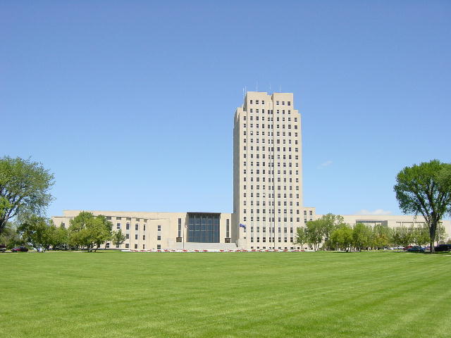
1) The capital building of North Dakota. 2) Theodore Roosevelt National Park.
Thursday, August 2, 2001
Lewistown, MT
We went for a nice walk this morning in Medora before getting underway. The weather was lovely with a mild wind out of the east. Today’s drive was beautiful through Montana with nary a cloud in the Big Sky. Eastern Montana had more of the badlands that we had just left in North Dakota. As we drove through central Montana, the landscape changed to wide-open pastures with grazing cattle and occasional antelope.
Central Montana’s beauty is minimalistic with very few trees, and the only agriculture is fields of hay to feed the cattle in winter. The temperature soared into the mid nineties as we traveled through the afternoon. But the heat was very dry, not sticky – just hot.
The sparseness off this country is refreshing. We drove on some lovely US highways that had very little traffic and even fewer inhabitants. Christine baked up a meal of halibut that was truly fitting for our splendid environs.
Friday, August 3, 2001 St. Mary, MT
Today quickly became hot, as it had been yesterday. There was cool relief overnight, but the sun quickly returned the high temperatures. We drove through Great Falls on our way to Glacier National Park. The landscape became more and more mountainous as we drover further west. The views of the rugged Rocky Mountains here were inspiring. They have such a different appearance here compared to the Rockies of Colorado.
We settled into a great campground on the east edge of the park with splendid views in all directions. We’re hoping to spend tomorrow motorcycling through the park as long as the weather holds out.
Christine: We are paying the extra money to stay in a KOA for these nights, as this is a very nice campground and they have a great little location for Internet access. I will be spending time getting caught up on my classes, as I don't know when I'll get access in Canada.
Saturday, August 4, 2001 St. Mary, MT
We awoke to a beautiful day. Christine grabbed some internet time while I got the motorcycle ready for a ride. We rode up to Logan Pass on the Going To The Sun Road going from east to west. The morning sun brought out great colors on the east-facing sides of the mountains. We really took our time riding through the park, pausing frequently to snap some photos of the beauty.
We arrived at the Logan Pass Visitor Center (6646 ft) mid morning. We went for a great three-mile hike up to Hidden Lake where we had some close encounters with mountain goats, and spied four bighorn sheep traveling along the scree well above us. The weather was perfect and the walk was refreshing. We returned to the motorcycle and rode down the west side of the pass to get some lunch at the Lake McDonald lodge before retracing our route east back to St. Mary. By now the afternoon light was presenting us with all new views on our return trip.
Glacier National Park has an added interest of not being at extreme elevations. The tallest peaks in the Park are barely over 10,000 ft, yet appear equal in grandeur to the Rocky peaks in Colorado that are over 4000 feet taller. The living glaciers in the park continue to shrink with the current warming cycle of the earth, but many are still very visible from the roads in and around the park.
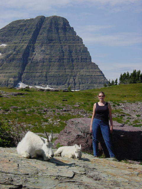
1) Hidden Lake. 2) Mama and baby goat resting.
Sunday, August 5, 2001 Canmore, Alberta
We got underway by 9:00 as we continued north and crossed into Canada at Waterton Lakes National Park. We had yet another beautiful day and drove through this park that borders Glacier National Park to the south. Together these parks form an international peace park that pursues loftier conservation and preservation issues that overcome political differences.
Waterton Lakes is home for the Prince of Wales Lodge. This frequently photographed lodge is perched on a bluff between Upper and Middle Waterton Lakes, capturing one of the finest panoramas to behold. After a brief stop at the lodge we drove down the Akamina Parkway to scenic Cameron Lake. Having used up our morning, we stopped at a pullout for lunch before leaving the park.
We continued north toward Banff on the Cowboy Trail, Alberta Highway 22. This smooth ribbon of pavement borders the eastern edge of the Rockies in Alberta where the prairies meet the mountains. It was a gorgeous day with constant scenic beauty and peaceful traveling. As we neared Calgary we turned west on the Trans-Canada Highway toward Banff. We stopped tonight in Canmore, just outside Banff National Park. Canmore is a quaint little granola town nestled among beautiful mountains.
This is a holiday weekend in Canada so the big parks are pretty busy. There is a big Folk Music Festival going on right now in Canmore. We secured one of the very last campsites in this campground. Christine baked up a chicken dinner, then we headed out to explore on foot. We listened to some of the folk music before finding the Grizzly Paw Brewpub in town. A couple of tasty pints were the perfect topping to this fine day.


1) The Prince Edwards Lodge at Waterton National Park. 2) The view from Prince Edwards Lodge.
Monday, August 6, 2001 Donald, BC
We got underway early on another splendid day. We took a very relaxed pace as we began a big loop through Canada’s mountain National Parks. We drove through the southern portion of Banff National Park, then turned southwest through the Kootenay National Park to Radium Hot Springs. We passed a moose cow and calf along this section, and then we turned north on British Columbia Highway 95.
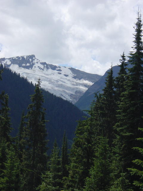
After stopping for lunch in Golden, British Columbia we continued on to Glacier National Park (Canada’s version, as opposed to the one we visited in Montana). Being further north, the Canadian Rocky Mountains have many more glaciers and ice fields. The trip over Rogers Pass through Glacier National Park provided great views of several glaciers.
We continued west to Mount Revelstoke National Park. We stopped at a grove of giant western cedar trees. These monstrous conifers are similar to the coastal redwoods seen in northern California. These cedars live to be 500-600 years old. This stand of cedars offered up cool damp air and rich aromas of moist growth.
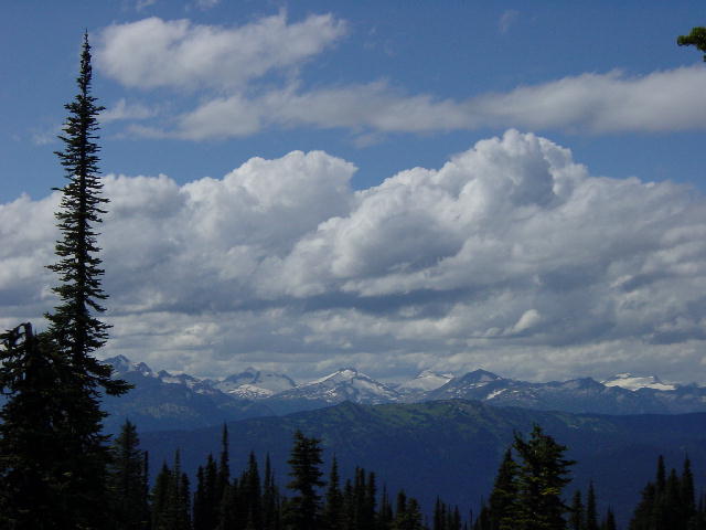
Mount Revelstoke National Park includes a very steep and windy 15-mile drive to the summit of Mount Revelstoke. Once on the summit we were treated to 360-degree views and a wildflower bonanza. We walked around the summit for a couple miles enjoying the peak of the flower blossoms. By now we had already put in a long day, so we made our way back to a campground on the Columbia River just west of Golden. We passed through several rain showers on our return and finally reached our campsite just after 7:00. Christine cooked up a great spaghetti dinner as we settled in for the evening.
Christine: As Joe mentioned the summer wild-flowers are in full bloom right now. I love these flowers and sometimes forget about the view as I am looking at flowers. I've been trying to memorize one or two flowers in each different region we've visited. Throughout Montana and North Dakota the sides of the road were filled with yellows and whites in daisies and buttercups. In Glacier there were many great flowers, unfortunately I didn't get a great pictures, but the one I remembered is the Lewis Monkeyflower, named after Lewis and Clark. IT was a pretty violet color. To see a great bunch of flowers from Revelstoke, check out the Spotlight pictures page.
I have a special place in my heart for all the bright red Indian Paintbrush I've seen throughout all of these Rocky National Parks. The first time I saw an Indian Paintbrush was in March in Zion National Park. On our first walk of that day, there was one splash of red climbing right out of a rock wall. And now we are seeing lots of these Indian Paintbrush throughout the mountains and along the roads. They add a wonderful splash of color which goes so well with the blues and yellows.
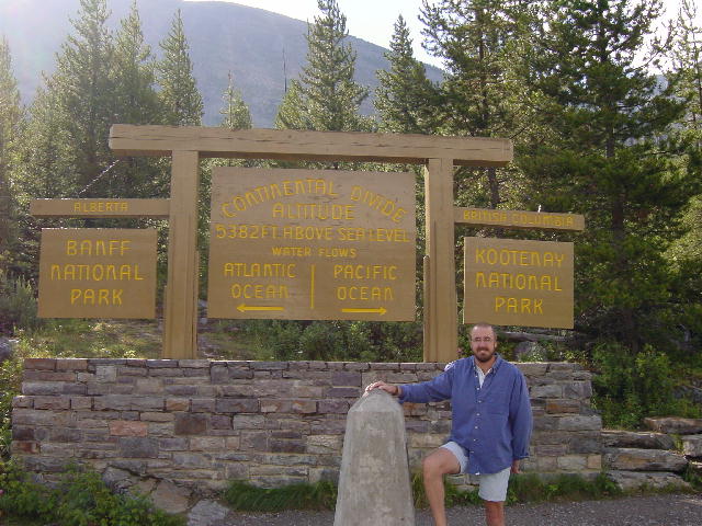
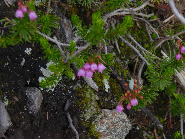
1) Just one of the many continental divide signs we've crossed. 2) A view of Revelstoke Park. 3) Just one of the many glaciers in the Canadian Glacier National Park. 4) Red Heather, we spent way too long getting a picture of these delicate pink flowers. They also come in white.
Tuesday, August 7, 2001 Jasper, Alberta
 Our morning view.
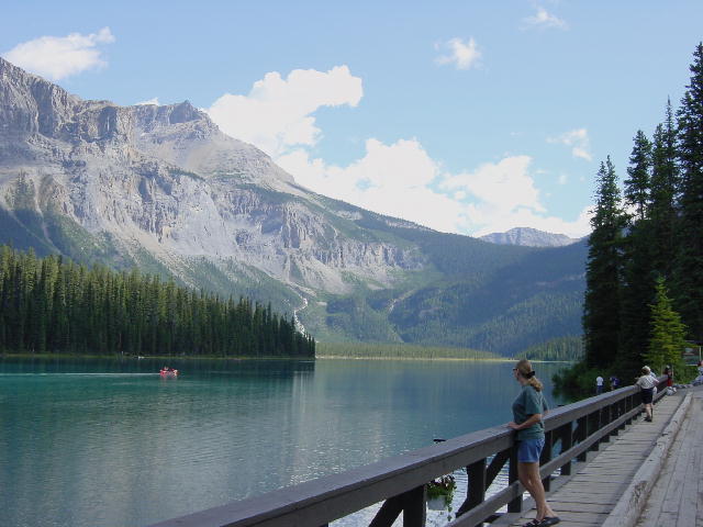
I awoke to a spectacular view of some low wispy clouds passing across the feet of the mountains to our west. We were blessed with yet another great day of travel weather. We got underway going east on the Trans-Canada Highway into Yoho National Park. We took a side trip to see Emerald Lake. This was very worthwhile. The aquamarine lake at the foot of glaciated mountain peaks was very tranquil. The entire area put off a very subdued aura.
On our way back to the highway we stopped at a natural bridge that was still in the making. The Yoho River carved out a hole in the rock, which the fast moving water rushes into resulting in a remaining span of rock across the river. Most natural bridges that I have seen in Utah and elsewhere were carved out by water thousands of years ago. It was very interesting to see the work in progress.
We took another side trip to see the Takakkaw Falls, a Cree word meaning “magnificent. At nearly a thousand feet tall, the title fits. The falls are the product of the runoff from Daly Glacier, plummeting to the valley floor. Christine and I were both awestruck.
We returned to Banff National Park to visit Lake Louise. We were both very disappointed with the intense congestion of tourists here. Lake Louise is truly a spectacular location, but the crowds were heavy detractors to our spending any time here. We ate lunch here and then turned north on the Icefields Parkway to explore the northern section of Banff National Park and continue on into Jasper National Park.
The Icefields Parkway is spectacular with an abundance of views of glaciers and snowcapped peaks. I stopped trying to photograph all the postcard shots, and instead sat back to just take it all in. We crossed over into Jasper National Park and stopped to visit the Athabasca Glacier descending from The Columbia Icefield. This is the most accessible glacier in these parks. There is a parking area very near the foot of the Glacier. I had visited this glacier eight years ago on my continental motorcycle tour, and was now amazed to see how much more the glacier had receded since then, approximately 300 yards. It is believed that the glacier will disappear over the next 100 years if our current global climate continues to warm.
As we continued north toward the town of Jasper, we spied a large black bear grazing on berries within sight from the road. Later, as we approached our campground for the night, we watched a group of elk grazing right along the parkway.
We settled in for the evening and I put some steaks on the grill, which wouldn’t normally be noteworthy, but tonight I somehow managed to catch the picnic table on fire. I had removed the finished steaks and disconnected the propane hose. I then went in to enjoy dinner while letting the grill burn off the gas remaining in the hose. After enjoying several mouthfuls of my meal I became surprised at the amount of smoke drifting by the door. Suspecting that something was awry, I was surprised to discover that the surface of the picnic table right under the grill had gotten too hot and was now flaming nicely. A couple pots of water doused the flames, and then I resumed eating my dinner. Who woulda’ thought? I’ll get to try the grill tomorrow night and learn whether I’ve done any serious damage.
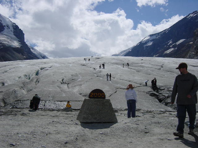
1) Emerald Lake. 2) The 2000 marker in front of the Athabasca Glacier, a good 50 feet from the beginning of the glacier today.
Wednesday, August 8, 2001 Dawson Creek, BC
Well, we’re in the north. We awoke in a cold RV this morning. It was 51 degrees inside and 44 degrees outside … in August! We actually fired up the furnace to take the edge off the chill before our morning showers. It was a great feeling lying snuggled under the covers in a warm bed this morning. It’s been many months since I experienced that sensation.
On our way out of the east side of Jasper National Park we stopped to admire a massive bull elk grazing along the highway. His rack was huge, at least twelve points. What a beautiful beast. We haven’t seen an abundance of wildlife in these parks, but we have viewed a wide variety.
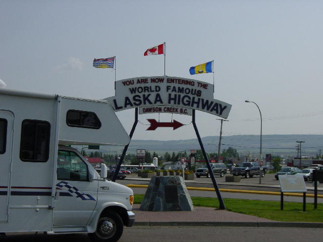
We turned north on highway 40, The Bighorn Highway, once we left the park. We passed through Grande Cache and Grande Prairie on our way to Dawson Creek, mile zero of the ALCAN (Alaska – Canada Highway).
By Christine: Today was an easy drive. We got to our original destination of Grande Prairie and decided to continue to Dawson Creek, where Joe hoped to obtain an oil change and I hoped to get some Internet time.
As we were leaving Grande Prairie, we picked up a woman hitchhiker. She had flown into Grande Prairie and was trying to get home to Fort Nelson, B. C. Which is about 300 miles past Dawson Creek, but we got her about an hour and a half toward her destination. We find hitchhikers are always happy with a ride in the RV. The woman worked in the construction/gas camps feeding the men in the camps.
We gained another hour this afternoon, so we were very productive when we reached Dawson Creek. We found a very friendly campground that does oil changes, so we were able to get that done right away. We drew another ping in the windshield today and the spider from our rock in Quebec keeps growing but we won't replace the windshield until we are back in the United States from this trip to Alaska. No sense replacing it twice.
We enjoyed a few beers and a nice dinner at a Pub here in town. It is amazing how much cheaper food and camping are in Canada, but the gas prices sure make up for those savings.

1) A large male elk, just outside of Jasper. 2) Mile 0 of the Alaskan Highway!
To see more pictures of the American and Canadian Rocky Mountains, click here to go the new Spotlight pictures page.
Thursday, August 9, 2001 Sikanni Chief, BC
We slept in this morning and did some grocery shopping, and spent some time on the internet at the library. We finally left town shortly after noon and began the ALCAN adventure. We got as far as the Sikanni Chief River (Mile Post 162) before calling it a day.
We camped next to some folks from Texas that were heading south. They lamented about having such a rainy stay in Alaska. We are hoping that we are bringing better weather with us north.
The Alaska Highway was first constructed in just over eight months during 1942. The demand for the highway resulted from the Japanese attack on Pearl Harbor in December of 1941. U.S. national security concerns recognized that Alaska’s proximity to Japan made it a likely target for a first strike against the continental U.S. It was believed that Japan could establish a foothold in Alaska and invade the interior over land and by air from there.
The Alaska Highway was first a military highway to transport defensive materials to Alaska. It did not open for civilian travel until after WWII. The highway is in a state of constant maintenance and improvement during the summer months with as many as a hundred miles being redone in any year. The highway officially begins in Dawson Creek, BC and terminates 1390 miles later at Delta Junction, AK; just a hundred miles southeast of Fairbanks. The highway continues to shorten as yearly improvements endeavor to straighten the route and reduce the severity of the grades. In another fifteen years the highway will likely be as drivable as any two-lane highway in the lower 48 states.
Friday, August 10, 2001 Muncho Lake, BC
Well the adventure is truly taking shape today. We had planned to get to Liard Hot Springs today, but stopped forty miles short when we had a blowout of the inside rear tire. Christine was driving, and it really freaked us out. The tire frayed out severely around the blowout. The frayed portion caught on the mud flap tearing it from its mounts. We were not in a good spot on the road to be disabled; the shoulder fell away steeply.
I walked back down the road to ask for advice from a road crew that we had just passed. It turned out that we could choose between turning back twenty-four miles to a service station at Toad River, or limping forward nine miles to a service station at Muncho Lake. I was encouraged to go to Toad River for better service, but the shorter option of limping up to Muncho Lake won out. I’ve since come to regret that choice.
We inched forward at about 10 mph, trying not to put any undue stress on the remaining right rear tire, and minimizing the thwacking of the frayed tire against the RV’s undercarriage. We pulled into the service station and smiled at the sight of a huge service bay. The smiles quickly faded. We were treated with the most disinterested level of service possible. The proprietor’s wife immediately informed us that she had no mechanic. Getting any helpful information from that point was like pulling teeth. Her husband operated a tour boat on Muncho Lake that kept him tied up until 10:00 PM. It was too late to order any new tires today out of Fort Nelson because the Greyhound coming north was already past that stop. Most parcel deliveries occur via the Greyhound Courier service.
I was very frustrated with this lack of service, and was determined to optimize my possibilities. We had so few choices. We picked a camping site behind the service garage. It had no hookups for us, but we can manage. I took the motorcycle off and decided to ride down to Toad River to see what service I might get there. At Toad River I received better service, but my outlook was not much improved. I bought the closest thing he had to a tire that would fit my RV. The used tire he had was the right size, but it was rated one level below the weight range that I needed. The tire appeared to have 50,000 miles on it, but could be good for a few hundred more in a pinch. I gave the man $25US and strapped the old tire to the back of the motorcycle.
Once back at Muncho Lake I paid to use the telephone so that I could call some tire sources ahead of us in Watson Lake and Whitehorse. I was disappointed to learn that no one had the right tires for me in those towns. At this point Christine and I resigned ourselves to making no progress tomorrow. We simply had no other choice. I was only going to put on the underrated used tire that I bought in Toad River if I was certain to have a new tire awaiting me a short distance up the road. Since there weren’t any, we had to wait for a new tire to come to us from Fort Nelson.
We settled into our campsite and I grilled out some very tasty burgers for dinner. We played some cards and did some reading before putting an end to this day. We fell asleep to the sound of the electrical generator humming in the background, providing power to the service station. Most of these remote stops along the highway are totally self-sufficient, running their own generator constantly to provide electrical power to their homes and businesses.
Saturday, August 11, 2001 Muncho Lake, BC
I got up to meet with the other half of the ownership of this service station. I was amazed at how well matched the proprietor was to his wife. He was equally lacking in joy and empathy. My disappointment was mounting. I hoped to consult with this guy about my options, but he was utterly uninterested. It was like talking to a bureaucrat at the DMV—as much fun as having my teeth drilled sans painkiller.
I finally got him to call his tire supplier in Fort Nelson. This rudimentary phone call seemed to frustrate him more than I did. We finally learned that they had tires for me, a different brand but all the specs were right. I went ahead and ordered two of them feeling that a matched pair would perform better. The remaining right rear tire would be removed and saved as a spare in case of future blowouts.
With the tires ordered and fingers crossed, Christine and I considered how to spend the day. We opted to climb on the motorcycle and drive forty miles north to the Liard River Hot Springs for a stress-relieving soak. These springs are great because they haven’t been totally developed into a swimming pool. The springs are in their natural wooded settings with small conveniences like benches and steps to improve their access. The Alpha Pool is the hotter of the two pools with a water temperature of up to 125 degrees F. The trick is to enter the water at the far end of the pool and inch yourself toward the heat. I think we maxed out in the vicinity of 110 degrees F. It can get dangerous to ones health above that.
After a pleasing soak we stopped for a hearty lunch at Trapper Ray’s right across the highway from the entrance to the hot springs. I ordered some poutine off the menu. Poutine is an old favorite of mine, though I’ve never eaten it by that name. It is merely a plate of gravy, cheese and french fries. It brought back good memories of late nights in the local chili parlor in the Cincinnati of my youth.
We returned to Muncho Lake at a leisurely pace and greatly enjoyed an afternoon nap. I went down to the garage at 7:00 PM to confirm that my tires had arrived. It was pure relief for me to see those tires. I now had an appointment set for them to be installed tomorrow morning at 8:00 AM by our charming and gracious host.
Christine baked up a pizza for dinner with a little help from our standby generator. We then became absorbed in a tightly contested game of scrabble. The end could have gone either way, but it went my way. (By Christine: For any Scrabble lovers around, this was a great game. I used all my letters at one point. The score was within a few points.
We have been seeing some wildlife along the highway over the past few days, a few moose, but mostly stone sheep. The stone sheep are most often seen right along the roadway or even on it, licking the surface of the pavement. Most of the gravel roads up here are sprayed with calcium chloride to control the dust. The Alaska Highway was sprayed steadily for many years before it was finally paved. The calcium chloride continues to get washed onto the road by rain and then the calcium dries on the pavement. Generations of stone sheep have learned to lick the pavement to benefit from the calcium there.
Sunday, August 12, 2001 Teslin, YT
We had the RV parked in front of the garage at 8:00 AM sharp this morning and proceeded with the tire change over. Everything went according to plan, including an outrageously expensive bill (his plan, not mine). Christine and I were just happy to finally put that place in our rear view mirror. We were once again under way. It felt good.
We hit some of our first gravel this morning. It was less than a twenty-mile stretch, but out RV gets so uncomfortable convulsing over the washboard ripples in most gravel roads. I was driving all over the road in search of the smoothest line, but mostly we just endured it all at very slow speeds.
We finally reached the Yukon Territory providing us with a sense of progress. We stopped in Watson Lake for groceries and to snap a photo at the famous Signpost Forest. This is a city park with posts erected for people to nail signs to from all over the world. Most of the signs are of town names.
We continued west across the Yukon Territory to the Continental Divide. Here, waters northeast of the highway travel north to the Beaufort Sea in the Arctic Ocean. Waters southeast of the highway reach the Bering Sea in the Pacific Ocean.
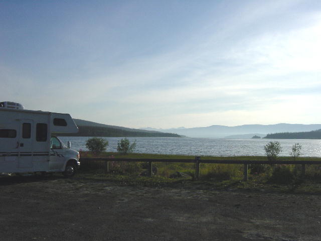
We stopped today at a beautiful campsite on the edge of Teslin Lake. The view across the lake was gorgeous as we enjoyed another great day of weather. Skies have been partly cloudy to clear for us with overnight lows in the 40’s and daytime highs around 80.
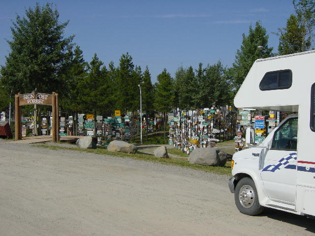
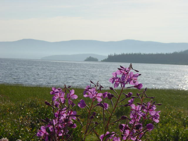
1) The signpost forest. It is much larger than what you see here. Lots of Wisconsin signs. 2) Our campsite on Lake Teslin. 3) This is Fireweed with Lake Teslin behind it. Fireweed is the flower of the Yukon and is also very popular in Alaska. It is so named because it is the first thing to arise after a fire goes through. It is watched all summer long as the flowers go up the stem and when they are blooming at the top fall is near.
Monday, August 13, 2001 Kluane Wilderness Village, YT
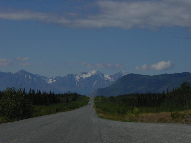
We covered another great day today with a mix of road construction checking our pace. We passed through Whitehorse, the territorial capital of the Yukon Territory. Then we continued on to the Kluane National Park and Reserve along the south side of Kluane Lake. Kluane National Park contains Mt. Trudeau (formerly Mt. Logan), Canada’s tallest mountain at 19,551 feet. Though we couldn’t see that peak from our road-based views, we did have the constant company of many other beautiful mountains along this section.
Kluane Lake is the largest lake in the Yukon Territory. Its water color is consistent with other glacier fed lakes; a light milky turquoise caused by the light reflecting off of the glacial silt suspended in the water. Our approach to the lake from the east side was very spectacular. We saw it first from the leeward side, which accounted for the calm mirror-like surfaces reflecting back the awesome landscapes before us. The lake totally changed in appearance as we rounded a bluff and faced some wind. The now choppy water dissolved the reflections and varied the colors.
We stopped for the night just beyond the west edge of the lake in a village that is little more than a service stop. After a dinner of chicken breasts cooked on the grill we ventured across the street for a couple beers at Scully’s Saloon, home of the famous Burl Bar. The bar is beautifully constructed of burl woods, spruce and birch. We settled in for some friendly conversation with Phil, the bartender. It was a quiet evening so far, but it was clear that this place was conducive to heavy drinking. Christine and I resisted the urge to keep pace with some of the locals, unwilling to suffer through a long day of driving tomorrow.

1) Kluane Mountain Range. 2)Kluane Lake.
Tuesday, August 14, 2001 Gakona, AK
We had no trouble getting started this morning knowing that we would cross into Alaska today. The drive this morning included quite a bit of construction as well as some wildlife sightings. We saw a moose cow and calf standing in the middle of a pond grazing on the soft water grasses. It was a very picturesque scene, but too distant to capture in a picture without a strong telephoto lens. A little later we spotted a black bear moving alongside the road.
We crossed into Alaska without fanfare and made our way to Tok, our departure point from the Alaska Highway. From here we took the Tok Cut-off southwest toward Anchorage. The Alaska Highway officially continues for about another hundred miles toward Fairbanks, terminating at Delta Junction about a hundred miles shy of Fairbanks.
As we continued south the Wrangell—St. Elias Mountain Ranges could be seen in the distant. Mt. Stanford (16,237 ft) and Mt. Drum (12,010 ft) were both prominent peaks in our view. We stopped for the night along the Copper River with the winds really rocking the RV. We had time to get some laundry done before arriving in Anchorage tomorrow.
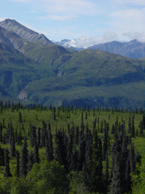 The Chugash Mountain Range
Wednesday, August 15, 2001 Eagle River, AK
We had a pretty slow drive today as we made our way to Christine’s brother’s house in Eagle River, just outside of Anchorage. We hit quite a bit of construction and then the road turned very narrow and twisty through the Mat-Su Valley. The Mat-Su Valley is a beautiful area defined by the Matinuska and Susitna Rivers.
We stopped for lunch at the Long Rifle Lodge overlooking the Matinuska Glacier. Our view from the restaurant there was excellent. This glacier is about twenty-six miles long and is fairly stable, unlike the many receding glaciers we saw on our way up through British Columbia. The Matinuska Glacier is not being monitored, so its condition is measured only by casual observation.
We arrived in Eagle River early so I dropped Christine off at the library and took the RV for a badly needed bath. The dust and mud we encountered had dirtied the rig considerably, but not nearly as bad as many others we had passed on the road. Christine’s brother, Craig, has a job with one of the oil companies so we were waiting until the end of his workday to meet with him. He has a rough-hewn log house that dates back to 1919, making it one of the oldest buildings in the Anchorage area. Remember that this is still a very young state, and that ninety percent of the population didn’t arrive until after the beginning of oil production here in the early 1970’s.
We visited with Craig over a bottle of wine and then went out for a tasty dinner at a local brewpub here in Eagle River. We plan on spending a month in and around the state, so we began discussing our options.
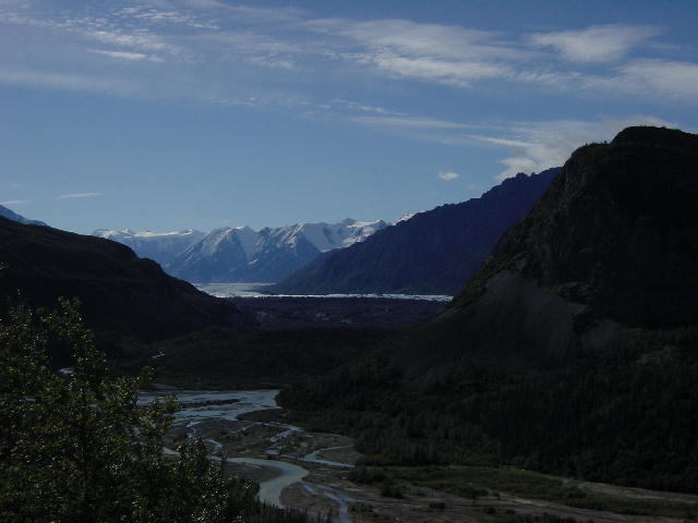

Two different views of the Matinuska Glacier.
To continue onto August 16th, click here.