Wind River Mountains Backpack Trip 3 - July, 2005
Click here to go back to the Frontier Home Page.
Introduction note: This backpack trip occurred over 4th of July break just like the previous year. My next door neighbor from Dayton, Dave Lewis, came out with a friend of his, Owen. This was Owen's first real backpacking trip. He taxed his bank account pretty hard getting geared up for the hike which resulted in some pretty nice gear. We managed to keep our pack weights down for this four-day adventure, but Owen was insistent on carrying nearly ten pounds of photography equipment (lots of film, SLR camera, telephoto lenses and a sturdy full-sized tripod). Dave and I(Joe) both encouraged him to leave some of the gear behind, at least the tripod, but he was not to be swayed. And afterall, he was the one carrying it.
In hind sight I'm sure he would have done things differently. He never once used the tripod, and he claims that none of his photos turned out. Dave brought his tiny digital camera, so I elected to go without a camera, thinking that two cameras should be ample. I won't make that mistake again. Dave's camera took great photos, as you'll see below, but his camera ran out of charge halfway through the hike and missed some spectacular high alpine scenery.
July 3, 2005
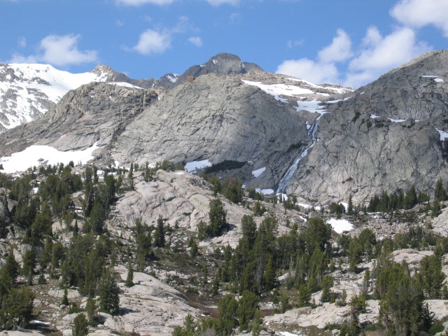
We used the Elkhart Park Trailhead near Pinedale, WY. That's the same entry that I used for last year's 4th of July hike. I had planned a different loop to take in some new scenery. We walked a little over five miles in that first afternoon and made camp on the bench. Owen had a little trouble with his altitude adjustment that first night and was unable to keep his dinner down. I felt bad for him, because he was going to need a lot of energy to get through the next few days.
Click on thumbprint photos to see them enlarged.
 |
 |
 |
 |
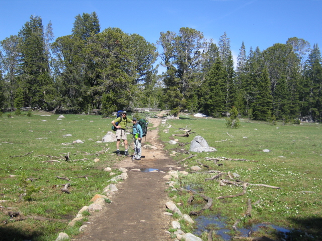
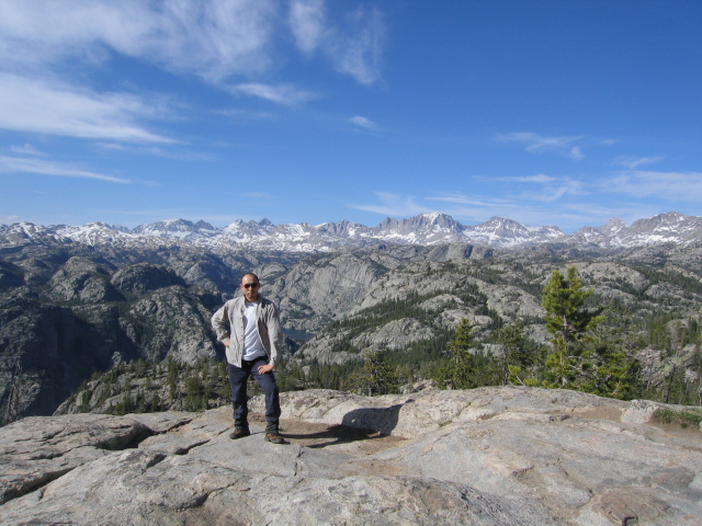
Joe & Owen on the trail. |
A quiet pond. |
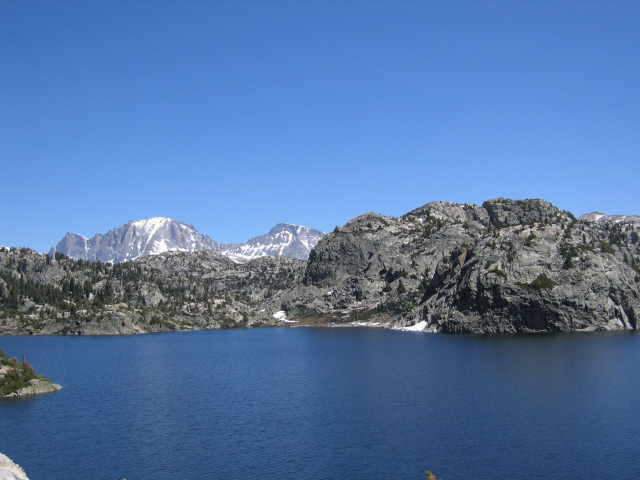
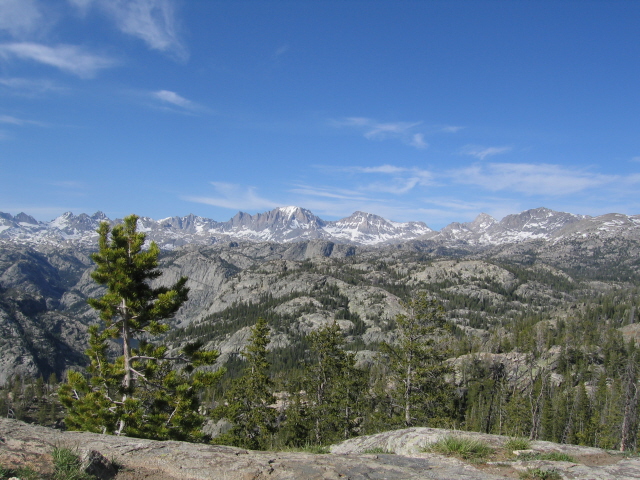
The Continental Divide. |
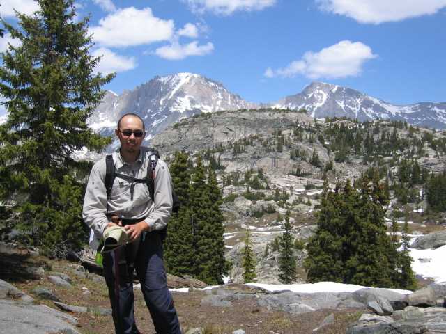
Joe. |
 |
 |
 |
 |
Dave. |
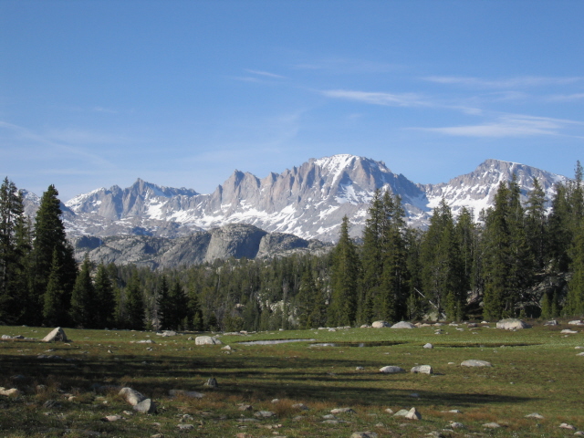
Fremont Peak. |
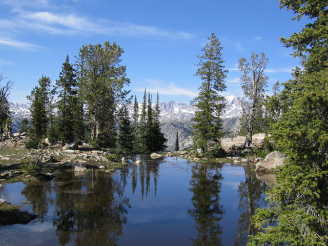
Reflecting pond. |
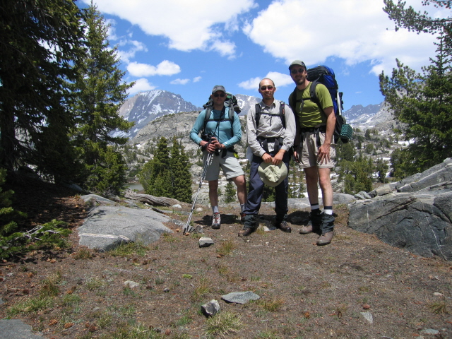
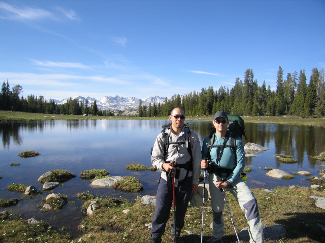
Dave & Owen. |
July 4, 2005
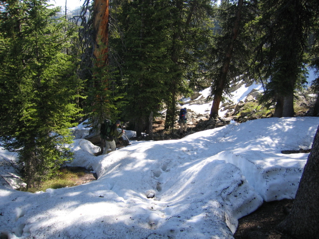
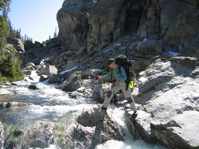
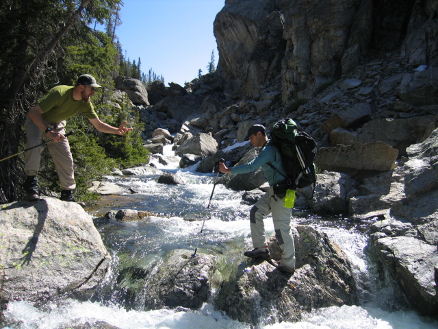
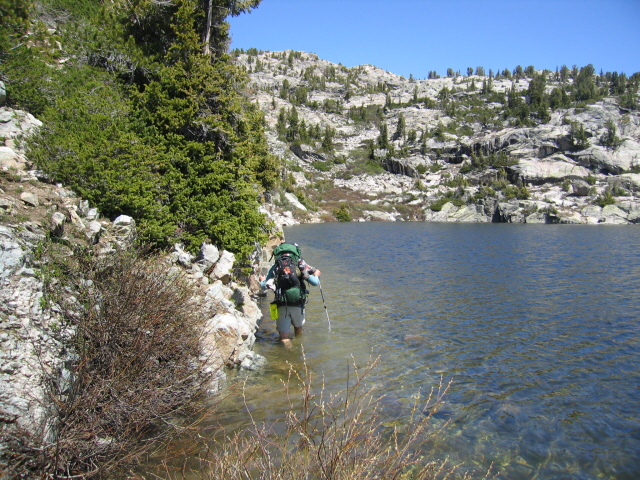
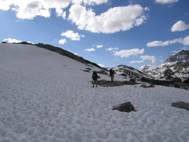
We woke to another beautiful day. We headed in toward Titcomb Basin along Seneca Lake. There had been a heavy late spring snow storm that left a lot of soft snow in the mountains. We found ourselves slogging through it on shaded north-facing slopes. The spring snowmelt had the streams roaring and had even raised the level of Seneca Lake almost three feet over the trail. We finally hooked up with the Highline Trail (a section of the Continental Divide Trail) and turned northwest. We were up high enough that much of the trail was hard to follow, and we were clearly the first human steps treading that section this year.
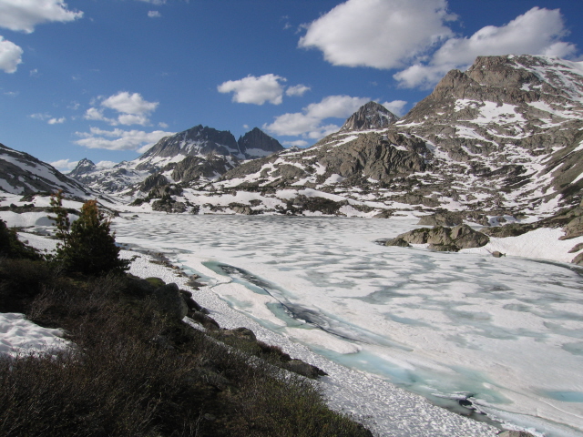
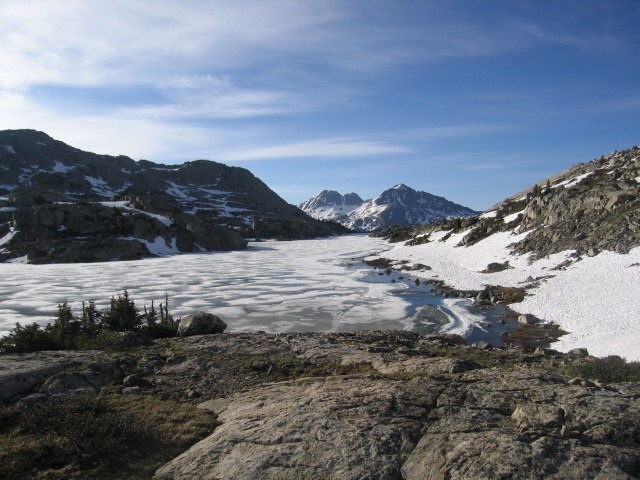
I was struggling with my route finding abilities. Dave had brought along his Garmin eTrex handheld GPS for fun and I had loaded it with about fifty waypoints just to have something to play with. We had no idea how handy that GPS would actually be. I misread the map and had us on a route veering westward away from the trail. The longer we stayed on my route the more convinced Dave became that we were no longer on the trail. We reached a lake that didn't match up with my map, so I was finally convinced that we needed to alter course. The GPS gave us a bearing and helped us find a key bridge crossing(Fremont Crossing)over a raging Fremont Creek. I now plan to hike with a GPS in the future. It really saved us some grief. We ended the day setting up camp along frozen Upper Jean Lake at 10,799' after a tough 10-mile day.
July 5-6, 2005
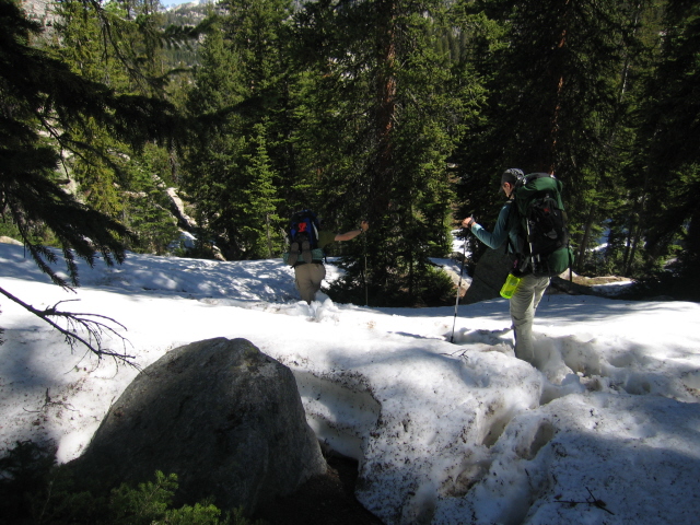
We started today with a grueling crawl over our high pass for the hike. This unnamed saddle took us over 11,000'. The fresh spring snow was causing us real trouble. Since the snow was so recent it hadn't had a chance to settle and firm up. With the warm July temperatures it meant that we were frequently post-holing to our crotch in very deep soft snow. The snow started out pretty firm in the cool morning, but softened quickly under the direct sunlight. I estimated that it took us about three hours to go one mile over the pass--our hardest mile of the hike, and I loved it! There must be something wrong with me.
We continued battling soft snow into the afternoon until we finally dropped below the snow line. We only got in about nine miles before finally calling in quits. We all had wet boots and feet from all the snow and were worn out. Now at lower elevations the mosquitoes started making themselves known.
Our final day left us with almost ten miles back to the car, the last two miles of which were almost all uphill. The 34-mile outing was a lot of fun. Owen did very well for his first backpacking trip, and this ended up being no cakewalk.