Pictures and Log of the Wind River Range
Click here to go back to the Frontier Home Page.
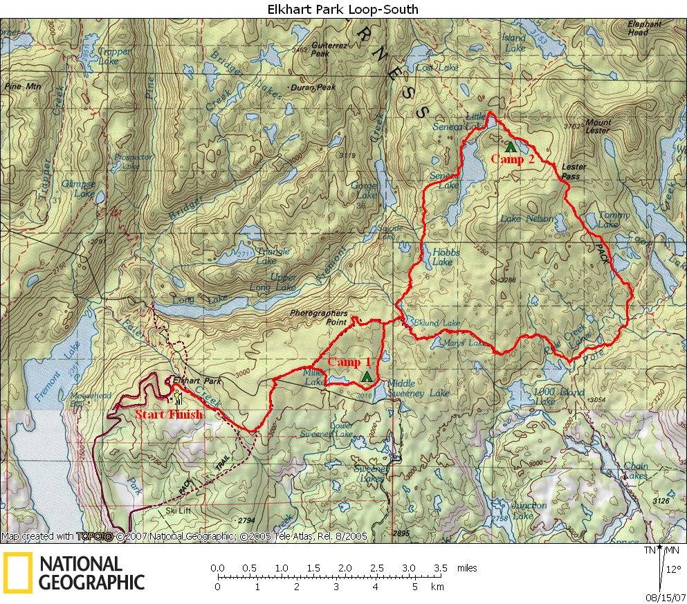
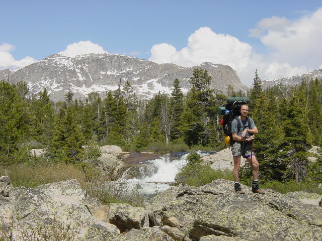
Following you can find pictures we took during our first Wind River Range backpacking trip. We hiked 26 miles in 3 days over the July 4th weekend, 2004. Below the pictures you can find Joe's description of those three days.
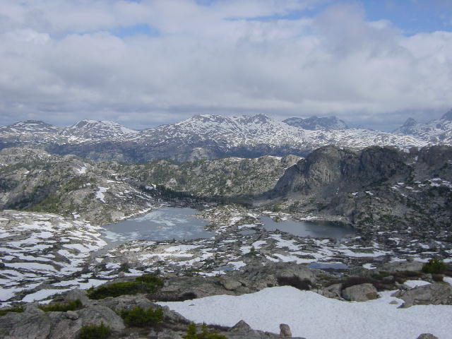
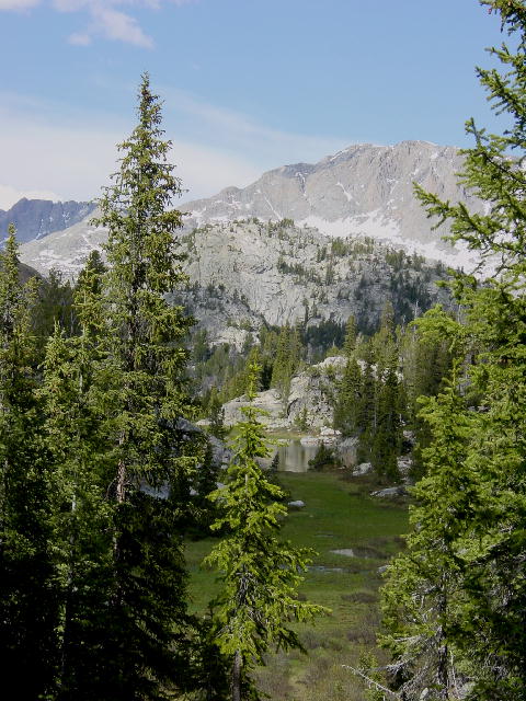
The above picture shows the view north of Lester Pass. The trail we followed went down and between the two lakes you see.
 |
Please remember the following pictures are just thumbnails, click on any picture that you would like to see larger.
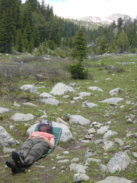

1) Titcomb needles and the nearby peaks. 2) Christine taking full advantage of a little downtown near Monument creek. The mosquitoes were bad for much of the trip and the head net really helped. 3) Joe before we completed the middle crossing over Pole Creek. 4) Christine fording the middle crossing of Pole Creek. This was our hardest creek crossing. The water was moving very fast and the water was above the knees at times.
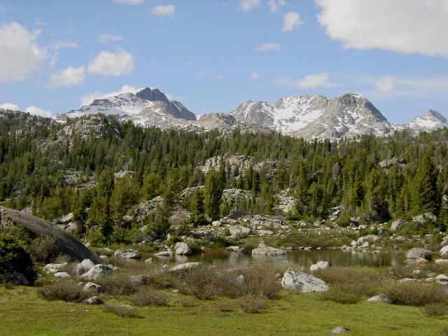

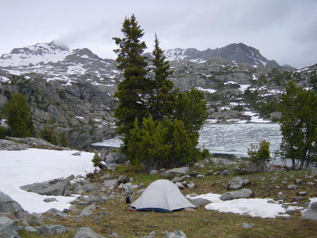
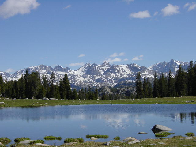
1) A mountain valley view. 2) A mountain pond view. 3) Christine crossing the upper part of Pole Creek. 4) This was our campsite on Saturday night, near still ice covered Tommy Lake before going over Lester Pass.
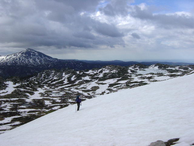
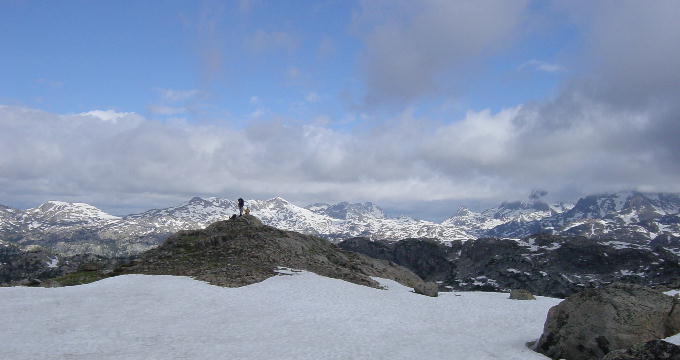
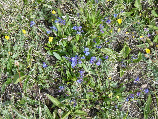
1) Christine climbing through the snow over Lester Pass. It looks dark because it had been storming. 2) After climbing Lester Pass this is what we were greeted with on the other side. Another beautiful view, with Joe on the distant rock. 3) There were lots of beautiful wild flowers throughout the hike, these were just over Lester Pass amid the snow.
Wind River Hike Description
Friday, July 2, 2004
Christine only worked a half day today so we were on our
way to the Winds (insider handle for the Wind River Range) by 1:30.
We reached the Pinedale Forest Ranger District Office at 3:00 and picked
up a bear-proof food canister (identical to the ones we used while hiking the
John Muir Trail in 2002). We drove up to the Elkhart Park trailhead at 9350’ and were
hiking in eastward on the Pole Creek Trail at 4:00.
We only planned to go a short four miles or so before
pitching camp for the night. We
enjoyed the gentle ascent to 10,100’ before turning south at the Miller Lake
cut-off. We dropped down to Miller
Lake and began experiencing the seasonal nuisance of swarming mosquitoes.
We quickly learned that we were much less likely to be bitten if we kept
moving. We continued down to Middle
Sweeney Lake at about 9900’ before finding a suitable camping spot for the
night. We had seen many signs of
moose; mostly familiar droppings, but also prints.
This was ideal moose habitat so we minimized noise and stayed alert for a
possible sighting, though we ended up seeing no large wildlife the entire
weekend.
As soon as we stopped walking the mosquitoes were upon us.
The 100% deet bug repellant was very effective at preventing the bites,
but the swarming around the face was only averted by wearing a headnet.
We pitched the tent and climbed in away from the mosquitoes to enjoy
sandwiches for dinner that Christine had made at home.
We had just settled in when it started to rain.
I jumped out and rushed to get the rainfly in place over the tent and
secure the rest of our gear. We
enjoyed our cold meal and soon retired after reading a few chapters aloud from a
John D. MacDonald paperback that I brought along.
Christine was disappointed to notice at this short distance
that blisters were already forming on her heals. This has been a chronic problem for Christine.
Her new boots were chosen carefully for fit, firmness and support.
On the downside, the firmness of the new boots make them slow to break
in.
Saturday, July 3, 2004
Happy Birthday to my sister, Martha. Even though it was light out by 5:30, we managed to snooze until 8:00 when the morning sun had finally heated the tent to the point of discomfort. I slept very well in my new Mountainsmith down sleeping bag that Christine got for me at Christmas. Having only planned to do about eight miles today meant that we didn’t really have to rush ourselves. We ate our cold granola breakfast and finally got hiking at 9:15 on a beautiful morning.
We rejoined the Pole Creek Trail (or so we thought) after
passing Upper Sweeney Lake. We
reached a trail sign at Eklund Lake that had me totally confused.
I finally deduced that we had mistakenly taken one of many unmarked
trails that happened to parallel the Pole Creek Trail.
With that confusion resolved, we continued eastward on the Pole Creek
Trail. We were almost constantly
accompanied by mosquitoes. We were
able to walk without the headnets, but they were needed once we stopped.
We took an hour-long break at Monument Creek to pump some
water and relax, since we were still unhurried. We even read a couple more chapters aloud.
Shortly after our break, we reached our first stream crossing as we
turned northward onto the Highline Trail. We
had to ford the swift and swollen Pole Creek twice this day.
Our first crossing was known as the Middle Crossing.
It was just below a raging cascade and was the most difficult of the four
fords that we would do on this outing. We
each found sturdy long sticks to accompany the hiking poles that we already had.
We removed our boots and donned sport sandals before entering the frigid
35 degree snowmelt water. It was a
wide challenging crossing that required vigilant concentration while the lower
legs and feet went numb. It was
little more than knee deep at its deepest, but the speed of the current created
a significant challenge. We both
managed the ford without mishap and were soon back in our boots and on our way.
We climbed up to the Upper Crossings of Pole Creek and
again went through the routine of putting on our sandals and tying our boots to
our packs. This was actually two
crossings in one, only about a tenth of a mile apart.
The second being the serious one, it was still a good bit tamer than the
Middle Crossing.
We stopped at the outlet of one of the Cook Lakes to make
our dinner. Christine was trying
something new. We made a soup and
used TVP (Textured Vegetable Protein, a soy product) for the bulk.
It is always a challenge to find trail foods that packed enough punch
without being too heavy. TVP is a lightweight tasteless staple that is supposed to mix
with anything while truly taming ones hunger.
The meal was good, but based on our appetites the next day we remain
unconvinced of the claims about TVP. I’m
sure we’ll try it again, though.
After dinner we continued another half mile or so and found a campsite just west of ice-covered Tommy Lake at 10,600’ around 7:00. We had managed to use most of the day to go about eight miles. We were just 500’ below snow-covered Lester Pass. We settled in and read a bit more as the wind and rain kicked up and thunder roared above us, before finally dozing off. I failed to explain earlier that we intentionally cooked and ate dinner prior to reaching our campsite as a precaution against bear encounters. This is a proven method that we used while hiking the John Muir Trail. This way there are no smells of cooked food to attract animals anywhere near the campsite.
Sunday, July 4, 2004
We again only planned to do about eight miles today, but
intentionally got an earlier start anticipating more challenges.
We were back on the trail at 8:15, an hour earlier than yesterday, and
began the final ascent over Lester Pass in an intermittent drizzle/hail.
Approaching from the southern side on the Highline Trail we were met with
a massive snow bank flanking the southern side of the pass.
The trail disappeared into untrod snow leaving us to choose a route to
the pass.
A solo hiker named Kevin was just ahead of us and chose a
more aggressive pitch to the east. I
opted for a slightly less steep ascent angling to the west.
I began kicking footsteps into the firm snow and steadily angled my way
up before switching back for the easiest route off of the snow.
We didn’t have crampons (spikes that attach to boots for better
traction on ice and snow) and didn’t really miss them, but we sure could have
used baskets (3-5” diameter disks that make ski poles out of walking sticks)
on our walking sticks. I had failed
to bring them. Our walking sticks
just sank straight down in the snow.
The views from the pass were dark and overcast, but
absolutely spectacular. We joined
up with Kevin and together searched for a route down the heavily snow-covered
north side of the pass. We had fun
searching for the firm snow and sliding our way down while occasionally
post-holing through the soft snow up to our crotches. We separated from Kevin at the junction with the Seneca Lake
Trail where we turned west back toward the trailhead.
We had a couple detours along the Seneca Lakes as portions
of the trail were well under water due to the seasonally high water levels of
the lakes. The early afternoon
surprised us with an intense hailstorm that pelted us with small hailstones,
stinging any exposed skin. We
continued west as the afternoon began to clear.
We forded our last stream, the outlet creek for the Seneca Lakes.
We reached the true junction with the Pole Creek trail and found ourselves 5.5
miles from the trailhead. This was
as far as we intended to hike today, but we decided to have dinner and then
knock out another couple miles to shorten our hike out Monday morning.
We found a nice spot by Eklund Lake and cooked up a fantastic meal that Christine had gotten off the internet. It was a curried cashew chicken over brown rice that couldn’t have tasted any better. We ate our early dinner in the company of mosquitoes and a slight drizzle, but thoroughly enjoyed ourselves. At just 5:00 we were shortening our distance to the trailhead. The remaining 5.5 miles were the easiest of the weekend, a gentle descent of 1000 feet. At 6:00 we were only 3.3 miles from the trailhead, so we agreed to go ahead and hoof it on out and sleep in our own bed tonight. It was a push to finish the 13.5 miles, but gravity pulled us along. We reached the trailhead at 7:30 and were home in Green River at 9:45. It had been a wonderful weekend and a spectacular 26 mile hike. We look forward to many more great adventures in the Winds.