Labyrinth Canyon Float - July, 2007
Click here to go back to the Frontier Home Page.
Introduction note (by Joe): For Part II of Preston's outdoor adventure I had planned a canoe float down the Green River in Utah through Labyrinth Canyon, one of the most scenic flat water floats in the country. We had originally planned to do all 68 miles from the town of Green River, UT south to Mineral Bottom, the takeout point at the northern boundary of Canyonlands National Park. However, due to the severe drought this summer the flow in the river was at an extreme low. This meant that there would be nearly no perceptible current, requiring us to paddle constantly. We opted instead to skip the first 23 miles of river along the farms south of Green River and put in at Ruby Ranch, an access point right at the beginning of Labyrinth Canyon.
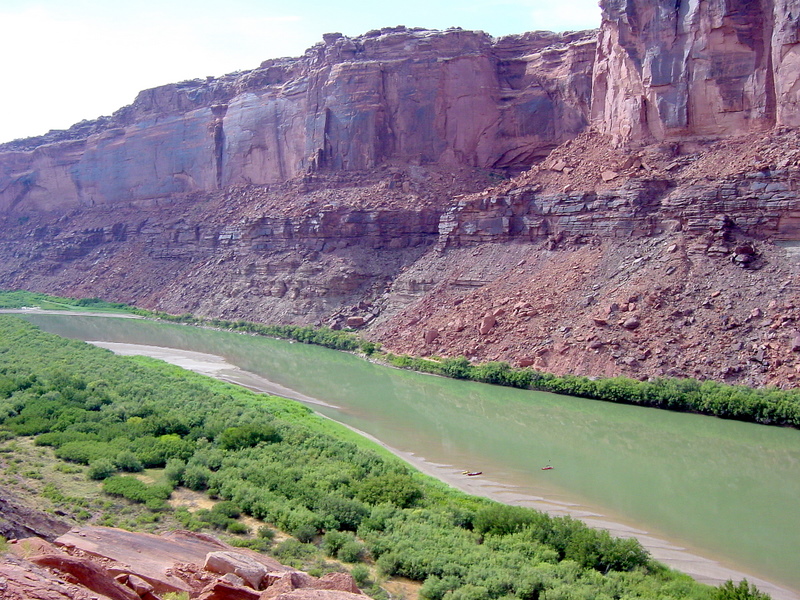
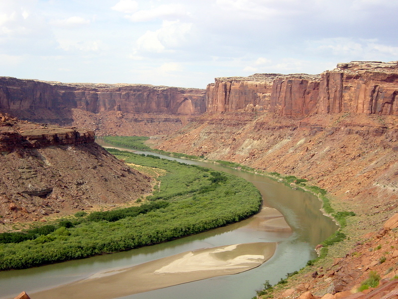
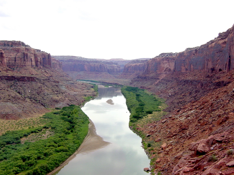
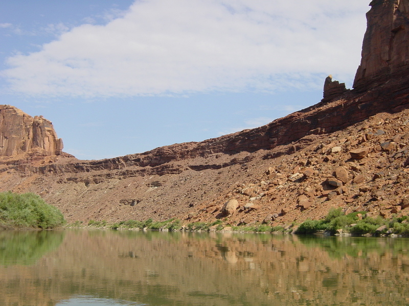
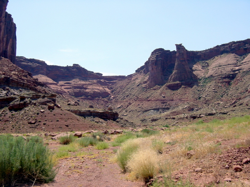
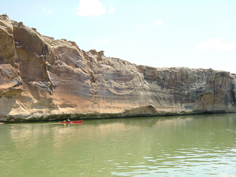
Labyrinth Canyon continues for 45 miles south of Ruby Ranch to Mineral Bottom where it ends and Stillwater Canyon begins. The Green River carves ever deeper into the many layers of sandstone. We start out right away with the Carmel Formation, then cliffs of Navajo Sandstone followed by the Kayenta Formation, Wingate Sandstone, Chinle Formation and Moenkopi Formation (for you geologists). As you proceed through the photos below, many of the sedimentary layers will be discernible. You can learn more about this trip from the BLM site.
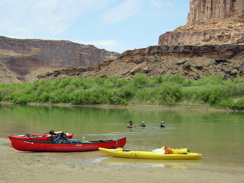
For this adventure I invited my very close friends Dave Martin and Jackie Bassham to join me and Preston. Dave has two sit-on-top touring kayaks, one which he lent to Jackie. Preston and I were able to borrow a friend's Old Town Discovery 169 canoe, and much gear. Dave & Jackie drove down from Park City and met us in Green River, Utah on Thursday July 19th.
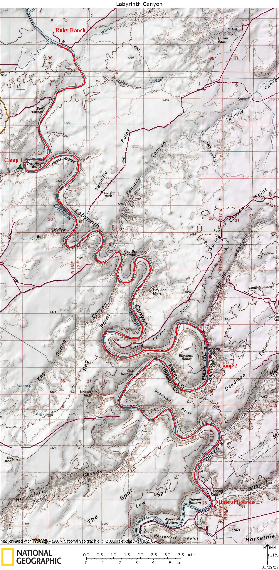
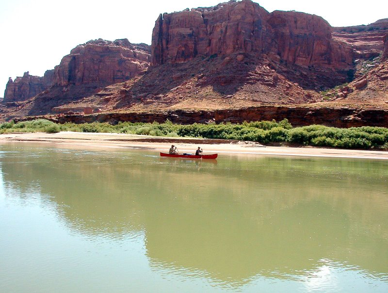
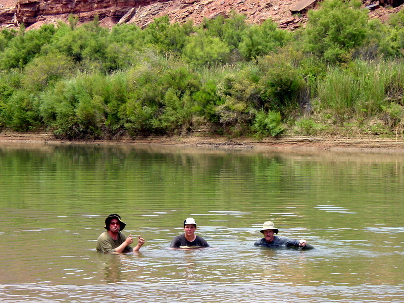
Friday - July 20th: In the morning we went through the time-consuming logistics of dropping the boats and gear off at the Ruby Ranch put-in point, then driving both trucks down to Mineral Bottom, the take-out point. We left Jackie's truck there and returned to Ruby Ranch in my truck. We finally got on the river Friday at 2:00 and decided to keep our first day light by only paddling 7 miles to a recommended campsite at Trin-Alcove Bend. We were into the Navajo Sandstone cliffs shortly after leaving Ruby Ranch, and they got taller very rapidly. The weather was very hot, but being on the water provided immediate moderation of the temperature. We did a lot of splashing and water play this first day to keep cool. Jackie managed to flip his kayak over twice in the first few miles.
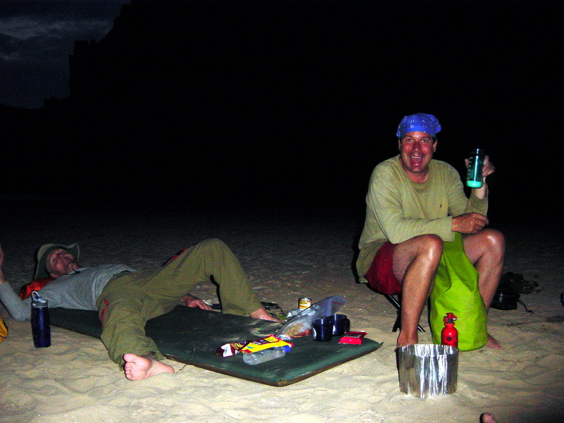
Preston and I were burdened with carrying all the drinking water for the group. It amounted to about 120 pounds of extra ballast on top of all our other gear, which included a mandatory fire pan and portable toilet. We carried the water because the Green River is usually too silty to filter and the springs are unreliable. When the water is low and slow like on our trip, the silt is greatly reduced, but then the salt concentration in the water becomes too high to drink. The fire pan was required with our river permit even though we had no plans of having any campfires in this heat. The river banks get so little rainfall in the canyon that campfires leave a long lasting stain on the ground. The fire pan permits "leave no trace" camping ethics. The portable toilet is a similar requirement to reduce human impact. The lack of rainfall prevents the ability of the soil to break down the human waste so the usual practice of burying excrement is not permitted. Everything must be packed out. Instead of buying or renting a portable river toilet we simply created our own using a large surplus ammo case with many plastic bags to line it with. The irony here is that our toilet got no use either. To a person, our group managed to delay the need for a toilet until we got off the river three days later.
Click on thumbprint photos to see them enlarged.
 |
 |
 |
 |
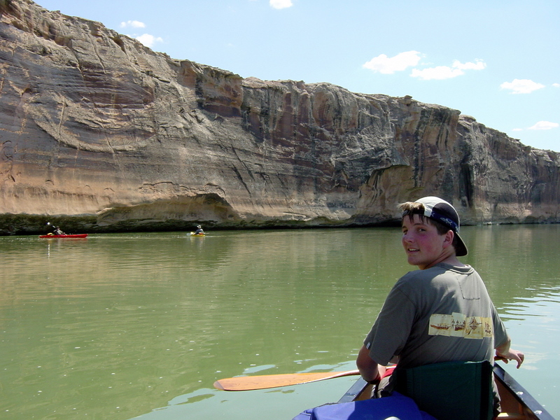
Dave with Navajo Sandstone. |
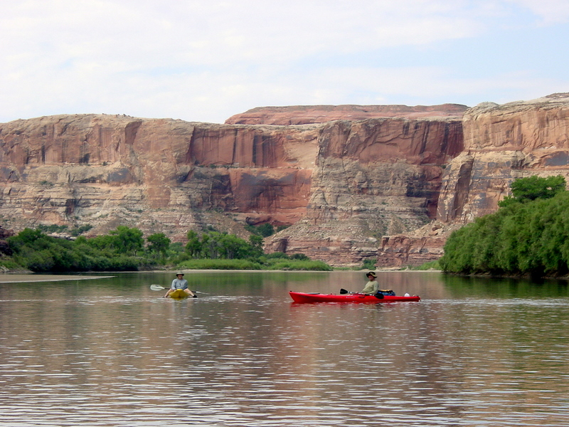
Dave & Jackie. |
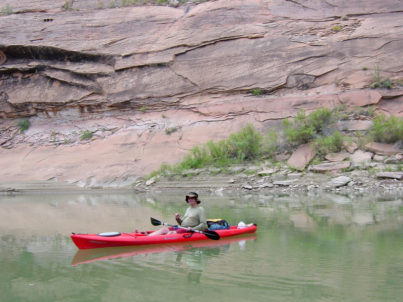
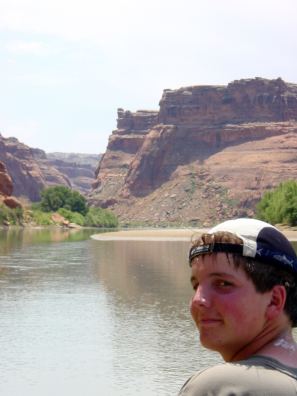
Preston. |
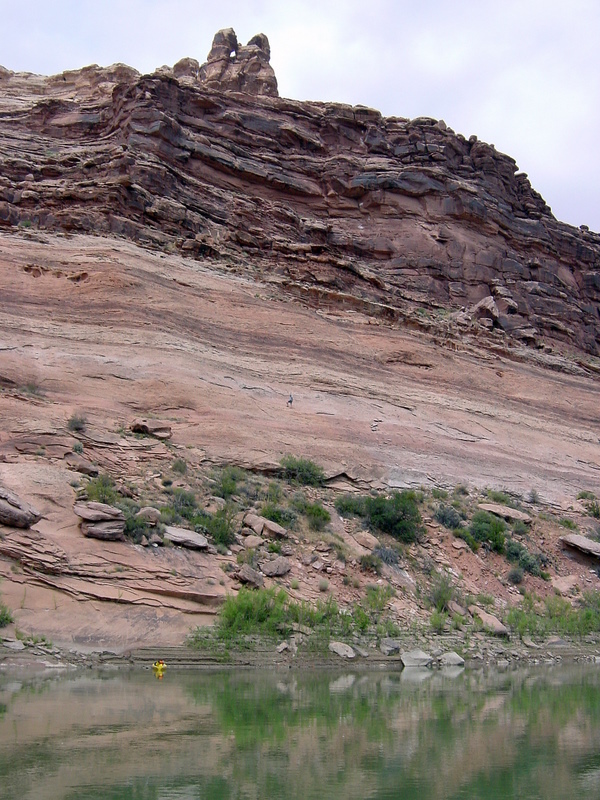
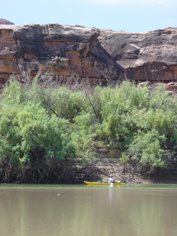
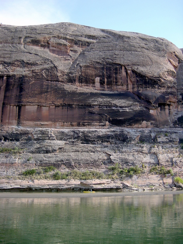
Jackie's yellow kayak provides scale to this cliff. |
 |
 |
 |
 |
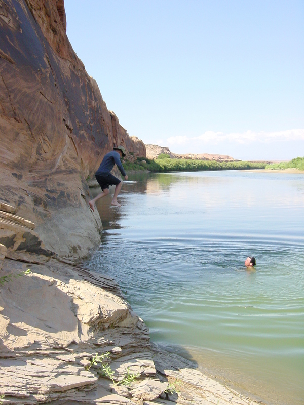
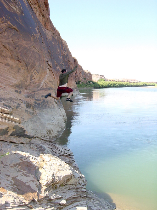
Jackie jumps. |
Preston flies! |
Dave leaps. |
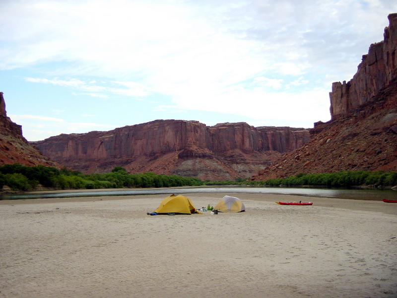
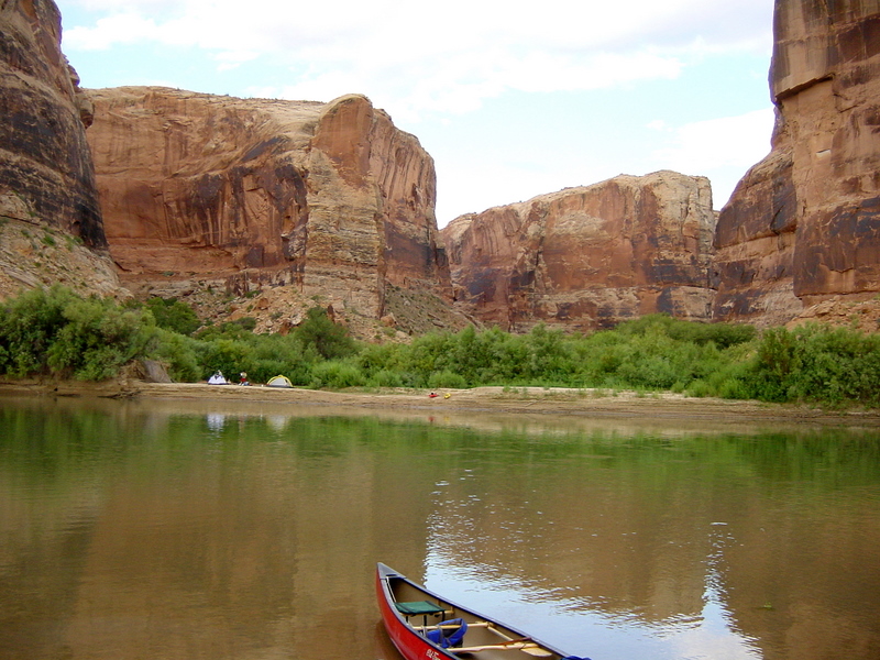
Camp 1 at Trin-Alcove Bend. |
Saturday - July 21st: We broke camp and began what was to be a 23-mile day of solid paddling. Floating twenty miles down a river in a canoe can usually be done in just a few hours with a moderate amount of paddling, but we really had very little current so it took us all day. We just settled into a steady groove of paddling and inched our way down river. Whenever we got too hot we would just jump in the river. The water was just cool enough to provide relief, but not really chill us. The cliffs just kept getting taller.
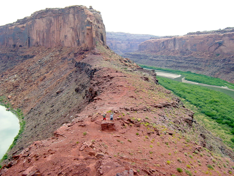
Near the end of our day we reached the beginning of Bowknot Bend. This part of the river forms a 7-mile meander or oxbow before nearly touching itself again, if it weren't for a ridge rising several hundred feet between the river. Jackie, Preston and I decided to climb it and were amazed by the great views of the river coming and going.
We struggled to find a good spot for Camp 2, but finally settled on a sandy island in the middle of the river halfway around Bowknot Bend. It was a good spot except for the windblown sand getting everywhere.
Sunday - July 22nd: It was now our third day on the river and we were all tired of drinking warm water, even with flavor packets mixed in. In hindsight we all agreed that it would have been worth the effort to bring some coolers just to have some cold drinks. It may have meant towing an inflatable dingy behind us, but we should have done it anyway. We had fifteen miles left to reach our take-out point at Mineral Bottom. We all anticipated making it into Moab for dinner and cold beers at the Moab Brewery.
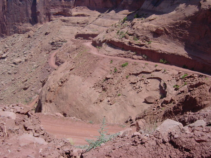
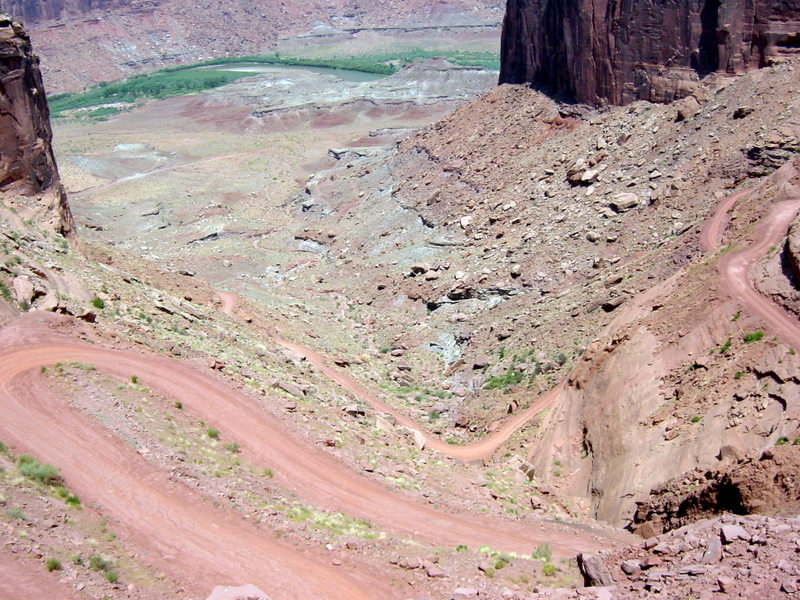
We reached the Mineral Bottom take-out point around 3:00 and got busy with getting all three boats strapped onto Jackie's truck and all gear stowed. Cold beers awaited us in Moab, but we had to get up the canyon wall first. The three photos below show the treacherous road that was our exit.
After dinner in Moab we reversed our inital effort by returning to Ruby Ranch to get my truck. We spent another night in Green River, Utah before returning to our respective homes on Monday. This was an outstanding water trip. We would have enjoyed a lot more river flow and cooler temperatures by doing this float in April, but then the water would have been too cold to play in. The bugs weren't too annoying so the main change would have been to go through the effort to bring cold beverages. I would recommend this adventure for anyone.