Escalante Canyoneering - August, 2006
Click here to go back to the Frontier Home Page.
Introduction note:
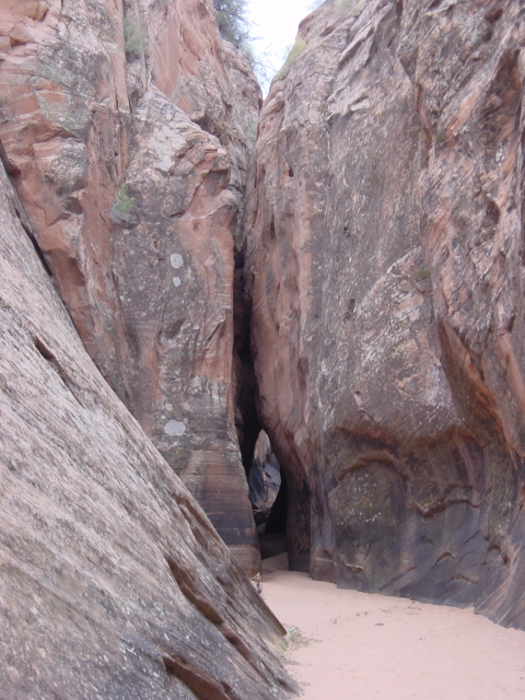
A little background to kick things off: Grand Staircase-Escalante National Monument (GSENM) was a controversial designation for a large swath of land in southern Utah when enacted by President Clinton in 1996. GSENM connects to the Glen Canyon National Recreation Area (GCNRA) formed when the Glen Canyon Dam backed up the Colorado River to form Lake Powell. These two protected areas set aside a huge area of southern Utah. One of the unique features of these lands is the multitude of slot canyons, narrow slits in the sandstone caused by erosion. There are many of them, and some probably yet to be discovered. The slots are so tight in some cases that they can easily be overlooked.
There are many dangers associated with exploring the slots. The first and foremost has to do with water. Since the slots were all formed by rainwater draining into the Colorado River, a flashflood can be a major hazard. The drainage for this area is so large that it can be raining 50 miles away and still cause a flash flood in the slots while the sky is blue overhead. Another risk factor is that the sandstone is so slippery even when dry, accounting for the term—slickrock. Many slots are explored by heading down the drainage which means that one can easily slide down some sections that are impossible to climb back up. This doesn’t become a problem until you reach a cliff or precipice that is too high to descend leaving one in a position of not being able to go forward or back. Another feature of some slots is referred to as a pothole. This is when the water swirls around and leaves a depression in the softer sandstone. These potholes can be a danger wet or dry. They are often too wide to span with arms and legs, so once in a deep enough pothole, there is no getting out. In the case of a wet pothole, there is no way of knowing how deep it is, then hypothermia becomes a major risk. All of these risks can easily be surmounted by never exploring the slots alone, and by also taking a rope along. A good guidebook that explains in detail the features of each slot is also very useful.
My friend Dave Lewis from Dayton, Ohio was planning another backpacking trip out here like the previous year. We had a great hike through the Wind River Mountains in 2005 that I had planned. Now he wanted to plan a hike through the canyons of the Escalante River. I was happy to let him organize this trip.
Tuesday August 8, 2006
I picked up Dave at the SLC airport in the afternoon and we drove directly south for about 4 hours to the town of Escalante. This tiny out of the way hamlet has seen some development since getting put on the map by Clinton’s actions, but it is still a very quiet setting. We stopped there briefly before heading down Hole In The Rock Road to make camp for the night. Hole In The Rock Road is located along an historic route that the Mormons blazed in the late 1800’s. It travels 55 miles southeast from the town of Escalante to where it descends down to Lake Powell. It is an unpaved road that gets progressively worse over its length. Our first camp was at Harris Wash Trailhead, eleven miles down Hole In The Rock Road and then another six miles on a side route to the trailhead. These side routes were an adventure of their own. My little Ford Ranger pickup had the necessary high ground clearance for these roads, but having only rear wheel drive demanded extra caution. Dave and I traversed several of these side roads with trepidation over the next few days. We settled into camp that first night and dozed off to the yipping of coyotes nearby.
Wednesday August 9, 2006
Dave worked hard to put a backpacking trip together because he knew that was my preference, but he also knew that it would make more sense to hit some of the slot canyons as day-hikes. We started this day with a plan to explore two slots as a day-hike before donning our heavy packs for a few days of backpacking. We drove back up to Hole In The Rock Road and started walking down Halfway Hollow to Harris Wash. There aren’t really any established trails, but it is easy to see and follow the drainages in this desert area. Most of the drainages are bone dry, even just a day after a rain, so we can walk right along the sandy bottom.
We set out to find Zebra Slot, a short but beautiful slot named for the alternating bands of light and dark sandstone. On the way we discovered a yet unnamed minor slot along Halfway Hollow. We decided to name it Double L slot for Lustik-Lewis, or was that Lewis-Lustik? Anyway, our slot enthusiasm was just beginning. A couple miles further and we reached Zebra Slot. The approach was so nondescript that it would have been easy to miss if the guidebook hadn’t been so detailed. The guidebook said nothing about having to wade through water here, yet we were faced with about ten yards of knee-deep stagnant water. It didn’t smell too bad, but the dead rat at the edge of the water was yet another reminder to exercise caution. This led us to question whether we were in the Zebra Slot or not. We proceeded through the cold water and we were rewarded with a truly beautiful slot that was indeed Zebra Slot.
We hiked a couple more miles from there to explore Tunnel Slot which the guidebook said was likely to be a wet slot, requiring a wade or swim of about 40 yards. We arrived at Tunnel Slot to find it totally dry. This taught us that the guidebook can only be relied upon just so far.
We returned back up Halfway Hollow to the truck and drove back down to the Harris Wash trailhead to begin our backpacking trip. Harris Wash is a pretty wide drainage and our plan was to follow it about eight or nine miles down to the Escalante River, then explore some slots near the Escalante River over the next couple days. The walking down Harris Wash was a bit awkward burdened by our packs. There wasn’t any water running down the wash, yet from a recent rain the route was a muddy quagmire that threatened to separate us from our shoes. This being the middle of summer in the desert meant that we knew we would have trouble finding good drinking water. We knew that there would be water running in the Escalante River, but it was reported to be an opaque grey in color with all the silt it carried. Filtering that water could clog my water filter pump in a heartbeat, so we were hoping to score some fresh water from one of the springs feeding into Harris Wash. After slogging halfway down the wash and passing two dry spring outlets, we paused to reconsider our plan. The memory of our morning fun exploring slots was quickly fading as we struggled down this unrewarding wash. After a brief discussion we agreed to scrap our backpacking trip and continue exploring as many slots as possible with day-hikes. We turned around and fought our way back to the truck.
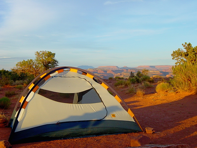
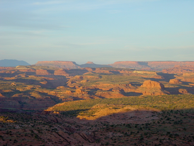
We drove back up to Escalante to buy several gallons of water and some ice to cool down the beers I brought. Dave then worked up an alternate plan. Now with plenty of drinking water and a plan to merely do day-hikes we drove back down Hole In The Rock Road sixteen miles to the Egypt trailhead turn-off, which required a challenging nine-mile drive from there to reach the trailhead high on a plateau at the boundary of the GSENM and GCNRA. We set up camp there on the edge of the plateau with splendid views east over the GCNRA and the Escalante River drainage.
Click on thumbprint photos to see them enlarged.
Thursday August 10, 2206
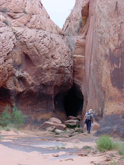
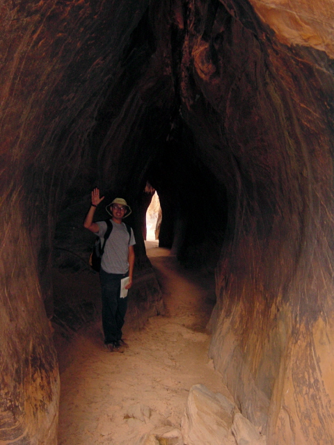
We awoke at our high campsite on Egypt Bench facing another hot dry day. Dave had a plan for us to descend down to the Escalante River and wade downstream to Neon Canyon to visit the Golden Cathedral. Our descent from Egypt Bench was a steep rock scramble until it leveled off. We then followed some rock cairns (piles of rocks to denote a trail) along what was supposed to be an old horse trail. Unfortunately the cairns led us down into Fence Canyon. The guidebook said nothing about this canyon, but we were excited to drop into another slot. We didn’t get very far before I started getting a bad feeling about this route. The sandstone sloped steeply down to a series of potholes, wet and dry. I followed a high ledge to see if I could tell whether we could truly get through. It looked very discouraging. Dave was gung ho to drop into the slot, but I got him to reconsider. He followed me along the ledge and then he tied one end of a 50-foot strap around his waist so that I could lower him to edge where he could get a better view. He learned that the slot would have left us with a 200-foot rappel down a sheer cliff. We narrowly avoided putting ourselves in a serious fix.
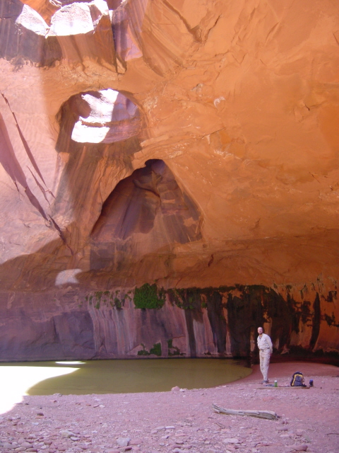
We backtracked and searched for nearly an hour for another route down to the river before finally finding another line of rock cairns that took us down the old horse trail. The Escalante was silty grey as predicted and never more than thigh deep. We headed down the river alternating between wading and bushwhacking along the shore until we reached Neon Canyon. This wide deep canyon had great colors and led us nearly a mile to a dead end called the Golden Cathedral. This massive overhang has two large holes in the ceiling that were formed by potholes from above that finally broke through.
We had plans of continuing down the Escalante River a bit further to explore Ringtail Canyon, but we were already so spent from the hike to that point that we turned back. We hot spotted some barely running clear water earlier that turned out to be our best bet for fresh water. We stopped and pumped over a gallon through our filter before ascending back up the horse trail to the brutal heat of the day. It was well over a hundred degrees as we scurried back up to the Egypt Bench. We were pretty beat by then and we both took naps to recover from the effort. Later we chased down dinner with some cold beers and settled in for another night on Egypt Bench.
Click on thumbprint photos to see them enlarged.
Friday August 11, 2006
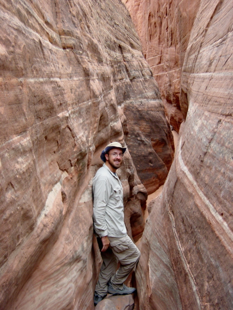
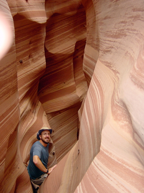
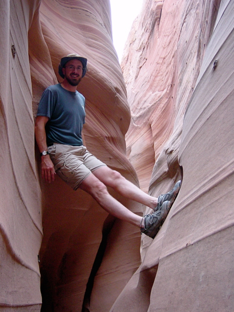
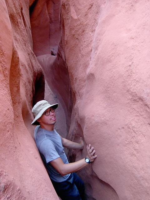
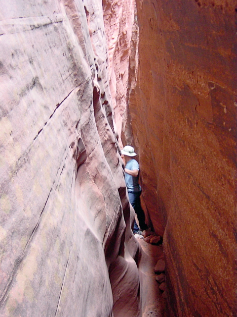
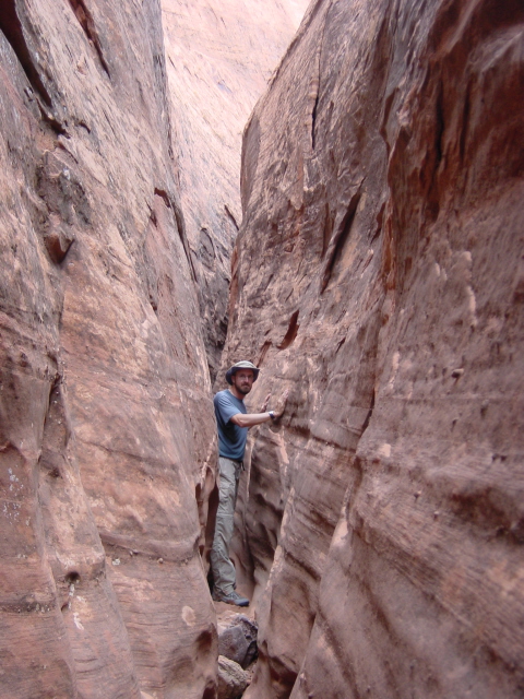
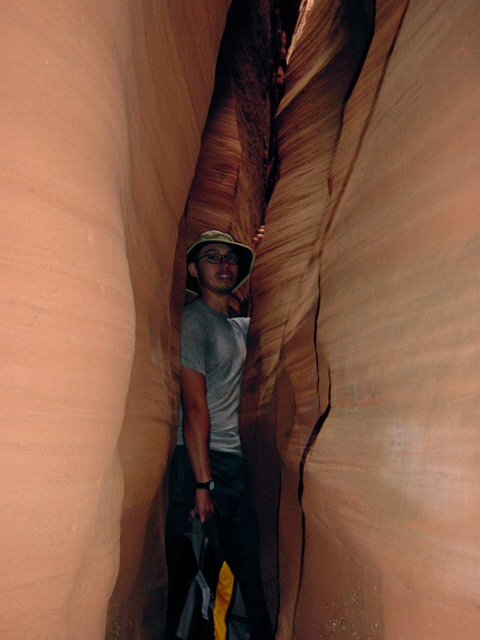
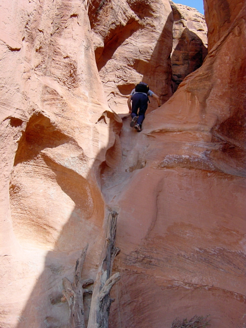
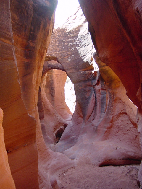
We started today with a short drive to the top of Egypt 3 Slot, one of the finest and narrowest in GSENM. This slot is divided into three sections, the third of which required technical gear to descend the steep drop-offs. The guidebook assured us that there would be an opening for us to climb out of the slot after the second section. To get started we skirted a 120-foot dryfall by descending a steep slope of slickrock and then dropping into the slot. This slot quickly became deep, dark and narrow. The guidebook had said that this slot narrows to a mere 8 inches in one section, while being narrow overall. I shrugged off the 8-inch warning, disbelieving that it really got that narrow and was still considered passable. I would later find out the truth of the matter.
It was a dry clear day and the deep slot was an escape from the building heat of the day. The gradual descent was dry and easy enough, but the depth and narrowness of the slot gradually built into a sense of pressure over the miles. We were moving right along and enjoying how yet another slot canyon was so different from the previous ones we had explored. Dave was leading and carrying our one backpack of gear. Dave is considerably smaller than I, and quite agile with all his rock climbing background. I was grateful that he carried the pack, because the narrowness of the slot often required him to hold the pack in one hand while sidestepping between the canyon walls.
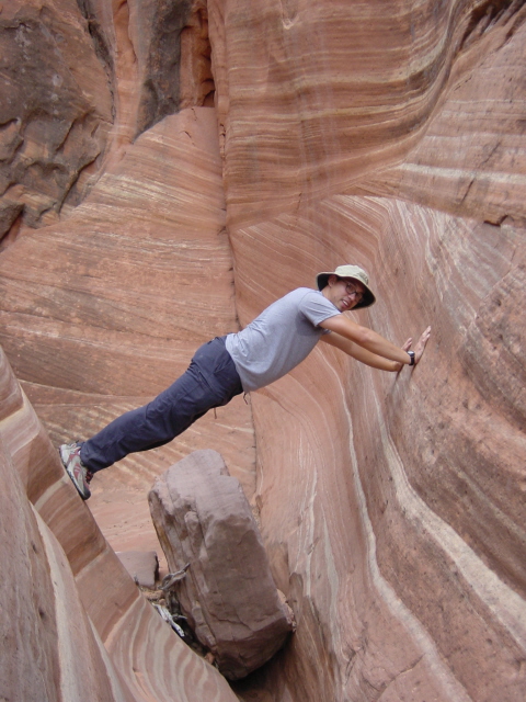
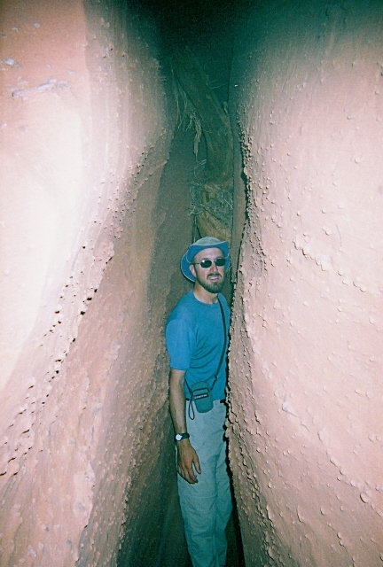
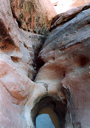
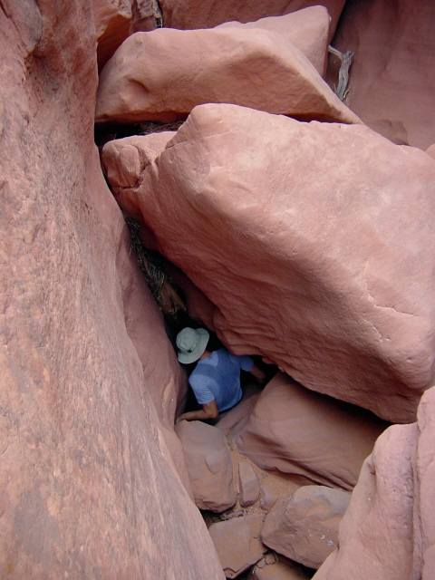
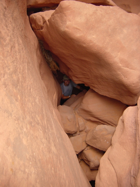
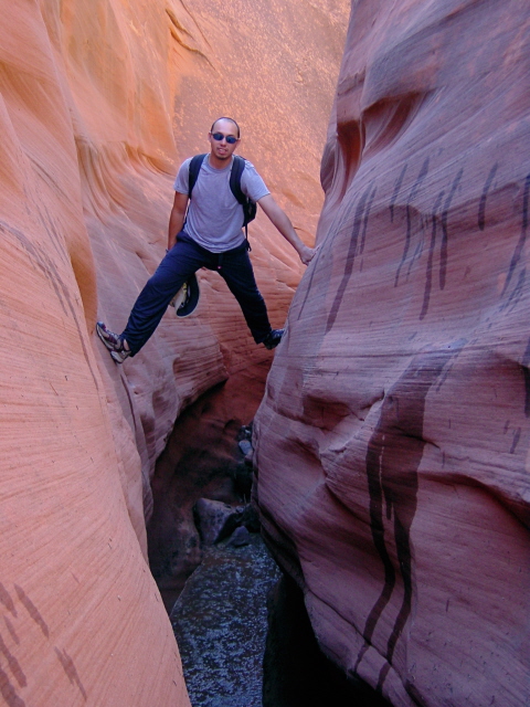
We later reached a point that held us up. We faced a wet pothole of considerable diameter and unknown depth. It is pictured below. The water was very stagnant with a nasty dead snake floating in it. Up to this point, Dave and I had perfected the maneuvers of stemming and chimneying over most obstacles. Stemming refers to spanning the slot with legs and arms pressed against opposing walls to pass over a challenging section. Chimneying works when the walls are a bit closer by pushing both feet against one wall to press the hands and back against the opposite wall. Both methods work quite well as long as the walls are close enough together. This pothole was too wide for either of those maneuvers. It could have been possible to leap across the pothole, but the landing area was a small pad of slickrock, making it a less desirable choice. With my long legs and arms, I offered to go first and tried to shimmy along the left side without sliding into the pothole. In a flash I lost my footing and began sliding into the pothole. I launched myself to the opposite wall trying to leap back and forth as I made my way across. It didn’t work. I ended up getting across by falling and jamming my left shoulder with a stiff-armed landing on the rock, and one leg in the water. On film the move would have been comedic, but I really hurt my shoulder and couldn’t do much with it the rest of the day. Dave went for the leap across option, having me on the other side to catch him. We continued on down the slot, but my movement was slowed and I could offer no help with the pack.
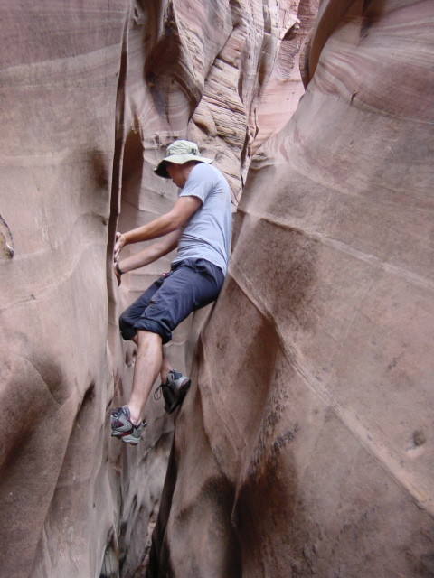
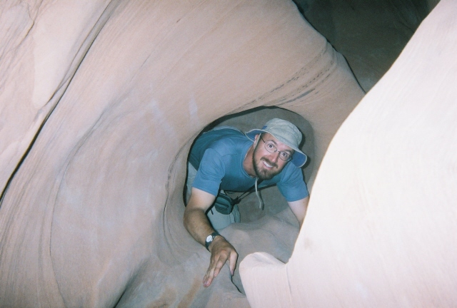
Later on we reached the 8-inch wide section referred to in the guidebook. I was amazed. There was no footing on the bottom here as the two walls met at the bottom forming a crack that made it a challenge to free each footstep after wedging the shoe into the crack. Though I am quite tall at 6’6”, I do not have a massive chest, yet there was no way for me to penetrate the crease. Dave’s smaller stature permitted him passage, but with no clearance. After miles of building pressure from the surrounding mass of rock, I finally felt the anxiety of the situation. In my head I knew that I could always get back out the way I came in, but the immediate situation truly rattled me. Dave was sensitive to the situation and waited patiently as I worked out what I would do. I really wanted to continue, so I decided to ascend about thirty feet to where the wall spacing was more generous. The challenge now was getting up there. My injured shoulder was really a handicap. The walls were too narrow to stem or chimney. The walls in this section were pimpled with bumps and burls that I could edge me shoes against. I managed to pass above the 50-foot narrow section before sliding back to the bottom and continuing in the normal 1-2 foot width to which we’d become accustomed.
We exited Egypt 3 after the second section as planned and dead reckoned our way back to the truck over the rim of the canyon. That was one memorable slot. We drove back into the town of Escalante and camped at a campground in town where we got showers, a hot pizza and some pitchers of beer. It was a good day with one painful mishap.
Click on thumbprint photos to see them enlarged.
Saturday August 12, 2006
With my shoulder still hurting, we decided to make this a light day. There are three short slot canyons common to tourists for their easy accessibility, but they are still quite worthwhile. We drove down Hole In The Rock Road twenty-six miles to the trailhead for Peak-A-Boo, Spooky and Brimstone Gulches. We hiked the short approach to Peek-A-Boo Slot and climbed a log to its entrance. This slot has fun twists, slides and holes that justify its name. Reaching the top of Peak-A-Boo, we accessed the rim and crossed the bench to descend Spooky Slot, which is darker and narrower. After Spooky we took the long walk to Brimstone only to get turned back by the smell of a rotting animal in some of the foulest standing water yet. We tried to chimney our way in above the water, but there was no end to it, so we turned back.
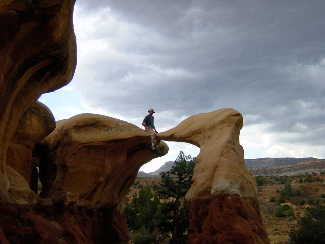
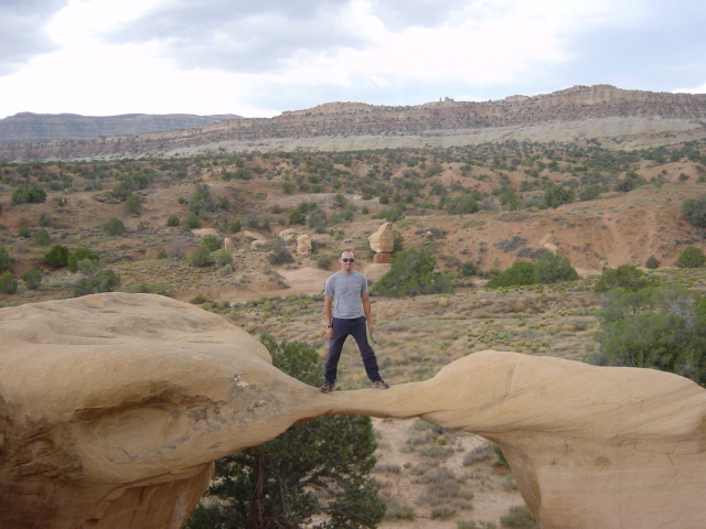
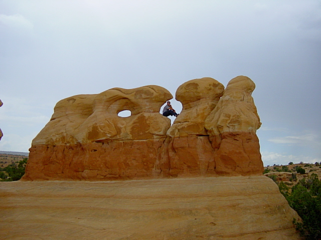
We returned up Hole In The Rock Road fourteen miles to Devil’s Garden, an interesting rock formation out in the open. At this point some weather started moving in. The wind picked up and a light rain fell on us as we drove back to Escalante. Hole In The Rock Road had become as slick as ice from the rain. Rainfall here brings all sorts of hazards. We visited the interagency park office yet again to report the dead animal in Brimstone and to get an update on the canyons we had planned for the next day. We were concerned about what changes the rain might have caused. We spoke again to a very helpful park agent that informed us that the brief 45-minute shower had considerably changed conditions throughout the area. We were advised to scrap our plans for the next day.
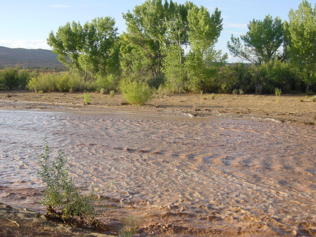
Dave and I mulled over our choices and decided on an alternate plan to explore the rarely visited slots of Red Breaks Canyon. We stocked up with some more water and returned to our campsite from the first night at Harris Wash trailhead. We arrived there and were overwhelmed with the flow of water rushing down Harris Wash. This had literally been a dry streambed except for some muddy areas just the day before. Now it was rushing with a torrent of red silt and mud. We knew that tomorrow would be a wet adventure.
Click on thumbprint photos to see them enlarged.
Sunday August 13, 2006
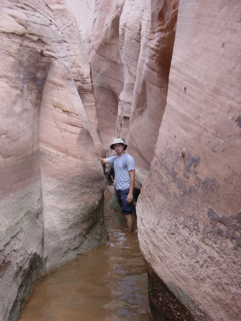
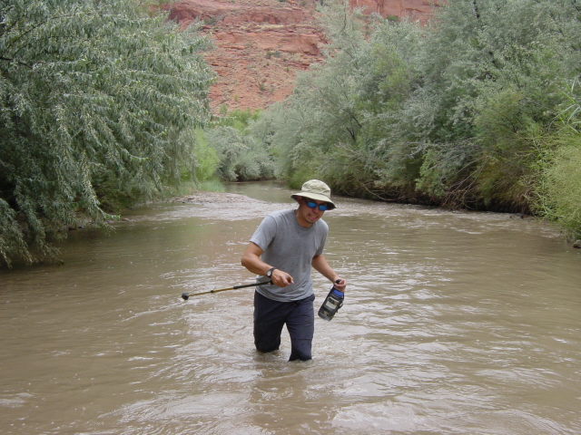
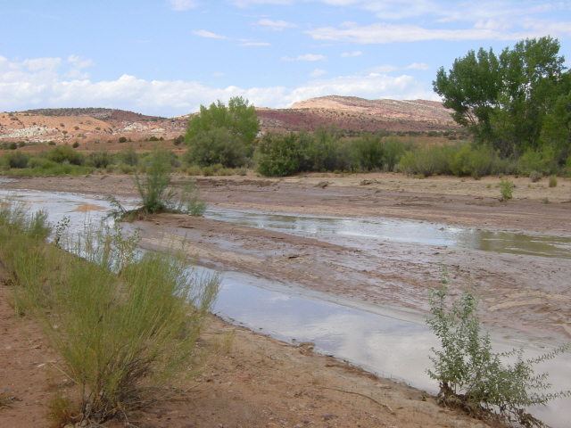
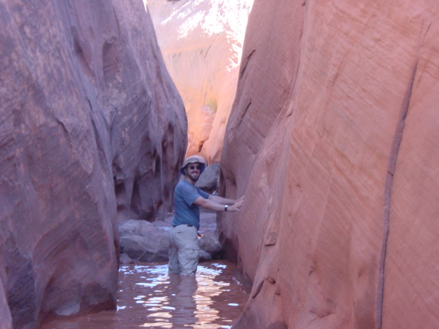
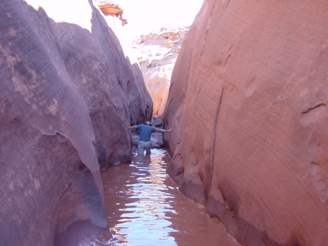
Just through the night the flow in Harris Wash dropped off considerably. I took a couple photos showing the change from evening to morning. I wish I had a photo from when it was bone dry. We had only sketchy instructions for Red Breaks Canyon but this being our fifth day of canyoneering we were buoyed with confidence from our experiences to date. We crossed a dwindling Harris Wash and worked our way up the main slot of Red Breaks Canyon and quickly found ourselves wading in water. We tried stemming and chimneying over the first few wet sections, but soon gave up on the slow effort and opted for the slightly quicker slogging through the water. We had a couple things going for us. There had been enough rain to flush out all the old standing water in the canyons, leaving a fresh volume of muddy water with no displeasing odor. The fresh water was also a bit warmer than it otherwise would have been. Since the water offered zero visibility, caution was required with each step to avoid a twisted ankle across the rocky bottom. Having the walls of the canyon to brace our arms against made the going a little quicker. Water depth was also a guessing game.
We worked our way four miles up the canyon, three of which were quite wet. We figured we would ascend to the rim and travel across the bench to an old jeep road for the return trip out in the open. Once on the rim however, we had trouble finding a safe route down to the road. We found ourselves descending one of the Red Breaks forks and back down into the main slot that we had just ascended. At this point we resolved to exit the way we entered, knowing that there wouldn’t be any surprises.
We set forth down another two miles of the wet slot and were surprised to find ourselves dropping into water over our heads in spots. We had failed to consider that some of the wet sections that we had chimneyed over were indeed quite deep. What a surprise to step off a rock fall into water we expected to be knee-deep and end up sinking over our head.
We returned to the truck and put on some dry clothes and prepared for the drive back to Salt Lake City. Dave had originally planned for one more day in the slots, but our adventure cup was running over by this point, and we had both had our fill. We drove up to Park City and spent a couple days with my friend Brad before dropping Dave back off at the airport for his return to Dayton, Ohio. Reflecting on this week of fun exploring slot canyons for the first time, I take with me a few truths. 1) Slot canyons are unique and independent of each other. While they all share the common trait of being narrow slots caused by erosion of sandstone, each one has its own character and personality. That personality can change with the seasons and the presence of water. 2) Slot canyons are a true adventure for people of all ages, but they should be approached with a healthy dose of respect. Preparation is critical. Having the right survival gear and knowing what to expect will assure a safer outing and a more fun adventure. 3) Choose your company and slots carefully. I was lucky to have such a cool and calm companion as Dave on this trip. We were in spots almost every day that could have caused melt-downs with the wrong company. If you choose an adventure in southern Utah’s slot canyons, I hope you heed these truths.


Click on thumbprint photos to see them enlarged.
 |
 |
 |
 |
Harris Wash with heavy flow. |
Harris Wash the next morning. |
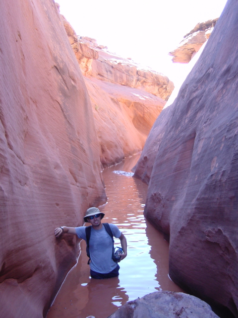
Joe wading in Red Breaks Canyon. |
Joe. |
 |
 |
 |
|
Dave in Red Breaks. |
Dave stemming over nasty water. |
Joe in deep water. |