AT Thru-Hike, Maine [1] 1997
Click here to go back to the Frontier Home Page.
Click here to go back to AT Home Page.
(178) Monday, September 15, 5:00PM
I'm standing out at this road waiting for a hitch into town. You could say that it is a fairly remote road since I have only had one car pass by in twenty-five minutes, and it was going the other way. This will be typical of some of the road crossings in Maine. At least this road is paved. I thought I could at least make good use of the time spent waiting by making my daily log entry.
Today is the 178th day of this journey. When planning this trip I thought I should be able to finish in this amount of time; and I probably would have had I not taken my "intermission." Then the question becomes whether I even would have finished had I not taken a mid-hike break. Oh well, at least I'm in Maine.
I'm very sore and scraped up from yesterday's hike. I fell more times yesterday than the combined total of all my previous falls. Today's hike was very demanding as well, but not nearly as painful as yesterday. It was a clearer breezy day with heavy gusts as I crossed the peaks of Baldpate Mtn. It was the closest I've come to having a truly clear day in over a week. The fog, clouds, and haze have really limited any mountain views. All I can do is imagine how spectacular it would be on a clear day, knowing what I'm supposed to be able to see.
I am now in Andover staying at the Pine-Ellis Hiker B&B. It's a very simple place with very special proprietors. I saw Capetown Jenny in town today, and I should finally see Trailmouse and Technicolor on the trail tomorrow. We're all bunching up here in Maine.
14.9 Miles Today, 1903.7 MTD
(179) Tuesday, September 16, 7:00PM
Today was a beautiful day. The sky was mostly clear with a very strong dry wind. I enjoyed having a fairly short day of hiking after a hearty breakfast in Andover. I am in my warm sleeping bag preparing for the cold night. A frost warning has been issued.
I did finally get to see Trailmouse & Technicolor. It was a warm reunion. I expect to see more of them in these final weeks. It's hard not to think about finishing. Each day now my thoughts tend to turn to the end. I still have many challenging and grueling miles, but each day brings me noticeably closer.
I hope this cool dry weather continues. The smell of autumn is frequent as the colors of the leaves are gradually warming. The trail in Maine is so wet and sloppy that a rainy day would put me ankle-deep in messy slippery mud. So far so good.
10.1 Miles Today, 1913.8 MTD
Click on thumbprint photos to see them enlarged.
(180) Wednesday, September 17, 11:00PM
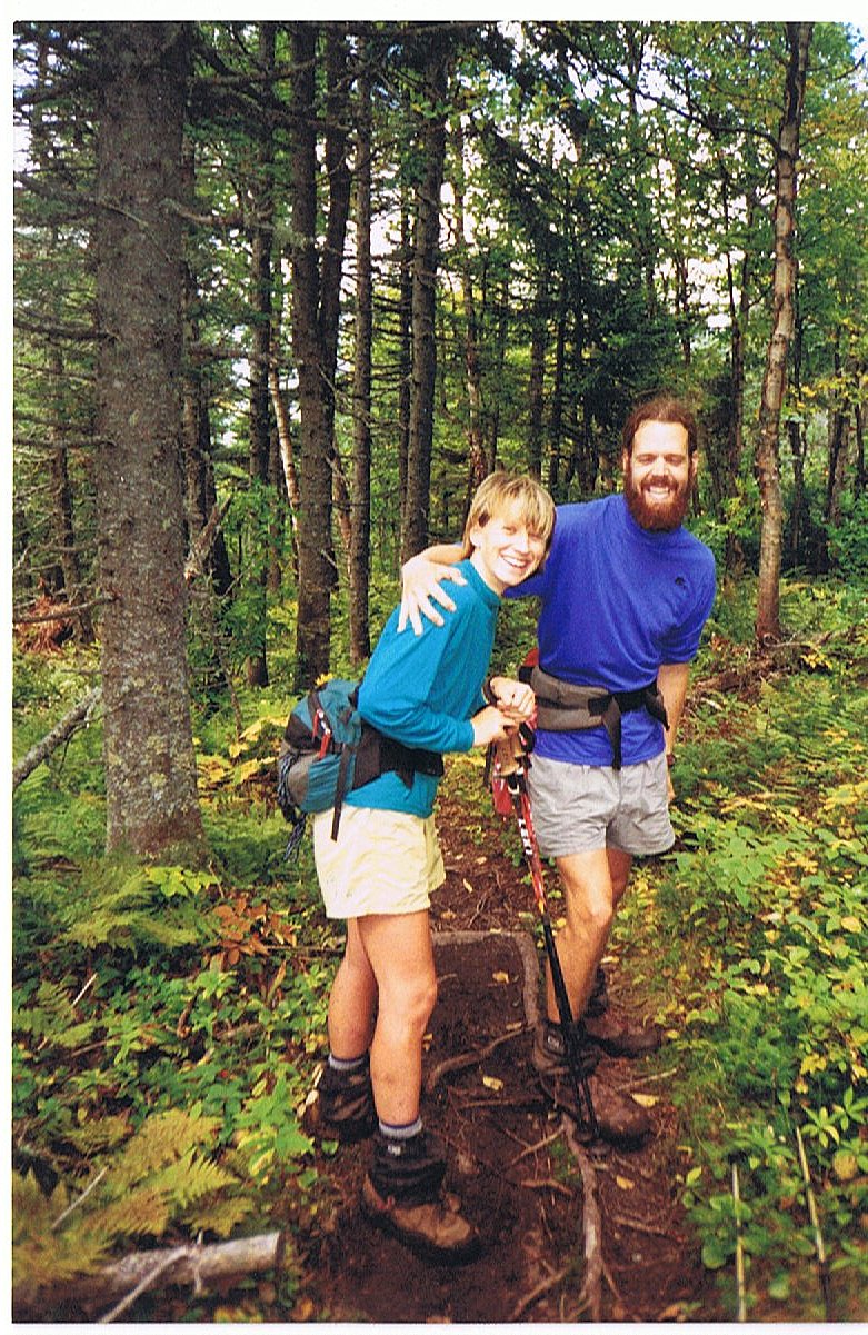
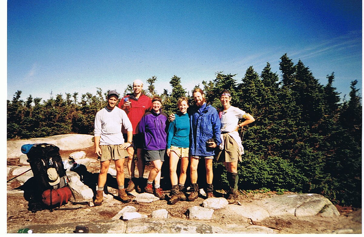
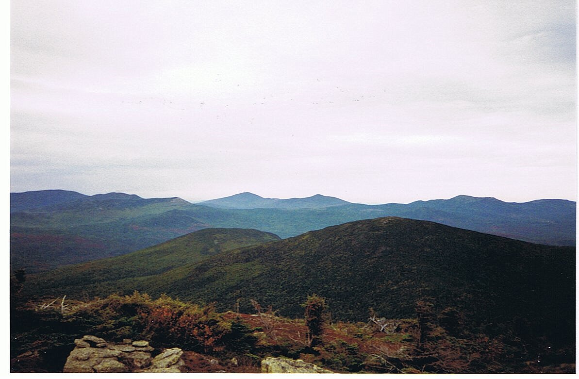
Today was an absolutely gorgeous day. I haven't had it this clear in nearly two weeks, since the day I crossed Kinsman Mountain. I had a great climb up Old Blue Mtn (3600') and spent a prolonged break drinking in the outstanding view about me. I met up with the Swiss Family (Aunt Marty, Pixie, and Earth Surfer) there after ten states apart.
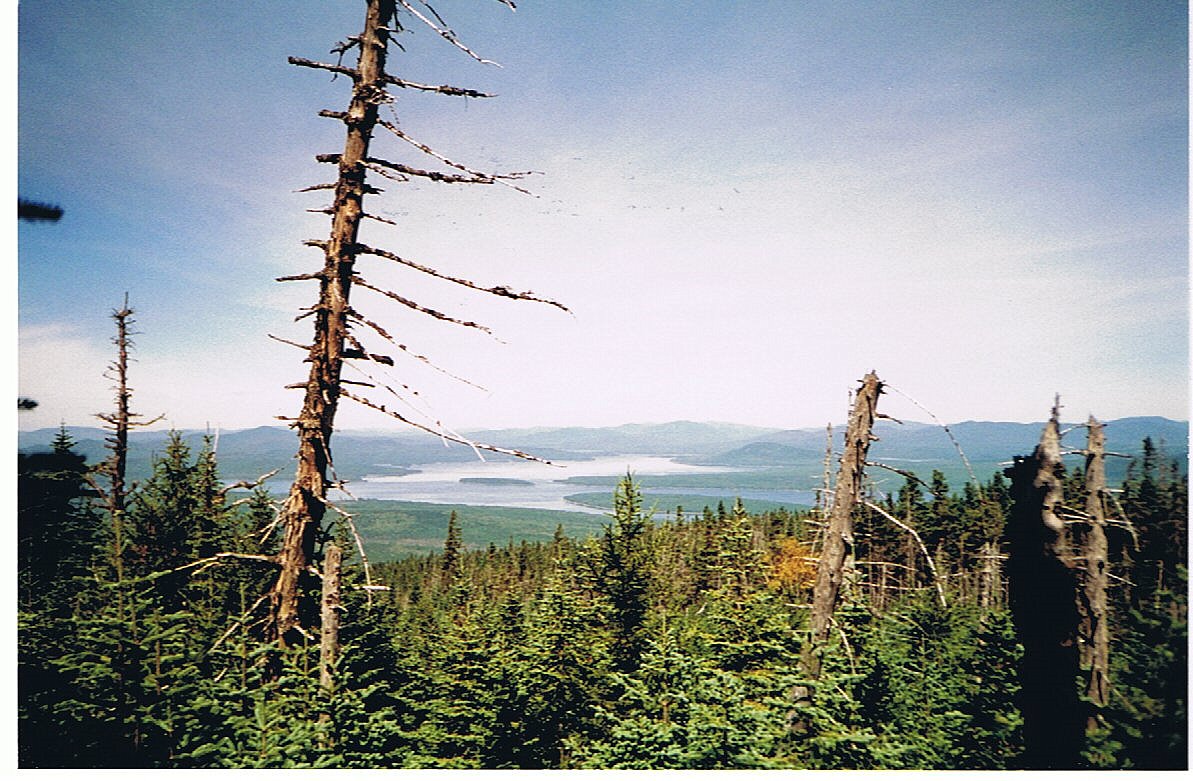
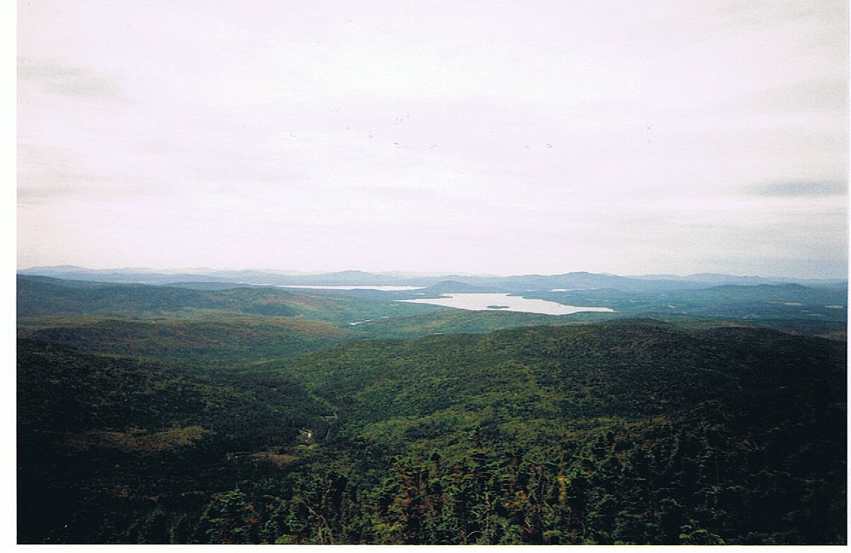
Coming down from Old Blue and on over the four peaks of Bemis Mtn. I was treated to a fantastic view of the Rangeley area which includes Rangeley Lake and Lake Mooselookmeguntic. The lake water was reflecting such a peaceful blue from the clear skies above.
I wasn't sure just what I wanted to do for the evening as I approached route 17 near the end of the day. I could hear people climbing into a vehicle as I climbed up the hill toward the roadside. I hollered as I crested the hill to get the attention of the van preparing to pull away. It worked, and out popped Big Bird and Mountain Laurel who had just scored the ride into nearby Oquossoc. There was room for me too, so we all headed down the road the ten miles to town. Brothers, Matt and Mark were our trail angels as they were heading to their camp. Camp is a common Maine expression for what the rest of us would refer to as a cabin on the lake. These two men in their late forties had a couple odd jobs to do at their family camp on Lake Rangeley. In the few minutes we had to get familiar with each other they offered to put us up for the night at their camp. Since none of the three of us hikers had certain plans for the night we decided to check it out. The camp was on the way to town and Matt offered to let us see it before we decided. It was perfect; just a cute little house sitting right on the edge of the lake with several grassy tent spots in the yard.
After accepting their invitation we began to discuss dinner plans. We ended up jumping right back in the van and driving into Rangeley for pizza and beer. On the way back from dinner we passed a bar advertising a special with 50 cent draft beer. We couldn't pass on that so we enjoyed several cheap rounds of beer. Then we stopped at a store on the way back to the camp to pick up some ice cream and some more beer.
13.3 Miles Today, 1927.1 MTD
Click on thumbprint photos to see them enlarged.
 |
 |
 |
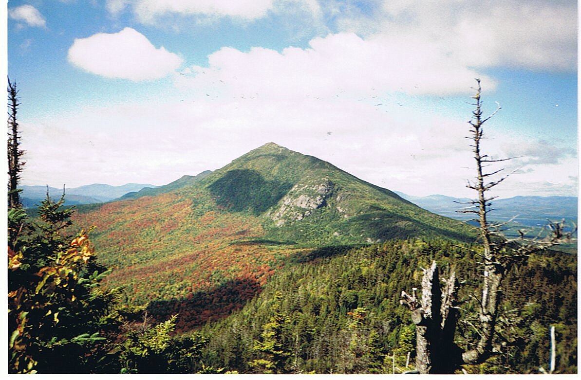
Old Blue Mtn.--Atop Old Blue on a gorgeous day with Hooty, Big Bird, Mountain Laurel, Technicolor, Trailmouse and Aunt Mary. |
Bemis Mtn.--Looking out over Lake Mooselookmeguntic...quite a mouthful. |
|
(181) Thursday, September 18, 11:00PM
I don't think I've had that much to drink on this whole trip. We ended up lighting a fire in the cabin to break the night chill. There were enough beds for everyone so none of our tents were pitched as we each passed out inside. Mountain Laurel regretted mixing her beer and ice cream. Apparently she spent much of the night purging the incompatible combination. I fortunately slept through the whole ordeal in my drunken stupor.
I awoke this morning feeling quite crusty, but not completely out of commission. Mtn. Laurel had gotten some sleep after clearing the toxins from her body. She felt quite depleted after losing all the precious calories and carbs from dinner. Our morning moved very slowly as Matt, Mark, and Big Bird were all kept awake by the ordeal through the night. I finally decided that I should take advantage of a slack-pack opportunity to help offset my diminished condition.
The trail today led to another road, route 4, which returned me through Rangeley right back to Oquossoc. I left my pack at the hiker hostel in town and had breakfast with the gang. It was going on 11:00 AM before Matt and Mark returned the three of us to the trail. I was still feeling crusty as I congratulated myself on my decision to slack-pack this section. This is really my first unadulterated slack-pack. No excuses . . . I did it to make my day easier. I'm in Maine, and it just doesn't matter to me any more . . . not much, anyhow.
It was another lovely day as I let the hike clean the toxins out of my body. The longer I hiked, the better I felt. It wasn't even a very challenging hike, other than being a bit hungover. I challenge anybody reading this to walk thirteen miles over rough terrain with a hangover.
I finished the hike and hitched a ride with Trailmouse & Technicolor back to Oquossoc. I got my laundry done and ate a great dinner: baked haddock stuffed with a mix of crabmeat and covered with a lobster sauce. It was excellent. Needless to say, I drank only water tonight. I just finished watching a video with Hooty and Farfrompuken, and am bound for bed.
13.1 Miles Today, 1940.2 MTD
Click on thumbprint photos to see them enlarged.
 |
Oquossoc--Brothers Matt and Mark from Rumford picked me up hitching a ride along with Big Bird and Mountain Laurel. They ended up getting us drunk and letting us crash at their camp on the shore of Rangely Lake. |
(182) Friday, September 19, 9:00PM
I put the pack back on today and began the three-day stretch to Stratton. Mac at the hostel cooked up an incredible hiker breakfast for the three of us: apple-cinnamon pancakes, home potatoes, three fried eggs, and a very fat slab of ham. It was very filling. He than drove us back to the trailhead for our ascent of Saddleback Mtn.
It started out as another very fine day with a lovely trail up the mountain. Uncharacteristic for a Maine trail section, today's trail was well groomed and maintained. The open summits of Saddleback provided some outstanding views all the way around. Supposedly Mt. Katahdin is visible from the summit, if you know what you're looking for. The sky was already turning grey as the wind picked up by the time I reached the top.
I was reacquainted today with Small World and with Geo. Each day now seems to introduce a long lost hiker. These reunions are very fun as we all near the end.
10.7 Miles Today, 1950.9 MTD
Click on thumbprint photos to see them enlarged.
(183) Saturday, September 20, 6:30PM
Wow, what a wet and nasty day. The rain began very early in the morning and stayed all day. I got to pack up a wet and muddy tent in the rain. This afternoon I got to set up a wet and muddy tent in the rain. It would be easy to have a bad attitude about all this, but I'm in Maine and it just doesn't matter. I now have less than 200 miles remaining.
The day went pretty well considering the lousy weather. The rain was mostly a drizzle until mid afternoon when it came down in full force. I was soaked all the way through and didn't even bother with my rain jacket. I reached camp just before 4:00 and immediately pitched my tent and filtered some water so that I could get inside and not have to get out.
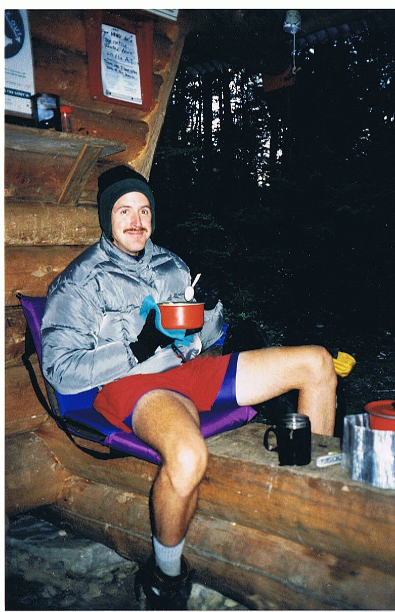
I mopped out the tent with my pack towel and then quickly got out of my soaking wet clothes since I was really beginning to feel a chill. I put on my dry long-johns, socks, fleece pullover and hat, and then slid into my sleeping bag. I immediately felt better. I then fired up my stove and made a hot cup of tea before starting dinner. I know exactly how to make the most of these trying conditions.
I am now through with dinner and am enjoying a cup of hot cider. Tomorrow will be a short eight miles over Crocker Mtn. and on into Stratton where I'll sleep in a warm dry bed tomorrow night. I have a day to kill before my rendezvous with Mark in Caratunk, so I'll take what may amount to be my last zero-mile day on Monday there in Stratton.
Mark Lancaster is another friend that I met while living in Charleston, South Carolina. He and I had done some backpacking together in the Smoky Mountains years ago. I had invited him to join me for a section of this hike as well. He had been to Maine several times before and had already failed two attempts to summit Mt. Katahdin, so this trip would provide a third opportunity to summit that granite peak, and also to keep me company for a few days of hiking.
It feels good to be in my tent with the rain and wind assaulting it. I'll have to give the tent a bath to get all of the mud out of it. It'll be nice to dry everything off in town tomorrow. Just another day on the Trail.
Tonight I'm camped in an area near Trail Mouse & Technicolor, and Capetown Jenny. We all first met nearly six months ago on our first day on the Trail. It's a very special coincidence.
14.2 Miles Today, 1965.1 MTD
Click on thumbprint photos to see them enlarged.
(184) Sunday, September 21
It was 37 degrees in the hollow where I camped this morning. The wind had been blowing in hard with the cooler temperatures. The steep warm-up climbs up Crocker Mtn. were very welcome this morning. I was halfway up the first summit before my toes stopped stinging. I was immediately so cold this morning when I put on all my wet clothes. The boots were so very cold and wet. The temperature continued to drop as I neared the first summit. Then the snow began falling; first light and wet, then hard and icy. Each of the summits was a mess with blowing snow.
After the second summit of Crocker the sky began to clear and turned it into a fine day. I got the hitch into Stratton for a day off.
7.3 Miles Today, 1972.4 MTD
(185) Monday, September 22
Zero-mile day.
(186) Tuesday, September 23, 4:00PM
I enjoyed a fine day off in Stratton. That's the problem . . . yesterday was a very fine day. It was so clear, and the summit views would have been great. Instead I lazed around and decided to hike out today . . . in the rain! I seriously had a day to kill before meeting Mark in Caratunk on Thursday, but I chose to waste a perfect hiking day.
Today I climbed up most of Bigelow Mtn. It was my intention to get over it and camp on the other side. I had a great breakfast and felt good climbing today, but I wanted to enjoy another day of clean dry clothes. I decided to stop short at the last available shelter for the day. I just didn't want to cross the exposed summits in this weather and get totally soaked from the wind-blown rain. I still haven't fought off this stubborn cold that I picked up, and opted for the dryness of the shelter.
Now I'll have to pull a couple long days to make Caratunk in time. I'm not too concerned; the trail is already starting to get a little easier.
5.1 Miles Today, 1977.5 MTD
(187) Wednesday, September 24, 7:30PM
Well I was rewarded for stopping short yesterday...rewarded with a very cold night, that is. It was 18 degrees at dawn this morning, and the gaps between the logs of the lean-to permitted a significant wind chill to make it feel cooler.
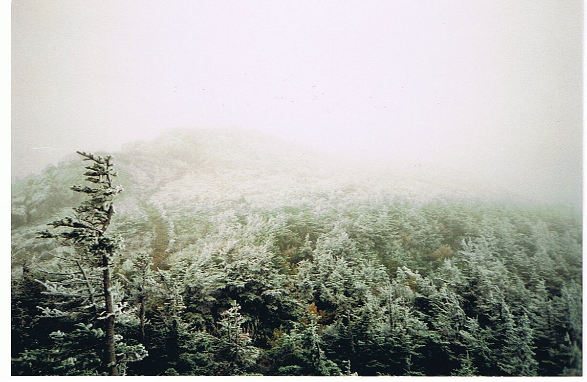
The rain never amounted to much yesterday afternoon, so it would have been fine for me to push on the next five or so miles that I had originally planned. Instead I got plenty of rest and hiked the long day today. The cold fog had formed some spectacular rime ice on the three Bigelow summits that I crossed this morning. I was hoping to get a view today that I would have missed by summiting yesterday. I was welcomed by harsh stinging wind over the fog-covered summits, but I knew there was sun above the fog just trying to get through. As I was descending from the final Bigelow summit (Avery Peak) just after ten this morning I decided to wait for the sun.
I waited for twenty very cold minutes tucked behind some krummholz out of the wind, and finally the fog lifted. At first there were just hints of clarity, then the veil lifted so the fog ceiling was just above me. And there it was, still well off in the distance, but unmistakable . . . Katahdin. This was my first certain sighting of the finish line. For this brief moment, I was glad I had spent the cold night before so that I could have this view today..
The Bigelow Mountains were the last significant climb before Katahdin. The second half of today was much easier, which portends a good bit of the remaining trail. Tomorrow I pass the 2000-mile mark; then I take the canoe ferry across the Kennebec River; and finally I meet up with Mark in Caratunk. Each day brings me noticeably closer to the end.
17.5 Miles Today, 1995 MTD

Click on thumbprint photos to see them enlarged.
Looking back at Avery Peak.
(188) Thursday, September 25, 6:00PM
I still love my tent. It was another cold night last night, but I was comfortable in the close protected quarters of my tent. This morning started crisp and clear as I headed out on the flattest section of trail since Pennsylvania. I passed several scenic ponds on my way to the Kennebec River. I saw another moose this morning. It was mammoth as we met on the trail. I must have appeared large to him, because he quickly moved off into the woods.
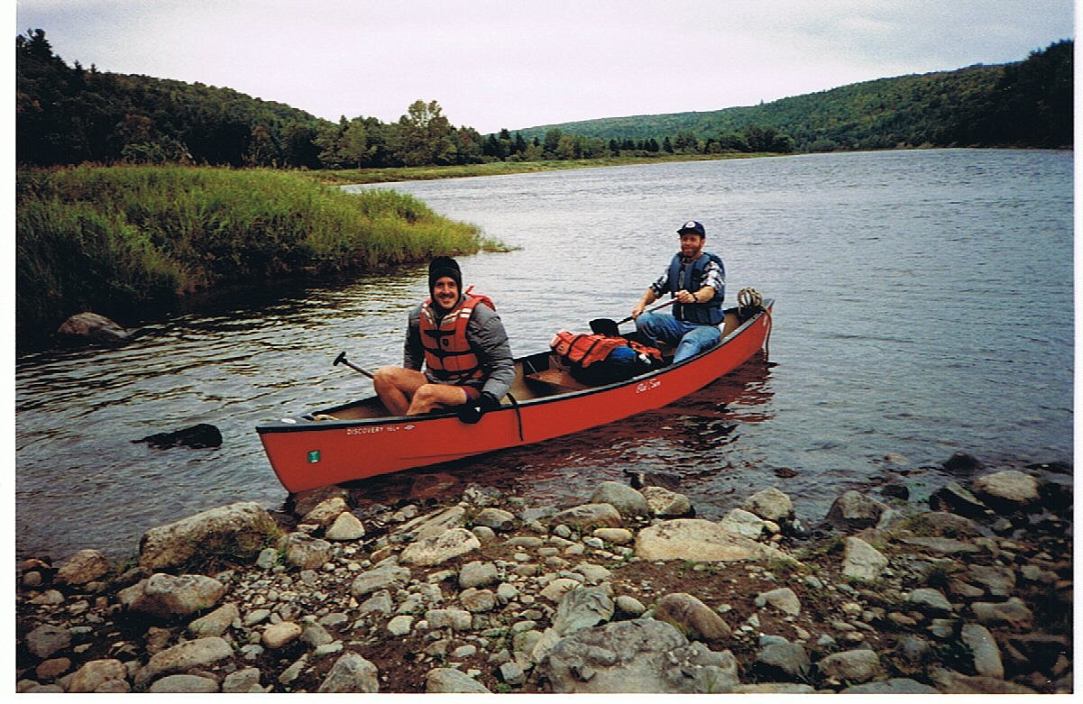
The Kennebec River is the largest river crossing along the AT that is not spanned by a bridge of some sort. The actual crossing is about seventy yards of very swift current. At its low level it's only about three feet deep, but the level can rise quickly without warning. The hydro-electric dam up river flushes a rage whenever its monitors kick it into operation. This occurs as needed, unpredictably. When the river is flushing, the water level can rise another two feet in a very short time. These occurrences have swept many a hiker down river over the years, killing one in 1985. Ever since, there has been a canoe ferry provided during brief specified hours each day to get the hikers across the river. Some stubborn purists still insist on fording the river on foot, but most everyone plans their river arrival in time to meet the ferry. I arrived a half-hour early to be certain of crossing. I can't imagine choosing to cross on foot.
I'm now in a hostel in Caratunk awaiting Mark's arrival. We'll get organized and set out for the thirty plus mile stretch to Monson in the morning. It'll be good to have him distract me for a few days. I've been spending too much of my time thinking about the end, and I still have so many more miles to go. I'll have plenty of time to contemplate my finish during the 100-mile Wilderness. I passed the 2000-mile mark today . . . a respectable achievement on any scale.
14.0 Miles Today, 2009 MTD

Click on thumbprint photos to see them enlarged.
(189) Friday, September 26, 8:30PM
I don't know what it is about my ambitious hiking partners, but they all seem to insist on a long first day. I had no plans to do more than six miles with Mark today, and thus we didn't hit the trail until after 11:00 this morning. Just after 6:00 tonight we ended our twelve-mile day. The second half of the day was much more challenging than the first half, but we made it.
The sky was threatening rain all day and even looked its worse while I was preparing dinner tonight, but it never more than pretended to drizzle a couple times. I hope Mark gets to enjoy some better weather over the next two days. His summit of Katahdin yesterday was clear until just below the peak, then he was socked in by fog. He finally bagged that peak on this third attempt. I hope I get up it on my first effort.
Mark kept a pretty good attitude all day, even though it drug out longer than either of us anticipated. I enjoyed having his company. We did a very good job of actually hiking together which meant that we did a lot of talking throughout the day. It was a different experience for me to have that kind of companionship on my hike. It was a very pleasant change from my normal familiar solitude.
Thanks to the long miles today, the next two days should break down very nicely. Tomorrow's distance will depend pretty much on how Mark feels in the morning.
11.9 Miles Today, 2020.9 MTD
Click on thumbprint photos to see them enlarged.
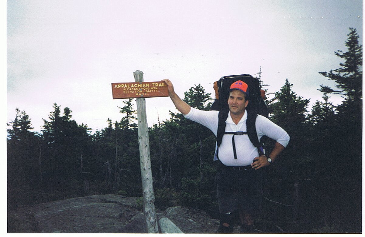 |
Pleasant Pond Mtn.--One last friend came out to hike with me. Mark Lancaster came up from South Carolina for 3 great days of hiking. |